
Original file (4,122 × 3,089 pixels, file size: 3.54 MB, MIME type: image/jpeg)
| This is a file from the
Wikimedia Commons. Information from its
description page there is shown below. Commons is a freely licensed media file repository. You can help. |
Summary
| Description |
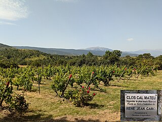
English: The vineyard is said to be the highest in Europe.
Wine from the grapes of this vineyard is produced every year. |
| Date | |
| Source | Own work |
| Author | Alan Mattingly |
| Camera location |
| View this and other nearby images on: OpenStreetMap |
|
|---|
Licensing
| This file is made available under the Creative Commons CC0 1.0 Universal Public Domain Dedication. | |
| The person who associated a work with this deed has dedicated the work to the
public domain by waiving all of their rights to the work worldwide under copyright law, including all related and neighboring rights, to the extent allowed by law. You can copy, modify, distribute and perform the work, even for commercial purposes, all without asking permission.
|
File history
Click on a date/time to view the file as it appeared at that time.
| Date/Time | Thumbnail | Dimensions | User | Comment | |
|---|---|---|---|---|---|
| current | 12:50, 21 July 2024 |
| 4,122 × 3,089 (3.54 MB) | Alan Mattingly | Uploaded own work with UploadWizard |
File usage
Global file usage
The following other wikis use this file:
- Usage on ca.wikipedia.org
- Usage on fr.wikipedia.org
Metadata
Original file (4,122 × 3,089 pixels, file size: 3.54 MB, MIME type: image/jpeg)
| This is a file from the
Wikimedia Commons. Information from its
description page there is shown below. Commons is a freely licensed media file repository. You can help. |
Summary
| Description |
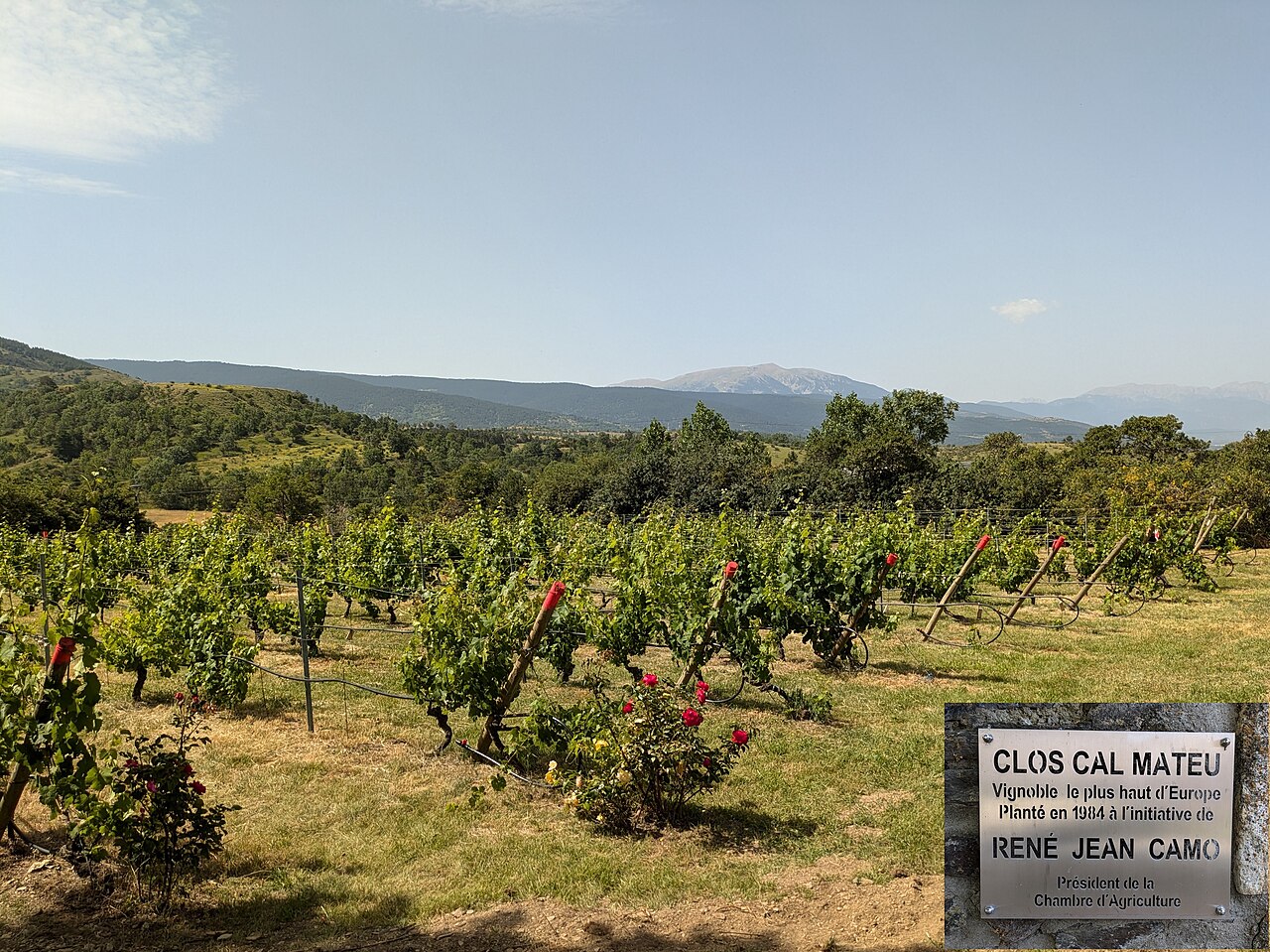
English: The vineyard is said to be the highest in Europe.
Wine from the grapes of this vineyard is produced every year. |
| Date | |
| Source | Own work |
| Author | Alan Mattingly |
| Camera location |
| View this and other nearby images on: OpenStreetMap |
|
|---|
Licensing
| This file is made available under the Creative Commons CC0 1.0 Universal Public Domain Dedication. | |
| The person who associated a work with this deed has dedicated the work to the
public domain by waiving all of their rights to the work worldwide under copyright law, including all related and neighboring rights, to the extent allowed by law. You can copy, modify, distribute and perform the work, even for commercial purposes, all without asking permission.
|
File history
Click on a date/time to view the file as it appeared at that time.
| Date/Time | Thumbnail | Dimensions | User | Comment | |
|---|---|---|---|---|---|
| current | 12:50, 21 July 2024 |
| 4,122 × 3,089 (3.54 MB) | Alan Mattingly | Uploaded own work with UploadWizard |
File usage
Global file usage
The following other wikis use this file:
- Usage on ca.wikipedia.org
- Usage on fr.wikipedia.org