Size of this preview:
654 × 600 pixels. Other resolutions:
262 × 240 pixels |
523 × 480 pixels |
749 × 687 pixels.
Original file (749 × 687 pixels, file size: 183 KB, MIME type: image/jpeg)
| This is a file from the
Wikimedia Commons. Information from its
description page there is shown below. Commons is a freely licensed media file repository. You can help. |
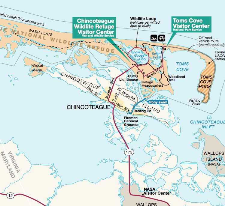
| Description | Excerpt from map of the Chincoteague-Assateague island area | |||
| Date | to 2013, as the new location of the causeway is shown (opened 2010) and was uploaded in 2013. | |||
| Source | http://www.nps.gov/asis/planyourvisit/upload/parkmap.pdf US Fish and Wildlife Service brochure] for Chincoteague NWR | |||
| Author | Unknown author | |||
| Permission ( Reusing this file) |
|
File history
Click on a date/time to view the file as it appeared at that time.
| Date/Time | Thumbnail | Dimensions | User | Comment | |
|---|---|---|---|---|---|
| current | 04:23, 21 October 2013 |
| 749 × 687 (183 KB) | Wehwalt | wider crop |
| 21:34, 17 October 2013 |
 | 1,345 × 685 (251 KB) | Wehwalt | {{Information |Description=Excerpt from map of the Chincoteague-Assateague island area |Source=http://www.nps.gov/asis/planyourvisit/upload/parkmap.pdf US Fish and Wildlife Service brochure] for Chincoteague NWR |Date=2010 to 2013, as the new location ... |
File usage
The following pages on the English Wikipedia use this file (pages on other projects are not listed):
Metadata
Size of this preview:
654 × 600 pixels. Other resolutions:
262 × 240 pixels |
523 × 480 pixels |
749 × 687 pixels.
Original file (749 × 687 pixels, file size: 183 KB, MIME type: image/jpeg)
| This is a file from the
Wikimedia Commons. Information from its
description page there is shown below. Commons is a freely licensed media file repository. You can help. |
| Description | Excerpt from map of the Chincoteague-Assateague island area | |||
| Date | to 2013, as the new location of the causeway is shown (opened 2010) and was uploaded in 2013. | |||
| Source | http://www.nps.gov/asis/planyourvisit/upload/parkmap.pdf US Fish and Wildlife Service brochure] for Chincoteague NWR | |||
| Author | Unknown author | |||
| Permission ( Reusing this file) |
|
File history
Click on a date/time to view the file as it appeared at that time.
| Date/Time | Thumbnail | Dimensions | User | Comment | |
|---|---|---|---|---|---|
| current | 04:23, 21 October 2013 |
| 749 × 687 (183 KB) | Wehwalt | wider crop |
| 21:34, 17 October 2013 |
| 1,345 × 685 (251 KB) | Wehwalt | {{Information |Description=Excerpt from map of the Chincoteague-Assateague island area |Source=http://www.nps.gov/asis/planyourvisit/upload/parkmap.pdf US Fish and Wildlife Service brochure] for Chincoteague NWR |Date=2010 to 2013, as the new location ... |
File usage
The following pages on the English Wikipedia use this file (pages on other projects are not listed):