Photos • Location


Size of this preview:
791 × 600 pixels. Other resolutions:
317 × 240 pixels |
633 × 480 pixels |
1,013 × 768 pixels |
1,107 × 839 pixels.
Original file (1,107 × 839 pixels, file size: 908 KB, MIME type: image/png)
| This is a file from the
Wikimedia Commons. Information from its
description page there is shown below. Commons is a freely licensed media file repository. You can help. |
Summary
| Description |
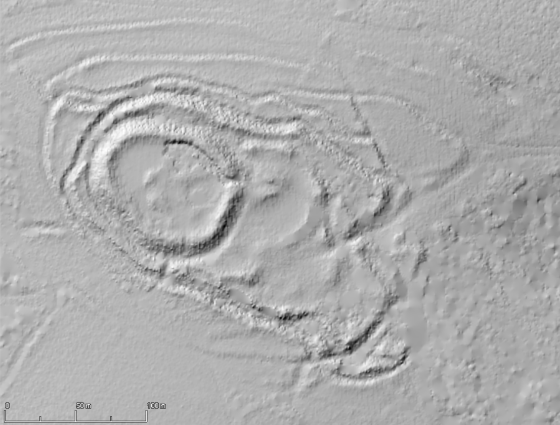
Galego: Castro de Castromaior, Portomarín, Lugo - Relevo PNOA |
| Date | |
| Source | Información Xeográfica de Galicia |
| Author | ING / Xunta de Galicia |
| Camera location |
| View this and other nearby images on: OpenStreetMap |
|
|---|
Licensing

|
The copyright holder of this file, Xunta de Galicia & Instituto Geográfico Nacional ( archived version), allows anyone to use it for any purpose, provided that the copyright holder is properly attributed. Redistribution, derivative work, commercial use, and all other use is permitted. |
Attribution:
PNOA cedido por © Instituto Geográfico Nacional - Xunta de Galicia
|
File history
Click on a date/time to view the file as it appeared at that time.
| Date/Time | Thumbnail | Dimensions | User | Comment | |
|---|---|---|---|---|---|
| current | 12:00, 15 July 2018 |
| 1,107 × 839 (908 KB) | Froaringus | User created page with UploadWizard |
File usage
The following pages on the English Wikipedia use this file (pages on other projects are not listed):
Global file usage
The following other wikis use this file:
- Usage on en.wiktionary.org
Metadata
Size of this preview:
791 × 600 pixels. Other resolutions:
317 × 240 pixels |
633 × 480 pixels |
1,013 × 768 pixels |
1,107 × 839 pixels.
Original file (1,107 × 839 pixels, file size: 908 KB, MIME type: image/png)
| This is a file from the
Wikimedia Commons. Information from its
description page there is shown below. Commons is a freely licensed media file repository. You can help. |
Summary
| Description |
Galego: Castro de Castromaior, Portomarín, Lugo - Relevo PNOA |
| Date | |
| Source | Información Xeográfica de Galicia |
| Author | ING / Xunta de Galicia |
| Camera location |
| View this and other nearby images on: OpenStreetMap |
|
|---|
Licensing
|
|
The copyright holder of this file, Xunta de Galicia & Instituto Geográfico Nacional ( archived version), allows anyone to use it for any purpose, provided that the copyright holder is properly attributed. Redistribution, derivative work, commercial use, and all other use is permitted. |
Attribution:
PNOA cedido por © Instituto Geográfico Nacional - Xunta de Galicia
|
File history
Click on a date/time to view the file as it appeared at that time.
| Date/Time | Thumbnail | Dimensions | User | Comment | |
|---|---|---|---|---|---|
| current | 12:00, 15 July 2018 |
| 1,107 × 839 (908 KB) | Froaringus | User created page with UploadWizard |
File usage
The following pages on the English Wikipedia use this file (pages on other projects are not listed):
Global file usage
The following other wikis use this file:
- Usage on en.wiktionary.org