
Size of this preview:
301 × 600 pixels. Other resolutions:
120 × 240 pixels |
241 × 480 pixels |
900 × 1,794 pixels.
Original file (900 × 1,794 pixels, file size: 771 KB, MIME type: image/jpeg)
| This is a file from the
Wikimedia Commons. Information from its
description page there is shown below. Commons is a freely licensed media file repository. You can help. |
Summary
| Description |
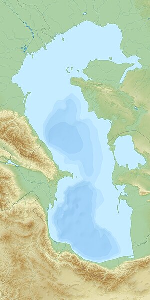
English: Relief Location map of Caspian_Sea.
|
| Date | |
| Source | Own work |
| Author | Uwe Dedering |
Licensing
I, the copyright holder of this work, hereby publish it under the following licenses:
This file is licensed under the
Creative Commons
Attribution-Share Alike 3.0 Unported license.
- You are free:
- to share – to copy, distribute and transmit the work
- to remix – to adapt the work
- Under the following conditions:
- attribution – You must give appropriate credit, provide a link to the license, and indicate if changes were made. You may do so in any reasonable manner, but not in any way that suggests the licensor endorses you or your use.
- share alike – If you remix, transform, or build upon the material, you must distribute your contributions under the same or compatible license as the original.

|
Permission is granted to copy, distribute and/or modify this document under the terms of the GNU Free Documentation License, Version 1.2 or any later version published by the Free Software Foundation; with no Invariant Sections, no Front-Cover Texts, and no Back-Cover Texts. A copy of the license is included in the section entitled GNU Free Documentation License. |
You may select the license of your choice.
File history
Click on a date/time to view the file as it appeared at that time.
| Date/Time | Thumbnail | Dimensions | User | Comment | |
|---|---|---|---|---|---|
| current | 13:59, 16 January 2011 |
| 900 × 1,794 (771 KB) | Uwe Dedering | more sea |
| 15:22, 26 November 2010 |
 | 900 × 1,794 (968 KB) | Uwe Dedering | {{Information |Description={{en|1= Relief Location map of Caspian_Sea. * Projection: Equirectangular projection, strechted by 138.0%. * Geographic limits of the map: :* N: 48.0° N :* S: 35.0° N :* W: 46.0° E :* E: 55.0° E * Projection center: :* NS: 4 |
File usage
The following pages on the English Wikipedia use this file (pages on other projects are not listed):
- Adsiz Ada
- Agrakhan Peninsula
- Ashuradeh
- Astrakhan
- Azeri–Chirag–Gunashli
- Batkachny Island
- Bolshiye Peshnye Islands
- Bolshoy Zyudostinsky Island
- Boyuk Zira
- Bulla Island
- Buzachi Peninsula
- Cape Peschany (Caspian Sea)
- Caspian Sea
- Cheleken Peninsula
- Chilov
- Chistoy Banki
- Dashli ada
- Dead Kultuk
- Derbent
- Durneva Island
- Filanovsky oil field
- Garabogazköl
- Gil Island (Azerbaijan)
- Hazar State Nature Reserve
- Kashagan Field
- Kaydak Inlet
- Kendirli Bay
- Khachmaz (city)
- Koker trilogy
- Krasnovodsk Peninsula
- Kura Island
- Makhachkala
- Mangyshlak Peninsula
- Miankaleh peninsula
- Neft Daşları
- Nordovy
- Northern Fleet (Iran)
- Pirallahi Island
- Podvodnyye Islands
- Qara Su
- Ramsar, Iran
- Russian conquest of Central Asia
- Shah Deniz gas field
- Spirkin Oseredok Island
- Svinoy (Caspian Sea)
- Tengiz Field
- Tyuleny Island (Caspian Sea)
- Türkmenbaşy Gulf
- Ukatny Island
- Verkhny Oseredok Island
- Yuri Korchagin field
- Zanbil
- Zhanbay Island
- Zyudev Island
- User:Benjamin Trovato/sandbox
- User:Ty654/List of earthquakes from 1985-1989 exceeding magnitude 6+
- Module:Location map/data/Caspian Sea
- Module:Location map/data/Caspian Sea/doc
Global file usage
The following other wikis use this file:
- Usage on alt.wikipedia.org
- Usage on ar.wikipedia.org
- Usage on av.wikipedia.org
- Usage on azb.wikipedia.org
- Usage on az.wikipedia.org
- Xəzər dənizi
- Abşeron yarımadası
- Bakı buxtası
- Azəri–Çıraq–Günəşli
- Abşeron arxipelaqı
- Bakı arxipelaqı
- Şahdəniz
- Şablon:Yer xəritəsi Xəzər dənizi
- Qızılağac körfəzi
- Aşur ada
- Daş adalar qövsü
- Sualtı adaları
- Abşeron körfəzi
- Spirkin Oseredok
- Janbay
- Durnev
- Böyük Setnoy
- Züdev
- Yuxarı Oseredok
- Oğurca
- Batkaçnıy
- Tülen adaları
- Çistaya Banka
- Kiçik Setnoy
- Morskoy Setnoy
- Kulalı
- Manqışlaq körfəzi
- Qaraboğazgöl
- Qızılyar körfəzi
- Aqraxan yarımadası
- Tüleniy
- Böyük Peşnıye adaları
- Türkmənbaşı körfəzi
- Şimali Çələkən körfəzi
- Türkmən körfəzi
- Cənubi Çələkən körfəzi
- Uzunada körfəzi
- Balxan körfəzi
- Astrabad körfəzi
- Qazax körfəzi
- Kaydak körfəzi
- Myortvıy Kultuk körfəzi
- Nijnıy adası
- Lixaçev adası
View more global usage of this file.
Metadata
Size of this preview:
301 × 600 pixels. Other resolutions:
120 × 240 pixels |
241 × 480 pixels |
900 × 1,794 pixels.
Original file (900 × 1,794 pixels, file size: 771 KB, MIME type: image/jpeg)
| This is a file from the
Wikimedia Commons. Information from its
description page there is shown below. Commons is a freely licensed media file repository. You can help. |
Summary
| Description |
English: Relief Location map of Caspian_Sea.
|
| Date | |
| Source | Own work |
| Author | Uwe Dedering |
Licensing
I, the copyright holder of this work, hereby publish it under the following licenses:
This file is licensed under the
Creative Commons
Attribution-Share Alike 3.0 Unported license.
- You are free:
- to share – to copy, distribute and transmit the work
- to remix – to adapt the work
- Under the following conditions:
- attribution – You must give appropriate credit, provide a link to the license, and indicate if changes were made. You may do so in any reasonable manner, but not in any way that suggests the licensor endorses you or your use.
- share alike – If you remix, transform, or build upon the material, you must distribute your contributions under the same or compatible license as the original.
|
|
Permission is granted to copy, distribute and/or modify this document under the terms of the GNU Free Documentation License, Version 1.2 or any later version published by the Free Software Foundation; with no Invariant Sections, no Front-Cover Texts, and no Back-Cover Texts. A copy of the license is included in the section entitled GNU Free Documentation License. |
You may select the license of your choice.
File history
Click on a date/time to view the file as it appeared at that time.
| Date/Time | Thumbnail | Dimensions | User | Comment | |
|---|---|---|---|---|---|
| current | 13:59, 16 January 2011 |
| 900 × 1,794 (771 KB) | Uwe Dedering | more sea |
| 15:22, 26 November 2010 |
| 900 × 1,794 (968 KB) | Uwe Dedering | {{Information |Description={{en|1= Relief Location map of Caspian_Sea. * Projection: Equirectangular projection, strechted by 138.0%. * Geographic limits of the map: :* N: 48.0° N :* S: 35.0° N :* W: 46.0° E :* E: 55.0° E * Projection center: :* NS: 4 |
File usage
The following pages on the English Wikipedia use this file (pages on other projects are not listed):
- Adsiz Ada
- Agrakhan Peninsula
- Ashuradeh
- Astrakhan
- Azeri–Chirag–Gunashli
- Batkachny Island
- Bolshiye Peshnye Islands
- Bolshoy Zyudostinsky Island
- Boyuk Zira
- Bulla Island
- Buzachi Peninsula
- Cape Peschany (Caspian Sea)
- Caspian Sea
- Cheleken Peninsula
- Chilov
- Chistoy Banki
- Dashli ada
- Dead Kultuk
- Derbent
- Durneva Island
- Filanovsky oil field
- Garabogazköl
- Gil Island (Azerbaijan)
- Hazar State Nature Reserve
- Kashagan Field
- Kaydak Inlet
- Kendirli Bay
- Khachmaz (city)
- Koker trilogy
- Krasnovodsk Peninsula
- Kura Island
- Makhachkala
- Mangyshlak Peninsula
- Miankaleh peninsula
- Neft Daşları
- Nordovy
- Northern Fleet (Iran)
- Pirallahi Island
- Podvodnyye Islands
- Qara Su
- Ramsar, Iran
- Russian conquest of Central Asia
- Shah Deniz gas field
- Spirkin Oseredok Island
- Svinoy (Caspian Sea)
- Tengiz Field
- Tyuleny Island (Caspian Sea)
- Türkmenbaşy Gulf
- Ukatny Island
- Verkhny Oseredok Island
- Yuri Korchagin field
- Zanbil
- Zhanbay Island
- Zyudev Island
- User:Benjamin Trovato/sandbox
- User:Ty654/List of earthquakes from 1985-1989 exceeding magnitude 6+
- Module:Location map/data/Caspian Sea
- Module:Location map/data/Caspian Sea/doc
Global file usage
The following other wikis use this file:
- Usage on alt.wikipedia.org
- Usage on ar.wikipedia.org
- Usage on av.wikipedia.org
- Usage on azb.wikipedia.org
- Usage on az.wikipedia.org
- Xəzər dənizi
- Abşeron yarımadası
- Bakı buxtası
- Azəri–Çıraq–Günəşli
- Abşeron arxipelaqı
- Bakı arxipelaqı
- Şahdəniz
- Şablon:Yer xəritəsi Xəzər dənizi
- Qızılağac körfəzi
- Aşur ada
- Daş adalar qövsü
- Sualtı adaları
- Abşeron körfəzi
- Spirkin Oseredok
- Janbay
- Durnev
- Böyük Setnoy
- Züdev
- Yuxarı Oseredok
- Oğurca
- Batkaçnıy
- Tülen adaları
- Çistaya Banka
- Kiçik Setnoy
- Morskoy Setnoy
- Kulalı
- Manqışlaq körfəzi
- Qaraboğazgöl
- Qızılyar körfəzi
- Aqraxan yarımadası
- Tüleniy
- Böyük Peşnıye adaları
- Türkmənbaşı körfəzi
- Şimali Çələkən körfəzi
- Türkmən körfəzi
- Cənubi Çələkən körfəzi
- Uzunada körfəzi
- Balxan körfəzi
- Astrabad körfəzi
- Qazax körfəzi
- Kaydak körfəzi
- Myortvıy Kultuk körfəzi
- Nijnıy adası
- Lixaçev adası
View more global usage of this file.