
Original file (SVG file, nominally 2,419 × 1,960 pixels, file size: 1.57 MB)
| This is a file from the
Wikimedia Commons. Information from its
description page there is shown below. Commons is a freely licensed media file repository. You can help. |
| Description |
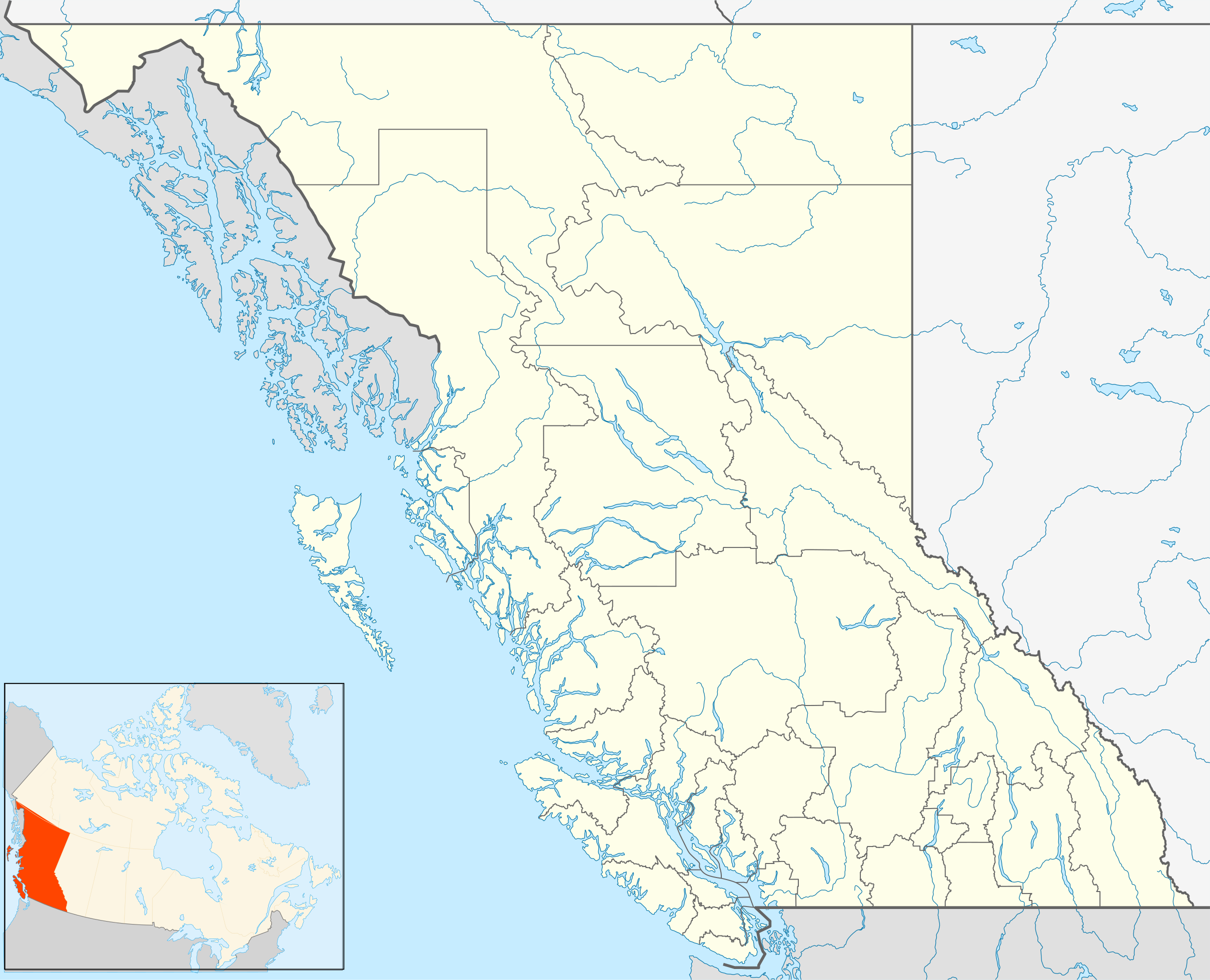
Quadratische Plattkarte, N-S-Streckung 170 %. Geographische Begrenzung der Karte:
Equirectangular projection, N/S stretching 170 %. Geographic limits of the map:
|
| Date | |
| Source | Own work, File:Canada_British_Columbia_location_map.svg by NordNordWest |
| Author | Hanhil ( talk) 16:54, 24 September 2009 (UTC) |
| Permission ( Reusing this file) |
I, the copyright holder of this work, hereby publish it under the following license: This file is licensed under the
Creative Commons
Attribution-Share Alike 3.0 Unported license.
|
File history
Click on a date/time to view the file as it appeared at that time.
| Date/Time | Thumbnail | Dimensions | User | Comment | |
|---|---|---|---|---|---|
| current | 15:08, 1 October 2018 |
| 2,419 × 1,960 (1.57 MB) | Allice Hunter | Reverted to version as of 20:46, 7 April 2013 (UTC) |
| 03:06, 4 August 2018 |
 | 2,419 × 1,960 (1.53 MB) | Allice Hunter | Comox Valley District | |
| 20:46, 7 April 2013 |
 | 2,419 × 1,960 (1.57 MB) | Hanhil | undid the version of 10 mar 2011 18:37 where the northern part of the Queen Charlotte Islands were gone | |
| 16:37, 10 March 2011 |
 | 2,419 × 1,960 (1.01 MB) | Hanhil | change in line with http://commons.wikimedia.org/?title=File%3ACanada_British_Columbia_location_map.svg&action=historysubmit&diff=51783638&oldid=44779970 | |
| 16:54, 24 September 2009 |
 | 2,419 × 1,960 (1.58 MB) | Hanhil | {{Information |Description= {{de|Positionskarte von British Columbia, Kanada}} Quadratische Plattkarte, N-S-Streckung 170 %. Geographische Begrenzung der Karte: * N: 60.3° N * S: 48.1° N * W: 139.3° W * O: 113.7� |
File usage
More than 100 pages use this file. The following list shows the first 100 pages that use this file only. A full list is available.
- 100 Mile House
- 108 Mile Ranch
- Abbotsford, British Columbia
- Abbotsford International Airport
- Armstrong, British Columbia
- Bamfield
- Barkerville
- Bella Bella, British Columbia
- Bennett, British Columbia
- Bountiful, British Columbia
- Burns Lake
- Butchart Gardens
- Cache Creek, British Columbia
- Campbell River, British Columbia
- Cassiar, British Columbia
- Castlegar, British Columbia
- Central Saanich
- Chemainus
- Chilliwack
- Clearwater, British Columbia
- Courtenay, British Columbia
- Cowichan Valley
- Cranbrook, British Columbia
- Creston, British Columbia
- Crofton, British Columbia
- Cypress Provincial Park
- Dawson Creek
- Duncan, British Columbia
- Esquimalt
- Fernie, British Columbia
- Field, British Columbia
- Fintry, British Columbia
- Fort St. John, British Columbia
- Gibsons
- Golden, British Columbia
- Greater Victoria
- Greendale, Chilliwack
- Haida Gwaii
- Hazelton, British Columbia
- Highlands, British Columbia
- Hope, British Columbia
- Hudson's Hope
- Kamloops
- Kelowna
- Kicking Horse Pass
- Kimberley, British Columbia
- Kootenays
- Ladysmith, British Columbia
- Laidlaw, British Columbia
- Liard River, British Columbia
- Lillooet
- List of people from British Columbia
- Lytton, British Columbia
- McBride, British Columbia
- Merritt, British Columbia
- Mission, British Columbia
- Nakusp
- Nanaimo
- Nelson, British Columbia
- North Cowichan
- Oak Bay, British Columbia
- Ocean Falls
- Oliver, British Columbia
- Osoyoos
- Parksville, British Columbia
- Peachland
- Penticton
- Port Alberni
- Port McNeill
- Pouce Coupe
- Powell River, British Columbia
- Prince George, British Columbia
- Prince George Airport
- Prince Rupert, British Columbia
- Qualicum Beach
- Quesnel, British Columbia
- Race Rocks Ecological Reserve
- Rossland, British Columbia
- Saanich, British Columbia
- Salmon Arm
- Savona, British Columbia
- Sidney, British Columbia
- Skookumchuck, British Columbia
- Smithers, British Columbia
- Sooke
- South Cariboo Regional Airport
- Sparwood
- Squamish, British Columbia
- Stein Valley Nlaka'pamux Heritage Park
- Stewart, British Columbia
- Summerland, British Columbia
- Terrace, British Columbia
- Ucluelet
- Vancouver
- Vernon, British Columbia
- Victoria, British Columbia
- Victoria International Airport
- View Royal
- Whistler, British Columbia
- Williams Lake, British Columbia
View more links to this file.
Global file usage
The following other wikis use this file:
- Usage on af.wikipedia.org
- Usage on ar.wikipedia.org
- Usage on ast.wikipedia.org
- Usage on azb.wikipedia.org
- Usage on ba.wikipedia.org
- Usage on bg.wikipedia.org
- Usage on bn.wikipedia.org
- Usage on ca.wikipedia.org
- Usage on ceb.wikipedia.org
- Usage on eo.wikipedia.org
- Usage on es.wikipedia.org
- Vancouver
- New Westminster
- Victoria (Columbia Británica)
- Kamloops
- Kelowna
- Abbotsford
- Surrey (Canadá)
- Armstrong (Columbia Británica)
- Hope (Columbia Británica)
- North Vancouver (Columbia Británica)
- Ciudad de Langley (Columbia Británica)
- Nanaimo
- Dawson Creek
- Whistler (Columbia Británica)
- Trail (Columbia Británica)
- Port Alberni (Columbia Británica)
- Penticton
- Aeropuerto Internacional de Vancouver
- Aeropuerto Internacional de Kelowna
- Aeropuerto Internacional de Victoria
- Aeropuerto Internacional de Abbotsford
- Aeropuerto de Nanaimo
- Plantilla:Mapa de localización de Columbia Británica
- Honeymoon Bay (Columbia Británica)
- Vernon (Columbia Británica)
- Mission (Columbia Británica)
- Fuerte de San Miguel de Nutca
- Monasterio de Santa Clara (Canadá)
- Prince George (Columbia Británica)
- Catedral del Sagrado Corazón (Kamloops)
- Catedral de San Andrés (Victoria)
View more global usage of this file.
Metadata
Original file (SVG file, nominally 2,419 × 1,960 pixels, file size: 1.57 MB)
| This is a file from the
Wikimedia Commons. Information from its
description page there is shown below. Commons is a freely licensed media file repository. You can help. |
| Description |
Quadratische Plattkarte, N-S-Streckung 170 %. Geographische Begrenzung der Karte:
Equirectangular projection, N/S stretching 170 %. Geographic limits of the map:
|
| Date | |
| Source | Own work, File:Canada_British_Columbia_location_map.svg by NordNordWest |
| Author | Hanhil ( talk) 16:54, 24 September 2009 (UTC) |
| Permission ( Reusing this file) |
I, the copyright holder of this work, hereby publish it under the following license: This file is licensed under the
Creative Commons
Attribution-Share Alike 3.0 Unported license.
|
File history
Click on a date/time to view the file as it appeared at that time.
| Date/Time | Thumbnail | Dimensions | User | Comment | |
|---|---|---|---|---|---|
| current | 15:08, 1 October 2018 |
| 2,419 × 1,960 (1.57 MB) | Allice Hunter | Reverted to version as of 20:46, 7 April 2013 (UTC) |
| 03:06, 4 August 2018 |
| 2,419 × 1,960 (1.53 MB) | Allice Hunter | Comox Valley District | |
| 20:46, 7 April 2013 |
| 2,419 × 1,960 (1.57 MB) | Hanhil | undid the version of 10 mar 2011 18:37 where the northern part of the Queen Charlotte Islands were gone | |
| 16:37, 10 March 2011 |
| 2,419 × 1,960 (1.01 MB) | Hanhil | change in line with http://commons.wikimedia.org/?title=File%3ACanada_British_Columbia_location_map.svg&action=historysubmit&diff=51783638&oldid=44779970 | |
| 16:54, 24 September 2009 |
| 2,419 × 1,960 (1.58 MB) | Hanhil | {{Information |Description= {{de|Positionskarte von British Columbia, Kanada}} Quadratische Plattkarte, N-S-Streckung 170 %. Geographische Begrenzung der Karte: * N: 60.3° N * S: 48.1° N * W: 139.3° W * O: 113.7� |
File usage
More than 100 pages use this file. The following list shows the first 100 pages that use this file only. A full list is available.
- 100 Mile House
- 108 Mile Ranch
- Abbotsford, British Columbia
- Abbotsford International Airport
- Armstrong, British Columbia
- Bamfield
- Barkerville
- Bella Bella, British Columbia
- Bennett, British Columbia
- Bountiful, British Columbia
- Burns Lake
- Butchart Gardens
- Cache Creek, British Columbia
- Campbell River, British Columbia
- Cassiar, British Columbia
- Castlegar, British Columbia
- Central Saanich
- Chemainus
- Chilliwack
- Clearwater, British Columbia
- Courtenay, British Columbia
- Cowichan Valley
- Cranbrook, British Columbia
- Creston, British Columbia
- Crofton, British Columbia
- Cypress Provincial Park
- Dawson Creek
- Duncan, British Columbia
- Esquimalt
- Fernie, British Columbia
- Field, British Columbia
- Fintry, British Columbia
- Fort St. John, British Columbia
- Gibsons
- Golden, British Columbia
- Greater Victoria
- Greendale, Chilliwack
- Haida Gwaii
- Hazelton, British Columbia
- Highlands, British Columbia
- Hope, British Columbia
- Hudson's Hope
- Kamloops
- Kelowna
- Kicking Horse Pass
- Kimberley, British Columbia
- Kootenays
- Ladysmith, British Columbia
- Laidlaw, British Columbia
- Liard River, British Columbia
- Lillooet
- List of people from British Columbia
- Lytton, British Columbia
- McBride, British Columbia
- Merritt, British Columbia
- Mission, British Columbia
- Nakusp
- Nanaimo
- Nelson, British Columbia
- North Cowichan
- Oak Bay, British Columbia
- Ocean Falls
- Oliver, British Columbia
- Osoyoos
- Parksville, British Columbia
- Peachland
- Penticton
- Port Alberni
- Port McNeill
- Pouce Coupe
- Powell River, British Columbia
- Prince George, British Columbia
- Prince George Airport
- Prince Rupert, British Columbia
- Qualicum Beach
- Quesnel, British Columbia
- Race Rocks Ecological Reserve
- Rossland, British Columbia
- Saanich, British Columbia
- Salmon Arm
- Savona, British Columbia
- Sidney, British Columbia
- Skookumchuck, British Columbia
- Smithers, British Columbia
- Sooke
- South Cariboo Regional Airport
- Sparwood
- Squamish, British Columbia
- Stein Valley Nlaka'pamux Heritage Park
- Stewart, British Columbia
- Summerland, British Columbia
- Terrace, British Columbia
- Ucluelet
- Vancouver
- Vernon, British Columbia
- Victoria, British Columbia
- Victoria International Airport
- View Royal
- Whistler, British Columbia
- Williams Lake, British Columbia
View more links to this file.
Global file usage
The following other wikis use this file:
- Usage on af.wikipedia.org
- Usage on ar.wikipedia.org
- Usage on ast.wikipedia.org
- Usage on azb.wikipedia.org
- Usage on ba.wikipedia.org
- Usage on bg.wikipedia.org
- Usage on bn.wikipedia.org
- Usage on ca.wikipedia.org
- Usage on ceb.wikipedia.org
- Usage on eo.wikipedia.org
- Usage on es.wikipedia.org
- Vancouver
- New Westminster
- Victoria (Columbia Británica)
- Kamloops
- Kelowna
- Abbotsford
- Surrey (Canadá)
- Armstrong (Columbia Británica)
- Hope (Columbia Británica)
- North Vancouver (Columbia Británica)
- Ciudad de Langley (Columbia Británica)
- Nanaimo
- Dawson Creek
- Whistler (Columbia Británica)
- Trail (Columbia Británica)
- Port Alberni (Columbia Británica)
- Penticton
- Aeropuerto Internacional de Vancouver
- Aeropuerto Internacional de Kelowna
- Aeropuerto Internacional de Victoria
- Aeropuerto Internacional de Abbotsford
- Aeropuerto de Nanaimo
- Plantilla:Mapa de localización de Columbia Británica
- Honeymoon Bay (Columbia Británica)
- Vernon (Columbia Británica)
- Mission (Columbia Británica)
- Fuerte de San Miguel de Nutca
- Monasterio de Santa Clara (Canadá)
- Prince George (Columbia Británica)
- Catedral del Sagrado Corazón (Kamloops)
- Catedral de San Andrés (Victoria)
View more global usage of this file.