Size of this preview:
658 × 599 pixels. Other resolutions:
263 × 240 pixels |
527 × 480 pixels |
843 × 768 pixels |
1,247 × 1,136 pixels.
Original file (1,247 × 1,136 pixels, file size: 1.42 MB, MIME type: image/png)
| This is a file from the
Wikimedia Commons. Information from its
description page there is shown below. Commons is a freely licensed media file repository. You can help. |
Summary
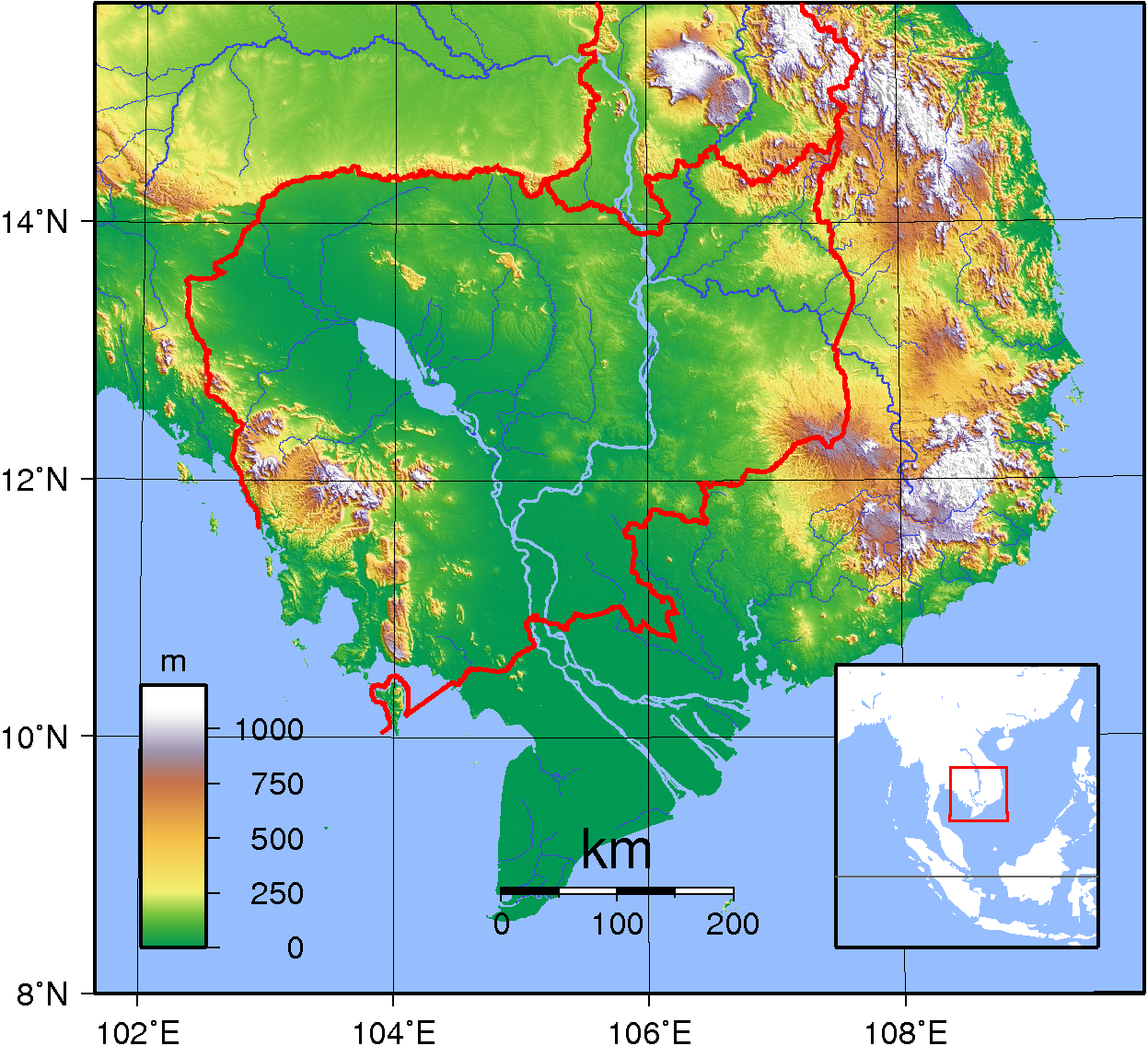
| Description | Topographic map of Cambodia. Created with GMT from publicly released GLOBE data. [1] |
| Date | |
| Source | Own work |
| Author | Sadalmelik |
Licensing
| This work has been released into the
public domain by its author, I,
Sadalmelik. This applies worldwide. In some countries this may not be legally possible; if so: I, Sadalmelik grants anyone the right to use this work for any purpose, without any conditions, unless such conditions are required by law. |
File history
Click on a date/time to view the file as it appeared at that time.
| Date/Time | Thumbnail | Dimensions | User | Comment | |
|---|---|---|---|---|---|
| current | 10:00, 14 October 2007 |
| 1,247 × 1,136 (1.42 MB) | Sadalmelik | Better data, nicer colours |
| 19:18, 11 June 2007 |
 | 1,222 × 1,053 (967 KB) | Sadalmelik | {{Information |Description=Topographic map of Cambodia. Created with GMT from publicly released GLOBE data.[http://www.ngdc.noaa.gov/mgg/topo/globe.html] |Source=self-made |Date=June 11, 2007 |Author= Sadalmelik }} [[Category:Maps of |
File usage
The following pages on the English Wikipedia use this file (pages on other projects are not listed):
Global file usage
The following other wikis use this file:
- Usage on bg.wikipedia.org
- Usage on bn.wikipedia.org
- Usage on fa.wikipedia.org
- Usage on fr.wikipedia.org
- Usage on hi.wikipedia.org
- Usage on hu.wikipedia.org
- Usage on is.wikipedia.org
- Usage on ja.wikipedia.org
- Usage on ka.wikipedia.org
- Usage on km.wikipedia.org
- Usage on lt.wikipedia.org
- Usage on mn.wikipedia.org
- Usage on no.wikipedia.org
- Usage on sl.wikipedia.org
- Usage on ta.wikipedia.org
- Usage on th.wikipedia.org
- Usage on uk.wikipedia.org
- Usage on vep.wikipedia.org
- Usage on vi.wikipedia.org
- Usage on vi.wikibooks.org
- Usage on zh.wikipedia.org
Size of this preview:
658 × 599 pixels. Other resolutions:
263 × 240 pixels |
527 × 480 pixels |
843 × 768 pixels |
1,247 × 1,136 pixels.
Original file (1,247 × 1,136 pixels, file size: 1.42 MB, MIME type: image/png)
| This is a file from the
Wikimedia Commons. Information from its
description page there is shown below. Commons is a freely licensed media file repository. You can help. |
Summary
| Description | Topographic map of Cambodia. Created with GMT from publicly released GLOBE data. [1] |
| Date | |
| Source | Own work |
| Author | Sadalmelik |
Licensing
| This work has been released into the
public domain by its author, I,
Sadalmelik. This applies worldwide. In some countries this may not be legally possible; if so: I, Sadalmelik grants anyone the right to use this work for any purpose, without any conditions, unless such conditions are required by law. |
File history
Click on a date/time to view the file as it appeared at that time.
| Date/Time | Thumbnail | Dimensions | User | Comment | |
|---|---|---|---|---|---|
| current | 10:00, 14 October 2007 |
| 1,247 × 1,136 (1.42 MB) | Sadalmelik | Better data, nicer colours |
| 19:18, 11 June 2007 |
| 1,222 × 1,053 (967 KB) | Sadalmelik | {{Information |Description=Topographic map of Cambodia. Created with GMT from publicly released GLOBE data.[http://www.ngdc.noaa.gov/mgg/topo/globe.html] |Source=self-made |Date=June 11, 2007 |Author= Sadalmelik }} [[Category:Maps of |
File usage
The following pages on the English Wikipedia use this file (pages on other projects are not listed):
Global file usage
The following other wikis use this file:
- Usage on bg.wikipedia.org
- Usage on bn.wikipedia.org
- Usage on fa.wikipedia.org
- Usage on fr.wikipedia.org
- Usage on hi.wikipedia.org
- Usage on hu.wikipedia.org
- Usage on is.wikipedia.org
- Usage on ja.wikipedia.org
- Usage on ka.wikipedia.org
- Usage on km.wikipedia.org
- Usage on lt.wikipedia.org
- Usage on mn.wikipedia.org
- Usage on no.wikipedia.org
- Usage on sl.wikipedia.org
- Usage on ta.wikipedia.org
- Usage on th.wikipedia.org
- Usage on uk.wikipedia.org
- Usage on vep.wikipedia.org
- Usage on vi.wikipedia.org
- Usage on vi.wikibooks.org
- Usage on zh.wikipedia.org