
Original file (SVG file, nominally 1,347 × 1,217 pixels, file size: 748 KB)
| This is a file from the
Wikimedia Commons. Information from its
description page there is shown below. Commons is a freely licensed media file repository. You can help. |
| Description |
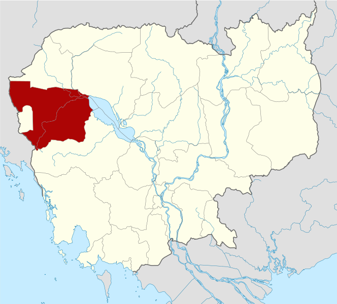
Deutsch: Positionskarte von
Kambodscha Quadratische Plattkarte, N-S-Streckung 105 %. Geographische Begrenzung der Karte: * N: 14.8° N * S: 9.9° N * W: 102.2° O * O: 107.9° O Equirectangular projection, N/S stretching 105 %. Geographic limits of the map: * N: 14.8° N * S: 9.9° N * W: 102.2° E * E: 107.9° E |
| Date | (UTC) |
| Source | Own work based on: Cambodia location map.svg by NordNordWest |
| Author | Kmusser |
| SVG development | This W3C-invalid
locator map was created with
Adobe Illustrator, and with Inkscape. |
| This is a
retouched picture, which means that it has been digitally altered from its original version. Modifications: highlighted Battambang Province. The original can be viewed here:
Cambodia location map.svg:
|
- You are free:
- to share – to copy, distribute and transmit the work
- to remix – to adapt the work
- Under the following conditions:
- attribution – You must give appropriate credit, provide a link to the license, and indicate if changes were made. You may do so in any reasonable manner, but not in any way that suggests the licensor endorses you or your use.
- share alike – If you remix, transform, or build upon the material, you must distribute your contributions under the same or compatible license as the original.

|
Permission is granted to copy, distribute and/or modify this document under the terms of the GNU Free Documentation License, Version 1.2 or any later version published by the Free Software Foundation; with no Invariant Sections, no Front-Cover Texts, and no Back-Cover Texts. A copy of the license is included in the section entitled GNU Free Documentation License. |
Original upload log
This image is a derivative work of the following images:
-
File:Cambodia_location_map.svg licensed with Cc-by-sa-3.0, GFDL
- 2009-02-12T21:35:03Z NordNordWest 1347x1217 (728478 Bytes) smaller file
- 2009-02-12T20:56:36Z NordNordWest 1347x1216 (1074945 Bytes) {{Information |Description= {{de|Positionskarte von [[:de:Kambodscha|Kambodscha]]}} Quadratische Plattkarte, N-S-Streckung 105 %. Geographische Begrenzung der Karte: * N: 14.8° N * S: 9.9° N * W: 102.2° O * O: 107.9° O {{
File history
Click on a date/time to view the file as it appeared at that time.
| Date/Time | Thumbnail | Dimensions | User | Comment | |
|---|---|---|---|---|---|
| current | 15:16, 8 June 2010 |
| 1,347 × 1,217 (748 KB) | Kmusser | {{Information |Description={{de|Positionskarte von Kambodscha}} Quadratische Plattkarte, N-S-Streckung 105 %. Geographische Begrenzung der Karte: * N: 14.8° N * S: 9.9° N * W: 102.2° O * O: 107.9° O {{en|Location map of [[:en:Cambod |
File usage
More than 100 pages use this file. The following list shows the first 100 pages that use this file only. A full list is available.
- Aek Phnum District
- Ampil Pram Daeum
- Andaeuk Haeb
- Angkor Ban
- Anlong Run
- Anlong Vil
- Banan district, Battambang
- Bansay Traeng
- Barang Thleak
- Battambang
- Battambang Municipality
- Battambang province
- Bavel (commune)
- Bavel District
- Bay Damram
- Boeng Pring
- Chaeng Mean Chey
- Chakrei
- Chamkar Samraong
- Chheu Teal
- Chrey, Moung Ruessei
- Chrey, Thma Koul
- Chrey Seima
- Chrouy Sdau
- Kakaoh
- Kampong Lpov
- Kampong Preah
- Kampong Prieng
- Kamrieng district
- Kantueu Muoy
- Kantueu Pir
- Kaoh Chiveang
- Kdol Doun Teav
- Kdol Tahen
- Kear (khum)
- Khnach Romeas
- Koas Krala district
- Kouk Khmum
- Lvea
- Mean Chey (commune)
- Moung
- Moung Ruessei
- Moung Ruessei district
- Norea (commune)
- Ou Char
- Ou Dambang Muoy
- Ou Dambang Pir
- Ou Mal
- Ou Rumduol
- Ou Samrel
- Ou Ta Ki
- Peam Aek
- Pech Chenda
- Phlov Meas
- Phnum Proek (commune)
- Phnum Proek district
- Phnum Sampov
- Preaek Khpob
- Preaek Luong
- Preaek Norint
- Preaek Preah Sdach
- Prek Chik
- Prey Chas
- Prey Khpos
- Prey Svay
- Prey Touch
- Prey Tralach
- Reang Kesei
- Robas Mongkol
- Roka, Cambodia
- Rotanak
- Rotanak Mondol District
- Ruessei Krang
- Rung Chrey
- Samlaut Multiple Use Area
- Samlout (commune)
- Samlout District
- Sampov Lun (commune)
- Sampov Lun District
- Samraong Knong
- Sangkae District
- Santepheap
- Sdau
- Serei Mean Chey
- Sla Kaet
- Snoeng
- Sung, Cambodia
- Svay Pao
- Ta Kream
- Ta Loas
- Ta Meun
- Ta Pon
- Ta Pung
- Ta Sanh
- Ta Sda
- Ta Taok
- Thma Koul District
- Traeng
- Tuol Ta Aek
- Voat Kor
View more links to this file.
Global file usage
The following other wikis use this file:
- Usage on ar.wikipedia.org
- Usage on bg.wikipedia.org
- Usage on ceb.wikipedia.org
- Usage on fa.wikipedia.org
- Usage on fi.wikipedia.org
- Usage on frr.wikipedia.org
- Usage on fr.wikipedia.org
- Usage on hi.wikipedia.org
- Usage on id.wikipedia.org
- Usage on it.wikipedia.org
- Usage on ja.wikipedia.org
- Usage on km.wikipedia.org
- ខេត្តបាត់ដំបង
- ស្រុកបាណន់
- ស្រុកថ្មគោល
- ក្រុងបាត់ដំបង
- ស្រុកបវេល
- ស្រុកឯកភ្នំ
- ស្រុកមោងឫស្សី
- ស្រុកភ្នំព្រឹក
- ស្រុកកំរៀង
- ស្រុកគាស់ក្រឡ
- ស្រុករតនមណ្ឌល
- ស្រុកសង្កែ
- ស្រុកសំឡូត
- ស្រុកសំពៅលូន
- ឃុំកន្ទឺ ១
- ឃុំកន្ទឺ ២
- ឃុំបាយដំរាំ
- ឃុំឈើទាល (ស្រុកបាណន់)
- ឃុំភ្នំសំពៅ
- ឃុំស្នឹង
- ឃុំតាគ្រាម
- ឃុំចែងមានជ័យ
- ទំព័រគំរូ:ខេត្តបាត់ដំបង
- ឃុំតាពូង
- ឃុំតាម៉ឺន
- ឃុំអូរតាគី
- ឃុំអន្លង់រុន
- ឃុំជ្រោយស្តៅ
- ឃុំបឹងព្រីង
- ឃុំគោកឃ្មុំ
- ឃុំបន្សាយត្រែង
- ឃុំរូងជ្រៃ
- សង្កាត់ទួលតាឯក
- សង្កាត់ព្រែកព្រះស្តេច
- ឃុំរតនៈ
- សង្កាត់ចំការសំរោង
View more global usage of this file.
Original file (SVG file, nominally 1,347 × 1,217 pixels, file size: 748 KB)
| This is a file from the
Wikimedia Commons. Information from its
description page there is shown below. Commons is a freely licensed media file repository. You can help. |
| Description |
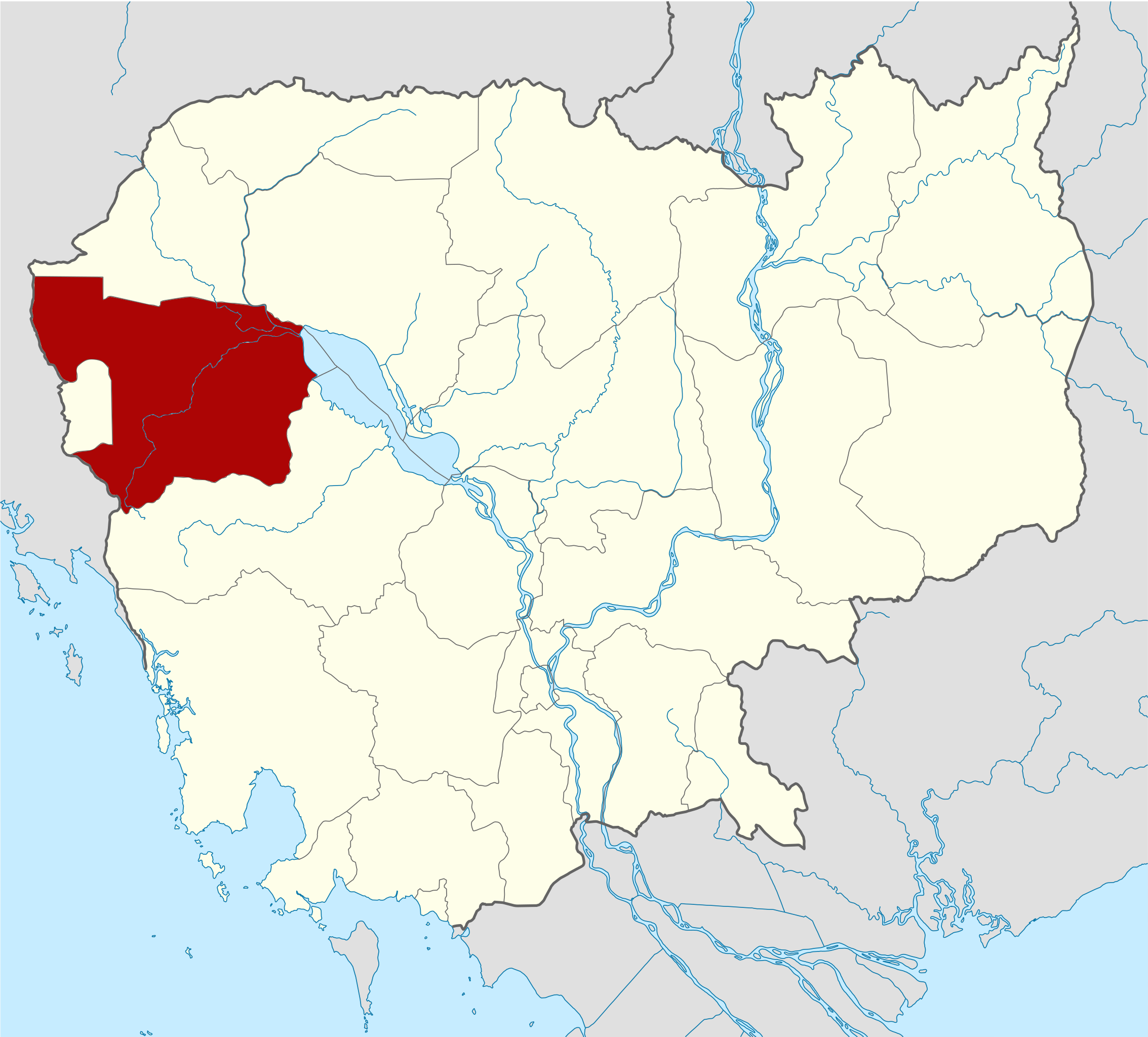
Deutsch: Positionskarte von
Kambodscha Quadratische Plattkarte, N-S-Streckung 105 %. Geographische Begrenzung der Karte: * N: 14.8° N * S: 9.9° N * W: 102.2° O * O: 107.9° O Equirectangular projection, N/S stretching 105 %. Geographic limits of the map: * N: 14.8° N * S: 9.9° N * W: 102.2° E * E: 107.9° E |
| Date | (UTC) |
| Source | Own work based on: Cambodia location map.svg by NordNordWest |
| Author | Kmusser |
| SVG development | This W3C-invalid
locator map was created with
Adobe Illustrator, and with Inkscape. |
| This is a
retouched picture, which means that it has been digitally altered from its original version. Modifications: highlighted Battambang Province. The original can be viewed here:
Cambodia location map.svg:
|
- You are free:
- to share – to copy, distribute and transmit the work
- to remix – to adapt the work
- Under the following conditions:
- attribution – You must give appropriate credit, provide a link to the license, and indicate if changes were made. You may do so in any reasonable manner, but not in any way that suggests the licensor endorses you or your use.
- share alike – If you remix, transform, or build upon the material, you must distribute your contributions under the same or compatible license as the original.
|
|
Permission is granted to copy, distribute and/or modify this document under the terms of the GNU Free Documentation License, Version 1.2 or any later version published by the Free Software Foundation; with no Invariant Sections, no Front-Cover Texts, and no Back-Cover Texts. A copy of the license is included in the section entitled GNU Free Documentation License. |
Original upload log
This image is a derivative work of the following images:
-
File:Cambodia_location_map.svg licensed with Cc-by-sa-3.0, GFDL
- 2009-02-12T21:35:03Z NordNordWest 1347x1217 (728478 Bytes) smaller file
- 2009-02-12T20:56:36Z NordNordWest 1347x1216 (1074945 Bytes) {{Information |Description= {{de|Positionskarte von [[:de:Kambodscha|Kambodscha]]}} Quadratische Plattkarte, N-S-Streckung 105 %. Geographische Begrenzung der Karte: * N: 14.8° N * S: 9.9° N * W: 102.2° O * O: 107.9° O {{
File history
Click on a date/time to view the file as it appeared at that time.
| Date/Time | Thumbnail | Dimensions | User | Comment | |
|---|---|---|---|---|---|
| current | 15:16, 8 June 2010 |
| 1,347 × 1,217 (748 KB) | Kmusser | {{Information |Description={{de|Positionskarte von Kambodscha}} Quadratische Plattkarte, N-S-Streckung 105 %. Geographische Begrenzung der Karte: * N: 14.8° N * S: 9.9° N * W: 102.2° O * O: 107.9° O {{en|Location map of [[:en:Cambod |
File usage
More than 100 pages use this file. The following list shows the first 100 pages that use this file only. A full list is available.
- Aek Phnum District
- Ampil Pram Daeum
- Andaeuk Haeb
- Angkor Ban
- Anlong Run
- Anlong Vil
- Banan district, Battambang
- Bansay Traeng
- Barang Thleak
- Battambang
- Battambang Municipality
- Battambang province
- Bavel (commune)
- Bavel District
- Bay Damram
- Boeng Pring
- Chaeng Mean Chey
- Chakrei
- Chamkar Samraong
- Chheu Teal
- Chrey, Moung Ruessei
- Chrey, Thma Koul
- Chrey Seima
- Chrouy Sdau
- Kakaoh
- Kampong Lpov
- Kampong Preah
- Kampong Prieng
- Kamrieng district
- Kantueu Muoy
- Kantueu Pir
- Kaoh Chiveang
- Kdol Doun Teav
- Kdol Tahen
- Kear (khum)
- Khnach Romeas
- Koas Krala district
- Kouk Khmum
- Lvea
- Mean Chey (commune)
- Moung
- Moung Ruessei
- Moung Ruessei district
- Norea (commune)
- Ou Char
- Ou Dambang Muoy
- Ou Dambang Pir
- Ou Mal
- Ou Rumduol
- Ou Samrel
- Ou Ta Ki
- Peam Aek
- Pech Chenda
- Phlov Meas
- Phnum Proek (commune)
- Phnum Proek district
- Phnum Sampov
- Preaek Khpob
- Preaek Luong
- Preaek Norint
- Preaek Preah Sdach
- Prek Chik
- Prey Chas
- Prey Khpos
- Prey Svay
- Prey Touch
- Prey Tralach
- Reang Kesei
- Robas Mongkol
- Roka, Cambodia
- Rotanak
- Rotanak Mondol District
- Ruessei Krang
- Rung Chrey
- Samlaut Multiple Use Area
- Samlout (commune)
- Samlout District
- Sampov Lun (commune)
- Sampov Lun District
- Samraong Knong
- Sangkae District
- Santepheap
- Sdau
- Serei Mean Chey
- Sla Kaet
- Snoeng
- Sung, Cambodia
- Svay Pao
- Ta Kream
- Ta Loas
- Ta Meun
- Ta Pon
- Ta Pung
- Ta Sanh
- Ta Sda
- Ta Taok
- Thma Koul District
- Traeng
- Tuol Ta Aek
- Voat Kor
View more links to this file.
Global file usage
The following other wikis use this file:
- Usage on ar.wikipedia.org
- Usage on bg.wikipedia.org
- Usage on ceb.wikipedia.org
- Usage on fa.wikipedia.org
- Usage on fi.wikipedia.org
- Usage on frr.wikipedia.org
- Usage on fr.wikipedia.org
- Usage on hi.wikipedia.org
- Usage on id.wikipedia.org
- Usage on it.wikipedia.org
- Usage on ja.wikipedia.org
- Usage on km.wikipedia.org
- ខេត្តបាត់ដំបង
- ស្រុកបាណន់
- ស្រុកថ្មគោល
- ក្រុងបាត់ដំបង
- ស្រុកបវេល
- ស្រុកឯកភ្នំ
- ស្រុកមោងឫស្សី
- ស្រុកភ្នំព្រឹក
- ស្រុកកំរៀង
- ស្រុកគាស់ក្រឡ
- ស្រុករតនមណ្ឌល
- ស្រុកសង្កែ
- ស្រុកសំឡូត
- ស្រុកសំពៅលូន
- ឃុំកន្ទឺ ១
- ឃុំកន្ទឺ ២
- ឃុំបាយដំរាំ
- ឃុំឈើទាល (ស្រុកបាណន់)
- ឃុំភ្នំសំពៅ
- ឃុំស្នឹង
- ឃុំតាគ្រាម
- ឃុំចែងមានជ័យ
- ទំព័រគំរូ:ខេត្តបាត់ដំបង
- ឃុំតាពូង
- ឃុំតាម៉ឺន
- ឃុំអូរតាគី
- ឃុំអន្លង់រុន
- ឃុំជ្រោយស្តៅ
- ឃុំបឹងព្រីង
- ឃុំគោកឃ្មុំ
- ឃុំបន្សាយត្រែង
- ឃុំរូងជ្រៃ
- សង្កាត់ទួលតាឯក
- សង្កាត់ព្រែកព្រះស្តេច
- ឃុំរតនៈ
- សង្កាត់ចំការសំរោង
View more global usage of this file.