
Original file (SVG file, nominally 1,152 × 640 pixels, file size: 151 KB)
| This is a file from the
Wikimedia Commons. Information from its
description page there is shown below. Commons is a freely licensed media file repository. You can help. |
Summary
| Description |
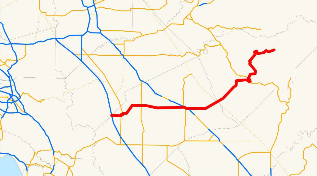
English: This is a map of State Route 140 in California. |
| Source | Email me if you would like a copy of the GIS data I created for the highways. |
| Author | User:NE2 |
Sources: BTS North American Transportation Atlas Data archive copy at the Wayback Machine, Caltrans State Truck Route List ( XLS file), Caltrans Log of Bridges on State Highways, All Caltrans Traffic Volumes on CSHS, California State Legislature Definitions of Routes
Licensing
| I, the copyright holder of this work, release this work into the
public domain. This applies worldwide. In some countries this may not be legally possible; if so: I grant anyone the right to use this work for any purpose, without any conditions, unless such conditions are required by law. |
File history
Click on a date/time to view the file as it appeared at that time.
| Date/Time | Thumbnail | Dimensions | User | Comment | |
|---|---|---|---|---|---|
| current | 18:21, 19 December 2007 |
| 1,152 × 640 (151 KB) | NE2 | == Summary == This is a map of State Route 140 in California. Email me if you would like a copy of the GIS data I created for the highways. Category:California State Route 140 [[Category:Maps of state highways in California| |
File usage
Global file usage
The following other wikis use this file:
- Usage on es.wikipedia.org
- Usage on nl.wikipedia.org
- Usage on www.wikidata.org
- Usage on zh-min-nan.wikipedia.org
Original file (SVG file, nominally 1,152 × 640 pixels, file size: 151 KB)
| This is a file from the
Wikimedia Commons. Information from its
description page there is shown below. Commons is a freely licensed media file repository. You can help. |
Summary
| Description |
English: This is a map of State Route 140 in California. |
| Source | Email me if you would like a copy of the GIS data I created for the highways. |
| Author | User:NE2 |
Sources: BTS North American Transportation Atlas Data archive copy at the Wayback Machine, Caltrans State Truck Route List ( XLS file), Caltrans Log of Bridges on State Highways, All Caltrans Traffic Volumes on CSHS, California State Legislature Definitions of Routes
Licensing
| I, the copyright holder of this work, release this work into the
public domain. This applies worldwide. In some countries this may not be legally possible; if so: I grant anyone the right to use this work for any purpose, without any conditions, unless such conditions are required by law. |
File history
Click on a date/time to view the file as it appeared at that time.
| Date/Time | Thumbnail | Dimensions | User | Comment | |
|---|---|---|---|---|---|
| current | 18:21, 19 December 2007 |
| 1,152 × 640 (151 KB) | NE2 | == Summary == This is a map of State Route 140 in California. Email me if you would like a copy of the GIS data I created for the highways. Category:California State Route 140 [[Category:Maps of state highways in California| |
File usage
Global file usage
The following other wikis use this file:
- Usage on es.wikipedia.org
- Usage on nl.wikipedia.org
- Usage on www.wikidata.org
- Usage on zh-min-nan.wikipedia.org