
Size of this PNG preview of this SVG file:
603 × 600 pixels. Other resolutions:
241 × 240 pixels |
483 × 480 pixels |
772 × 768 pixels |
1,030 × 1,024 pixels |
2,059 × 2,048 pixels |
1,273 × 1,266 pixels.
Original file (SVG file, nominally 1,273 × 1,266 pixels, file size: 474 KB)
| This is a file from the
Wikimedia Commons. Information from its
description page there is shown below. Commons is a freely licensed media file repository. You can help. |
.svg)
| Description |
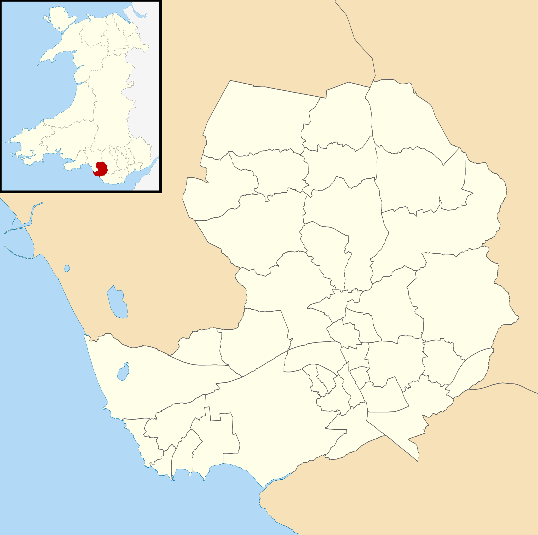
Blank map of Bridgend, UK with electoral wards shown. Equirectangular map projection on WGS 84 datum, with N/S stretched 160% Geographic limits:
|
| Date | |
| Source |
|
| Author | Nilfanion, created using Ordnance Survey data |
| Permission ( Reusing this file) |
This file is licensed under the
Creative Commons
Attribution-Share Alike 3.0 Unported license. Attribution: Contains Ordnance Survey data © Crown copyright and database right
|
File history
Click on a date/time to view the file as it appeared at that time.
| Date/Time | Thumbnail | Dimensions | User | Comment | |
|---|---|---|---|---|---|
| current | 17:57, 16 October 2010 |
| 1,273 × 1,266 (474 KB) | Nilfanion | {{Information |Description=Blank map of Bridgend, UK with electoral wards shown. Equirectangular map projection on WGS 84 datum, with N/S stretched 160% Geographic limits: *West: 3.82W *East: 3.45W *North: 51.68N *South: 51.45N |Source=[[ |
File usage
The following pages on the English Wikipedia use this file (pages on other projects are not listed):
.svg)
Size of this PNG preview of this SVG file:
603 × 600 pixels. Other resolutions:
241 × 240 pixels |
483 × 480 pixels |
772 × 768 pixels |
1,030 × 1,024 pixels |
2,059 × 2,048 pixels |
1,273 × 1,266 pixels.
Original file (SVG file, nominally 1,273 × 1,266 pixels, file size: 474 KB)
| This is a file from the
Wikimedia Commons. Information from its
description page there is shown below. Commons is a freely licensed media file repository. You can help. |
| Description |
Blank map of Bridgend, UK with electoral wards shown. Equirectangular map projection on WGS 84 datum, with N/S stretched 160% Geographic limits:
|
| Date | |
| Source |
|
| Author | Nilfanion, created using Ordnance Survey data |
| Permission ( Reusing this file) |
This file is licensed under the
Creative Commons
Attribution-Share Alike 3.0 Unported license. Attribution: Contains Ordnance Survey data © Crown copyright and database right
|
File history
Click on a date/time to view the file as it appeared at that time.
| Date/Time | Thumbnail | Dimensions | User | Comment | |
|---|---|---|---|---|---|
| current | 17:57, 16 October 2010 |
| 1,273 × 1,266 (474 KB) | Nilfanion | {{Information |Description=Blank map of Bridgend, UK with electoral wards shown. Equirectangular map projection on WGS 84 datum, with N/S stretched 160% Geographic limits: *West: 3.82W *East: 3.45W *North: 51.68N *South: 51.45N |Source=[[ |
File usage
The following pages on the English Wikipedia use this file (pages on other projects are not listed):