Photos • Location


 The categories of this image should be checked.
Check them now!
The categories of this image should be checked.
Check them now!

No higher resolution available.
Boundary_Stone,_Urra_Moor_-_geograph.org.uk_-_11308.jpg (640 × 480 pixels, file size: 113 KB, MIME type: image/jpeg)
| This is a file from the
Wikimedia Commons. Information from its
description page there is shown below. Commons is a freely licensed media file repository. You can help. |
Summary
| Description |
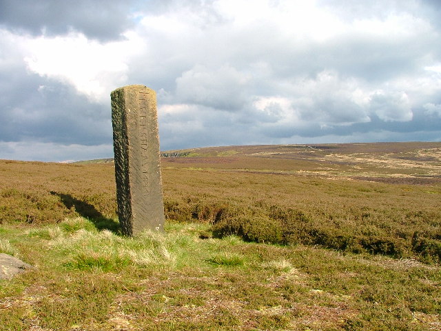
English: Boundary Stone, Urra Moor. This post was erected in 1848 and denotes the boundary of the Earl of Feversham's estate which included most of Farndale and Bransdale. |
| Date | |
| Source | From geograph.org.uk |
| Author | Mick Garratt |
| Attribution ( required by the license) | Mick Garratt / Boundary Stone, Urra Moor / |
| Object location |
| View this and other nearby images on: OpenStreetMap |
|
|---|
_&language=en)
Licensing

|
This image was taken from the
Geograph project collection. See
this photograph's page on the Geograph website for the photographer's contact details. The copyright on this image is owned by Mick Garratt and is licensed for reuse under the
Creative Commons Attribution-ShareAlike 2.0 license.
|
This file is licensed under the
Creative Commons
Attribution-Share Alike 2.0 Generic license.
Attribution: Mick Garratt
- You are free:
- to share – to copy, distribute and transmit the work
- to remix – to adapt the work
- Under the following conditions:
- attribution – You must give appropriate credit, provide a link to the license, and indicate if changes were made. You may do so in any reasonable manner, but not in any way that suggests the licensor endorses you or your use.
- share alike – If you remix, transform, or build upon the material, you must distribute your contributions under the same or compatible license as the original.
- Remove redundant categories and try to put this image in the most specific category/categories
- Remove this template
- The location categories are based on information from this geonames tool and this OpenStreetMap tool combined with a database. You can also have a look at this tool from mysociety.
- The topic category from Geograph was Boundary stone (find similar images stone at Geograph)
File history
Click on a date/time to view the file as it appeared at that time.
| Date/Time | Thumbnail | Dimensions | User | Comment | |
|---|---|---|---|---|---|
| current | 01:46, 30 January 2010 |
| 640 × 480 (113 KB) | GeographBot | == {{int:filedesc}} == {{Information |description={{en|1=Boundary Stone, Urra Moor. This post was erected in 1848 and denotes the boundary of the Earl of Feversham's estate which included most of Farndale and Bransdale.}} |date=2005-05-20 |source=From [ht |
File usage
The following pages on the English Wikipedia use this file (pages on other projects are not listed):
Global file usage
The following other wikis use this file:
- Usage on pl.wikipedia.org
Metadata
No higher resolution available.
Boundary_Stone,_Urra_Moor_-_geograph.org.uk_-_11308.jpg (640 × 480 pixels, file size: 113 KB, MIME type: image/jpeg)
| This is a file from the
Wikimedia Commons. Information from its
description page there is shown below. Commons is a freely licensed media file repository. You can help. |
Summary
| Description |
English: Boundary Stone, Urra Moor. This post was erected in 1848 and denotes the boundary of the Earl of Feversham's estate which included most of Farndale and Bransdale. |
| Date | |
| Source | From geograph.org.uk |
| Author | Mick Garratt |
| Attribution ( required by the license) | Mick Garratt / Boundary Stone, Urra Moor / |
| Object location |
| View this and other nearby images on: OpenStreetMap |
|
|---|
Licensing
|
|
This image was taken from the
Geograph project collection. See
this photograph's page on the Geograph website for the photographer's contact details. The copyright on this image is owned by Mick Garratt and is licensed for reuse under the
Creative Commons Attribution-ShareAlike 2.0 license.
|
This file is licensed under the
Creative Commons
Attribution-Share Alike 2.0 Generic license.
Attribution: Mick Garratt
- You are free:
- to share – to copy, distribute and transmit the work
- to remix – to adapt the work
- Under the following conditions:
- attribution – You must give appropriate credit, provide a link to the license, and indicate if changes were made. You may do so in any reasonable manner, but not in any way that suggests the licensor endorses you or your use.
- share alike – If you remix, transform, or build upon the material, you must distribute your contributions under the same or compatible license as the original.
- Remove redundant categories and try to put this image in the most specific category/categories
- Remove this template
- The location categories are based on information from this geonames tool and this OpenStreetMap tool combined with a database. You can also have a look at this tool from mysociety.
- The topic category from Geograph was Boundary stone (find similar images stone at Geograph)
File history
Click on a date/time to view the file as it appeared at that time.
| Date/Time | Thumbnail | Dimensions | User | Comment | |
|---|---|---|---|---|---|
| current | 01:46, 30 January 2010 |
| 640 × 480 (113 KB) | GeographBot | == {{int:filedesc}} == {{Information |description={{en|1=Boundary Stone, Urra Moor. This post was erected in 1848 and denotes the boundary of the Earl of Feversham's estate which included most of Farndale and Bransdale.}} |date=2005-05-20 |source=From [ht |
File usage
The following pages on the English Wikipedia use this file (pages on other projects are not listed):
Global file usage
The following other wikis use this file:
- Usage on pl.wikipedia.org