Original file (1,500 × 1,200 pixels, file size: 109 KB, MIME type: image/png)
| This is a file from the
Wikimedia Commons. Information from its
description page there is shown below. Commons is a freely licensed media file repository. You can help. |
Summary
| Description |
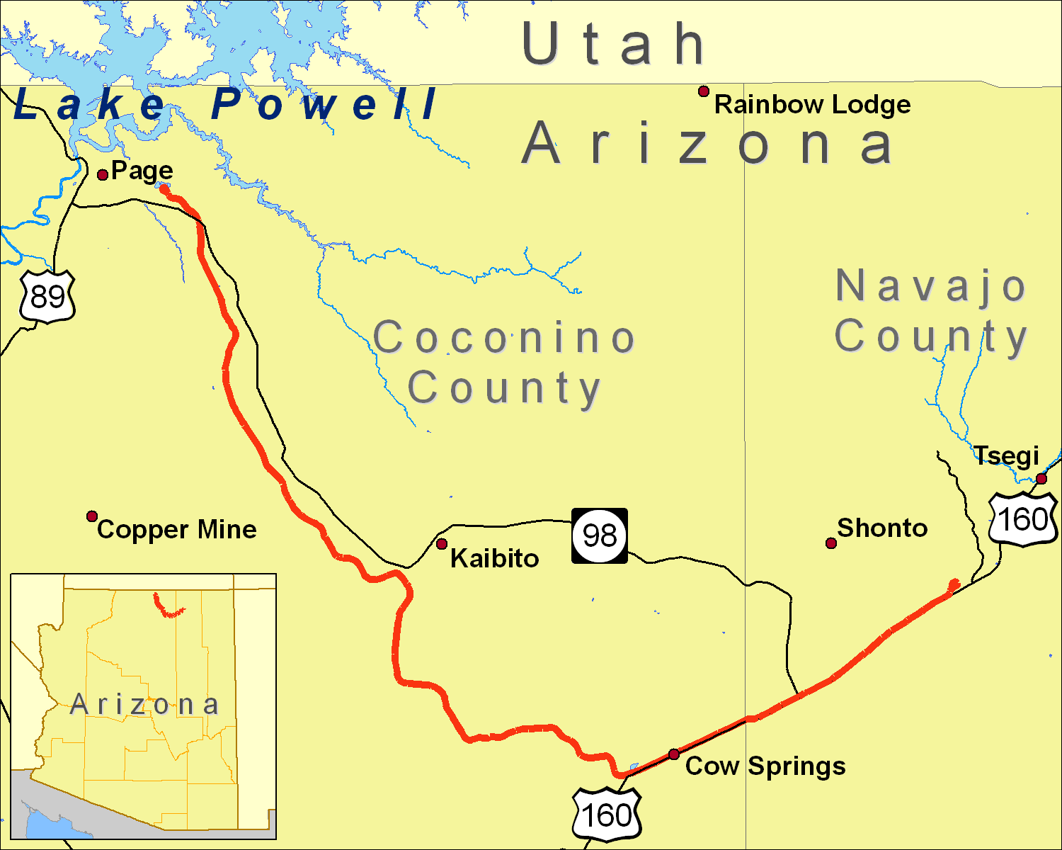
A map of the Black Mesa and Lake Powell Railroad extent, using data from the 2000 US Census TIGER Line file for railroads and roads (obtained from http://sdrsnet.srnr.arizona.edu/) and seamless.usgs.gov data. I created it using ArcGIS 9.1. |
| Date | 19 December 2006 (original upload date) |
| Source | No machine-readable source provided. Own work assumed (based on copyright claims). |
| Author | No machine-readable author provided. Shorelander~commonswiki assumed (based on copyright claims). |

|
This map image could be re-created using
vector graphics as an
SVG file. This has several advantages; see
Commons:Media for cleanup for more information. If an SVG form of this image is available, please upload it and afterwards replace this template with
{{
vector version available|new image name}}
.
It is recommended to name the SVG file “Black Mesa and Lake Powell RR Map.svg”—then the template Vector version available (or Vva) does not need the new image name parameter. |
Licensing

|
Permission is granted to copy, distribute and/or modify this document under the terms of the GNU Free Documentation License, Version 1.2 or any later version published by the Free Software Foundation; with no Invariant Sections, no Front-Cover Texts, and no Back-Cover Texts. A copy of the license is included in the section entitled GNU Free Documentation License. |
| This file is licensed under the Creative Commons Attribution-Share Alike 3.0 Unported license. | ||
| ||
| This licensing tag was added to this file as part of the GFDL licensing update. |
- You are free:
- to share – to copy, distribute and transmit the work
- to remix – to adapt the work
- Under the following conditions:
- attribution – You must give appropriate credit, provide a link to the license, and indicate if changes were made. You may do so in any reasonable manner, but not in any way that suggests the licensor endorses you or your use.
File history
Click on a date/time to view the file as it appeared at that time.
| Date/Time | Thumbnail | Dimensions | User | Comment | |
|---|---|---|---|---|---|
| current | 22:27, 18 January 2007 |
| 1,500 × 1,200 (109 KB) | Shorelander~commonswiki | Another new version, with some extra tweaks and a new road. |
| 00:27, 21 December 2006 |
 | 1,500 × 1,200 (109 KB) | Shorelander~commonswiki | New version, changing the size and fixing the spelling. | |
| 02:00, 19 December 2006 |
 | 2,100 × 1,496 (218 KB) | Shorelander~commonswiki | A map of the Black Mesa and Lake Powell Railroad extent, using data from the 2000 US Census TIGER Line file for railroads and roads (obtained from http://sdrsnet.srnr.arizona.edu/) and seamless.usgs.gov data. I created it using ArcGIS 9.1. Shrunk and crop | |
| 01:37, 19 December 2006 |
 | 6,300 × 4,500 (388 KB) | Shorelander~commonswiki | A map of the Black Mesa and Lake Powell Railroad extent, using data from the 2000 US Census TIGER Line file for railroads and roads (obtained from http://sdrsnet.srnr.arizona.edu/) and seamless.usgs.gov data. I created it using ArcGIS 9.1. |
File usage
Global file usage
The following other wikis use this file:
- Usage on cs.wikipedia.org
- Usage on de.wikipedia.org
- Usage on hu.wikipedia.org
- Usage on ja.wikipedia.org
- Usage on www.wikidata.org
Original file (1,500 × 1,200 pixels, file size: 109 KB, MIME type: image/png)
| This is a file from the
Wikimedia Commons. Information from its
description page there is shown below. Commons is a freely licensed media file repository. You can help. |
Summary
| Description |
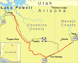
A map of the Black Mesa and Lake Powell Railroad extent, using data from the 2000 US Census TIGER Line file for railroads and roads (obtained from http://sdrsnet.srnr.arizona.edu/) and seamless.usgs.gov data. I created it using ArcGIS 9.1. |
| Date | 19 December 2006 (original upload date) |
| Source | No machine-readable source provided. Own work assumed (based on copyright claims). |
| Author | No machine-readable author provided. Shorelander~commonswiki assumed (based on copyright claims). |
|
|
This map image could be re-created using
vector graphics as an
SVG file. This has several advantages; see
Commons:Media for cleanup for more information. If an SVG form of this image is available, please upload it and afterwards replace this template with
{{
vector version available|new image name}}
.
It is recommended to name the SVG file “Black Mesa and Lake Powell RR Map.svg”—then the template Vector version available (or Vva) does not need the new image name parameter. |
Licensing
|
|
Permission is granted to copy, distribute and/or modify this document under the terms of the GNU Free Documentation License, Version 1.2 or any later version published by the Free Software Foundation; with no Invariant Sections, no Front-Cover Texts, and no Back-Cover Texts. A copy of the license is included in the section entitled GNU Free Documentation License. |
| This file is licensed under the Creative Commons Attribution-Share Alike 3.0 Unported license. | ||
| ||
| This licensing tag was added to this file as part of the GFDL licensing update. |
- You are free:
- to share – to copy, distribute and transmit the work
- to remix – to adapt the work
- Under the following conditions:
- attribution – You must give appropriate credit, provide a link to the license, and indicate if changes were made. You may do so in any reasonable manner, but not in any way that suggests the licensor endorses you or your use.
File history
Click on a date/time to view the file as it appeared at that time.
| Date/Time | Thumbnail | Dimensions | User | Comment | |
|---|---|---|---|---|---|
| current | 22:27, 18 January 2007 |
| 1,500 × 1,200 (109 KB) | Shorelander~commonswiki | Another new version, with some extra tweaks and a new road. |
| 00:27, 21 December 2006 |
| 1,500 × 1,200 (109 KB) | Shorelander~commonswiki | New version, changing the size and fixing the spelling. | |
| 02:00, 19 December 2006 |
| 2,100 × 1,496 (218 KB) | Shorelander~commonswiki | A map of the Black Mesa and Lake Powell Railroad extent, using data from the 2000 US Census TIGER Line file for railroads and roads (obtained from http://sdrsnet.srnr.arizona.edu/) and seamless.usgs.gov data. I created it using ArcGIS 9.1. Shrunk and crop | |
| 01:37, 19 December 2006 |
| 6,300 × 4,500 (388 KB) | Shorelander~commonswiki | A map of the Black Mesa and Lake Powell Railroad extent, using data from the 2000 US Census TIGER Line file for railroads and roads (obtained from http://sdrsnet.srnr.arizona.edu/) and seamless.usgs.gov data. I created it using ArcGIS 9.1. |
File usage
Global file usage
The following other wikis use this file:
- Usage on cs.wikipedia.org
- Usage on de.wikipedia.org
- Usage on hu.wikipedia.org
- Usage on ja.wikipedia.org
- Usage on www.wikidata.org