No higher resolution available.
Belgievlbrabant.png (398 × 335 pixels, file size: 6 KB, MIME type: image/png)
| This is a file from the
Wikimedia Commons. Information from its
description page there is shown below. Commons is a freely licensed media file repository. You can help. |

|
File:Province of Flemish Brabant (Belgium) location.svg is a vector version of this file. It should be used in place of this PNG file when not inferior.
File:Belgievlbrabant.png →
File:Province of Flemish Brabant (Belgium) location.svg
For more information, see
Help:SVG. |
_location.svg) |
Summary
| Description |
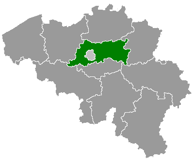
English: Map of Belgium with the 3 regions together , with the province of Flemish Brabant colored green. |
| Date | |
| Source | Wikimedia Commons (Article 'Maps_of_Belgium') |
| Author | User 'Morwen' |
Licensing

|
Permission is granted to copy, distribute and/or modify this document under the terms of the GNU Free Documentation License, Version 1.2 or any later version published by the Free Software Foundation; with no Invariant Sections, no Front-Cover Texts, and no Back-Cover Texts. A copy of the license is included in the section entitled GNU Free Documentation License. |
| This file is licensed under the Creative Commons Attribution-Share Alike 3.0 Unported license. | ||
| ||
| This licensing tag was added to this file as part of the GFDL licensing update. |
File history
Click on a date/time to view the file as it appeared at that time.
| Date/Time | Thumbnail | Dimensions | User | Comment | |
|---|---|---|---|---|---|
| current | 18:54, 24 May 2006 |
| 398 × 335 (6 KB) | Btrs | {{Information| |Description= Map of Belgium with the 3 regions togheter , with the province of Flemish Brabant colored green. |Source=Wikimedia Commons (Article 'Maps_of_Belgium') |Date=24 May 2006 |Author=User 'Morwen' |Permission=none needed , seen the |
File usage
The following pages on the English Wikipedia use this file (pages on other projects are not listed):
- Aarschot
- Affligem
- Asse
- Beersel
- Begijnendijk
- Bekkevoort
- Bertem
- Bever, Belgium
- Bierbeek
- Boortmeerbeek
- Boutersem
- Diest
- Dilbeek
- Drogenbos
- Galmaarden
- Geetbets
- Glabbeek
- Gooik
- Grimbergen
- Haacht
- Halle, Belgium
- Herent
- Herne, Belgium
- Hoegaarden
- Hoeilaart
- Holsbeek
- Huldenberg
- Kampenhout
- Kapelle-op-den-Bos
- Keerbergen
- Kortenaken
- Kortenberg
- Kraainem
- Landen
- Lennik
- Leuven
- Liedekerke
- Linkebeek
- Linter, Belgium
- Londerzeel
- Lubbeek
- Machelen
- Meise
- Merchtem
- Opwijk
- Oud-Heverlee
- Overijse
- Pepingen
- Roosdaal
- Rotselaar
- Scherpenheuvel-Zichem
- Sint-Genesius-Rode
- Sint-Pieters-Leeuw
- Steenokkerzeel
- Ternat
- Tervuren
- Tielt-Winge
- Tienen
- Tremelo
- Vilvoorde
- Wemmel
- Wezembeek-Oppem
- Zaventem
- Zemst
- Zoutleeuw
- User:Physchim62/Europa/Belgium
- User:SPQRobin/sandbox
- Template:Municipalities in Flemish Brabant
Global file usage
The following other wikis use this file:
- Usage on ban.wikipedia.org
- Usage on bg.wikipedia.org
- Фламандски Брабант
- Льовен
- Тийлт-Винге
- Шаблон:Фламандски Брабант
- Арсхот
- Ауд Хеверле
- Баутерсем
- Бегейнендейк
- Бекеворт
- Бертем
- Бийрбек
- Бортмербек
- Гетбетс
- Дист
- Заутлеу
- Керберген
- Кортенакен
- Кортенберг
- Ланден
- Линтер
- Льоббек
- Ротселар
- Схерпенхьовел-Зихем
- Тервьорен
- Тийнен
- Тремело
- Хахт
- Херент
- Холсбек
- Хугарден
- Хьолденберг
- Асе
- Афлигем
- Бевер
- Берсел
- Вилворде
- Везембек-Опем
- Вемел
- Галмарден
- Гойк
- Гримберген
- Дилбек
- Дрогенбос
- Завентем
- Земст
- Кампенхаут
- Капеле оп ден Бос
- Крайнем
View more global usage of this file.
No higher resolution available.
Belgievlbrabant.png (398 × 335 pixels, file size: 6 KB, MIME type: image/png)
| This is a file from the
Wikimedia Commons. Information from its
description page there is shown below. Commons is a freely licensed media file repository. You can help. |
|
|
File:Province of Flemish Brabant (Belgium) location.svg is a vector version of this file. It should be used in place of this PNG file when not inferior.
File:Belgievlbrabant.png →
File:Province of Flemish Brabant (Belgium) location.svg
For more information, see
Help:SVG. |
|
Summary
| Description |
English: Map of Belgium with the 3 regions together , with the province of Flemish Brabant colored green. |
| Date | |
| Source | Wikimedia Commons (Article 'Maps_of_Belgium') |
| Author | User 'Morwen' |
Licensing
|
|
Permission is granted to copy, distribute and/or modify this document under the terms of the GNU Free Documentation License, Version 1.2 or any later version published by the Free Software Foundation; with no Invariant Sections, no Front-Cover Texts, and no Back-Cover Texts. A copy of the license is included in the section entitled GNU Free Documentation License. |
| This file is licensed under the Creative Commons Attribution-Share Alike 3.0 Unported license. | ||
| ||
| This licensing tag was added to this file as part of the GFDL licensing update. |
File history
Click on a date/time to view the file as it appeared at that time.
| Date/Time | Thumbnail | Dimensions | User | Comment | |
|---|---|---|---|---|---|
| current | 18:54, 24 May 2006 |
| 398 × 335 (6 KB) | Btrs | {{Information| |Description= Map of Belgium with the 3 regions togheter , with the province of Flemish Brabant colored green. |Source=Wikimedia Commons (Article 'Maps_of_Belgium') |Date=24 May 2006 |Author=User 'Morwen' |Permission=none needed , seen the |
File usage
The following pages on the English Wikipedia use this file (pages on other projects are not listed):
- Aarschot
- Affligem
- Asse
- Beersel
- Begijnendijk
- Bekkevoort
- Bertem
- Bever, Belgium
- Bierbeek
- Boortmeerbeek
- Boutersem
- Diest
- Dilbeek
- Drogenbos
- Galmaarden
- Geetbets
- Glabbeek
- Gooik
- Grimbergen
- Haacht
- Halle, Belgium
- Herent
- Herne, Belgium
- Hoegaarden
- Hoeilaart
- Holsbeek
- Huldenberg
- Kampenhout
- Kapelle-op-den-Bos
- Keerbergen
- Kortenaken
- Kortenberg
- Kraainem
- Landen
- Lennik
- Leuven
- Liedekerke
- Linkebeek
- Linter, Belgium
- Londerzeel
- Lubbeek
- Machelen
- Meise
- Merchtem
- Opwijk
- Oud-Heverlee
- Overijse
- Pepingen
- Roosdaal
- Rotselaar
- Scherpenheuvel-Zichem
- Sint-Genesius-Rode
- Sint-Pieters-Leeuw
- Steenokkerzeel
- Ternat
- Tervuren
- Tielt-Winge
- Tienen
- Tremelo
- Vilvoorde
- Wemmel
- Wezembeek-Oppem
- Zaventem
- Zemst
- Zoutleeuw
- User:Physchim62/Europa/Belgium
- User:SPQRobin/sandbox
- Template:Municipalities in Flemish Brabant
Global file usage
The following other wikis use this file:
- Usage on ban.wikipedia.org
- Usage on bg.wikipedia.org
- Фламандски Брабант
- Льовен
- Тийлт-Винге
- Шаблон:Фламандски Брабант
- Арсхот
- Ауд Хеверле
- Баутерсем
- Бегейнендейк
- Бекеворт
- Бертем
- Бийрбек
- Бортмербек
- Гетбетс
- Дист
- Заутлеу
- Керберген
- Кортенакен
- Кортенберг
- Ланден
- Линтер
- Льоббек
- Ротселар
- Схерпенхьовел-Зихем
- Тервьорен
- Тийнен
- Тремело
- Хахт
- Херент
- Холсбек
- Хугарден
- Хьолденберг
- Асе
- Афлигем
- Бевер
- Берсел
- Вилворде
- Везембек-Опем
- Вемел
- Галмарден
- Гойк
- Гримберген
- Дилбек
- Дрогенбос
- Завентем
- Земст
- Кампенхаут
- Капеле оп ден Бос
- Крайнем
View more global usage of this file.