No higher resolution available.
Bedfordshire_outline_map_with_UK.png (504 × 600 pixels, file size: 196 KB, MIME type: image/png)
| This is a file from the
Wikimedia Commons. Information from its
description page there is shown below. Commons is a freely licensed media file repository. You can help. |
Summary
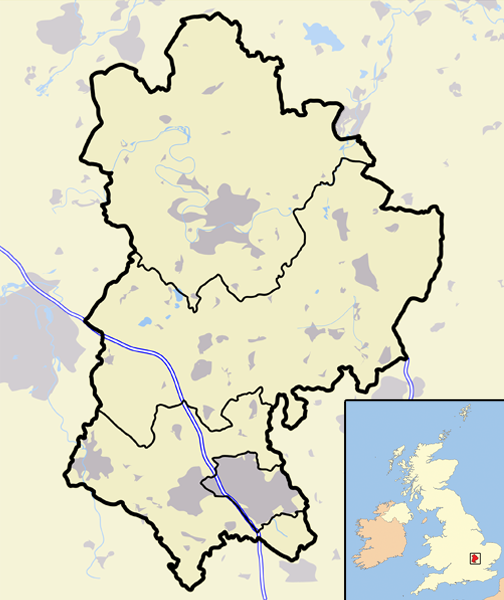
| Description | A map of the county of Bedfordshire, England, United Kingdom, showing the 1974-2009 district boundaries. |
| Date | |
| Source | Own work |
| Author | Jhamez84 |
Licensing
| I, the copyright holder of this work, release this work into the
public domain. This applies worldwide. In some countries this may not be legally possible; if so: I grant anyone the right to use this work for any purpose, without any conditions, unless such conditions are required by law. |
File history
Click on a date/time to view the file as it appeared at that time.
| Date/Time | Thumbnail | Dimensions | User | Comment | |
|---|---|---|---|---|---|
| current | 20:28, 12 March 2008 |
| 504 × 600 (196 KB) | Jza84 | {{Information |Description=A map of the county of Bedfordshire, England, United Kingdom |Source=self-made |Date=March 2008 |Author= Jhamez84 |Permission=See below |other_versions=None }} |
File usage
The following pages on the English Wikipedia use this file (pages on other projects are not listed):
- 1973 Mid Bedfordshire District Council election
- 1976 Mid Bedfordshire District Council election
- 1979 Mid Bedfordshire District Council election
- 1983 Mid Bedfordshire District Council election
- 1987 Mid Bedfordshire District Council election
- 1991 Mid Bedfordshire District Council election
- 1995 Mid Bedfordshire District Council election
- 1999 Mid Bedfordshire District Council election
- 2003 Mid Bedfordshire District Council election
- 2007 Mid Bedfordshire District Council election
- Wikipedia:WikiProject UK geography/2009 local government structural changes task force
- Template talk:Infobox UK place/maps
- Module:Location map/data/United Kingdom Bedfordshire 1974-2009
- Module:Location map/data/United Kingdom Bedfordshire 1974-2009/doc
- Module talk:Location map/data/United Kingdom Bedfordshire 1974-2009/doc
Global file usage
The following other wikis use this file:
- Usage on ml.wikipedia.org
- Usage on si.wikipedia.org
No higher resolution available.
Bedfordshire_outline_map_with_UK.png (504 × 600 pixels, file size: 196 KB, MIME type: image/png)
| This is a file from the
Wikimedia Commons. Information from its
description page there is shown below. Commons is a freely licensed media file repository. You can help. |
Summary
| Description | A map of the county of Bedfordshire, England, United Kingdom, showing the 1974-2009 district boundaries. |
| Date | |
| Source | Own work |
| Author | Jhamez84 |
Licensing
| I, the copyright holder of this work, release this work into the
public domain. This applies worldwide. In some countries this may not be legally possible; if so: I grant anyone the right to use this work for any purpose, without any conditions, unless such conditions are required by law. |
File history
Click on a date/time to view the file as it appeared at that time.
| Date/Time | Thumbnail | Dimensions | User | Comment | |
|---|---|---|---|---|---|
| current | 20:28, 12 March 2008 |
| 504 × 600 (196 KB) | Jza84 | {{Information |Description=A map of the county of Bedfordshire, England, United Kingdom |Source=self-made |Date=March 2008 |Author= Jhamez84 |Permission=See below |other_versions=None }} |
File usage
The following pages on the English Wikipedia use this file (pages on other projects are not listed):
- 1973 Mid Bedfordshire District Council election
- 1976 Mid Bedfordshire District Council election
- 1979 Mid Bedfordshire District Council election
- 1983 Mid Bedfordshire District Council election
- 1987 Mid Bedfordshire District Council election
- 1991 Mid Bedfordshire District Council election
- 1995 Mid Bedfordshire District Council election
- 1999 Mid Bedfordshire District Council election
- 2003 Mid Bedfordshire District Council election
- 2007 Mid Bedfordshire District Council election
- Wikipedia:WikiProject UK geography/2009 local government structural changes task force
- Template talk:Infobox UK place/maps
- Module:Location map/data/United Kingdom Bedfordshire 1974-2009
- Module:Location map/data/United Kingdom Bedfordshire 1974-2009/doc
- Module talk:Location map/data/United Kingdom Bedfordshire 1974-2009/doc
Global file usage
The following other wikis use this file:
- Usage on ml.wikipedia.org
- Usage on si.wikipedia.org