Photos • Location


Size of this preview:
800 × 600 pixels. Other resolutions:
320 × 240 pixels |
640 × 480 pixels |
1,024 × 768 pixels |
1,280 × 960 pixels.
Original file (1,280 × 960 pixels, file size: 1.19 MB, MIME type: image/jpeg)
| This is a file from the
Wikimedia Commons. Information from its
description page there is shown below. Commons is a freely licensed media file repository. You can help. |
Summary
| Description |
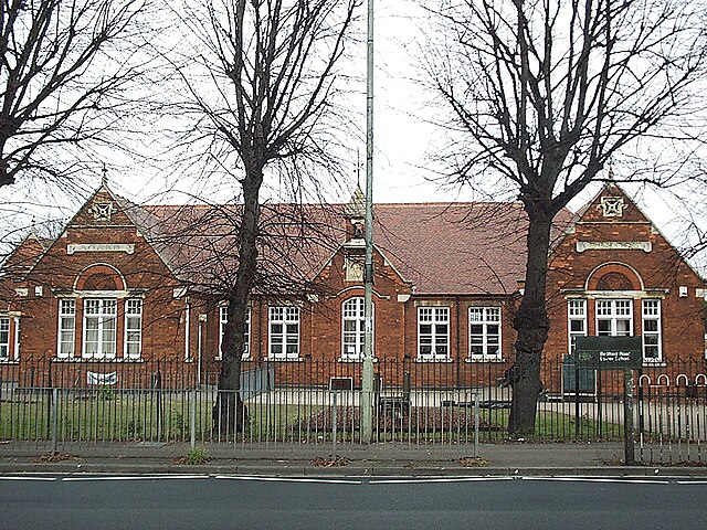
English: Bedford Road Lower School, Bedford Road, Kempston, Bedfordshire. The front of the School has plaques saying "Board" "School". |
| Date | |
| Source | Own work |
| Author | Simon Speed |
| Camera location | | View this and other nearby images on: OpenStreetMap |
|
|---|
Licensing
| I, the copyright holder of this work, release this work into the
public domain. This applies worldwide. In some countries this may not be legally possible; if so: I grant anyone the right to use this work for any purpose, without any conditions, unless such conditions are required by law. |
File history
Click on a date/time to view the file as it appeared at that time.
| Date/Time | Thumbnail | Dimensions | User | Comment | |
|---|---|---|---|---|---|
| current | 12:26, 8 January 2009 |
| 1,280 × 960 (1.19 MB) | Simonxag | {{Information |Description={{en|1=Bedford Road Lower School, Bedford Road, Kempston, Bedfordshire. The front of the School has plaques saying "Board" "School".}} |Source=Own work by uploader |Author= Simon Speed |Date=2009-01-04 |Permiss |
File usage
The following pages on the English Wikipedia use this file (pages on other projects are not listed):
Global file usage
The following other wikis use this file:
- Usage on it.wikipedia.org
- Usage on ru.wikipedia.org
Metadata
Size of this preview:
800 × 600 pixels. Other resolutions:
320 × 240 pixels |
640 × 480 pixels |
1,024 × 768 pixels |
1,280 × 960 pixels.
Original file (1,280 × 960 pixels, file size: 1.19 MB, MIME type: image/jpeg)
| This is a file from the
Wikimedia Commons. Information from its
description page there is shown below. Commons is a freely licensed media file repository. You can help. |
Summary
| Description |
English: Bedford Road Lower School, Bedford Road, Kempston, Bedfordshire. The front of the School has plaques saying "Board" "School". |
| Date | |
| Source | Own work |
| Author | Simon Speed |
| Camera location | | View this and other nearby images on: OpenStreetMap |
|
|---|
Licensing
| I, the copyright holder of this work, release this work into the
public domain. This applies worldwide. In some countries this may not be legally possible; if so: I grant anyone the right to use this work for any purpose, without any conditions, unless such conditions are required by law. |
File history
Click on a date/time to view the file as it appeared at that time.
| Date/Time | Thumbnail | Dimensions | User | Comment | |
|---|---|---|---|---|---|
| current | 12:26, 8 January 2009 |
| 1,280 × 960 (1.19 MB) | Simonxag | {{Information |Description={{en|1=Bedford Road Lower School, Bedford Road, Kempston, Bedfordshire. The front of the School has plaques saying "Board" "School".}} |Source=Own work by uploader |Author= Simon Speed |Date=2009-01-04 |Permiss |
File usage
The following pages on the English Wikipedia use this file (pages on other projects are not listed):
Global file usage
The following other wikis use this file:
- Usage on it.wikipedia.org
- Usage on ru.wikipedia.org