
Original file (SVG file, nominally 1,375 × 967 pixels, file size: 416 KB)
| This is a file from the
Wikimedia Commons. Information from its
description page there is shown below. Commons is a freely licensed media file repository. You can help. |
Summary
| Description |
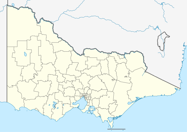
Quadratische Plattkarte, N-S-Streckung 124 %. Geographische Begrenzung der Karte:
Equirectangular projection, N/S stretching 124 %. Geographic limits of the map:
|
|
| Date | ||
| Source |
Own work, using
|
|
| Author | NordNordWest | |
| Permission ( Reusing this file) |
This file is licensed under the
Creative Commons
Attribution-Share Alike 3.0 Germany license.
 This file is licensed under the
Creative Commons
Attribution-Share Alike 3.0 Germany license.
|
|
| Other versions |
Derivative works of this file:
|


|
This map has been made or improved in the German
Kartenwerkstatt (Map Lab). You can
propose maps to improve as well.
|
File history
Click on a date/time to view the file as it appeared at that time.
| Date/Time | Thumbnail | Dimensions | User | Comment | |
|---|---|---|---|---|---|
| current | 22:08, 4 April 2010 |
| 1,375 × 967 (416 KB) | Chumwa | Reverted to version as of 21:59, 1 January 2010 |
| 21:49, 4 April 2010 |
 | 1,375 × 967 (273 KB) | Roke~commonswiki | local government low salience, dont appear on general use maps | |
| 21:59, 1 January 2010 |
 | 1,375 × 967 (416 KB) | NordNordWest | =={{int:filedesc}}== {{Information |Description= {{de|Positionskarte von Victoria, Australien}} Quadratische Plattkarte, N-S-Streckung 124 %. Geographische Begrenzung der Karte: * N: 33.8° S * S: 39.3° S |
File usage
More than 100 pages use this file. The following list shows the first 100 pages that use this file only. A full list is available.
- Arthurs Seat, Victoria
- Avalon Airport
- Bacchus Marsh railway station
- Badger Creek, Victoria
- Bairnsdale railway station
- Ballarat
- Balnarring, Victoria
- Bass Highway (Victoria)
- Beaconsfield, Victoria
- Bendigo
- Bendigo railway station
- Birregurra railway station
- Blind Bight, Victoria
- Boneo, Victoria
- Borung Highway
- Bunyip, Victoria
- Bunyip railway station
- Cape Schanck
- Castlemaine railway station
- Clarkefield railway station
- Cliffy Island
- Corio railway station
- Crib Point, Victoria
- Deen Maar Indigenous Protected Area
- Dingee railway station
- Drouin railway station
- East Warburton, Victoria
- Essendon Airport
- Fitzroy, Victoria
- Flinders, Victoria
- Garfield, Victoria
- Garfield railway station
- Geelong
- Geelong Airport
- Geelong railway station
- Gisborne railway station
- Goulburn Valley Highway
- HM Prison Morwell River
- HM Prison Won Wron
- Hamilton Highway
- Hastings, Victoria
- Hoddles Creek, Victoria
- Hyland Highway
- Kangaroo Flat railway station
- Keilor Park, Victoria
- Kyneton railway station
- Lang Lang, Victoria
- Lara railway station
- Launching Place, Victoria
- Little River railway station
- Loddon Valley Highway
- Longwarry railway station
- Macedon railway station
- Main Ridge, Victoria
- Malmsbury railway station
- Maroondah Highway
- Marshall railway station
- McIvor Highway
- Melbourne Airport
- Melbourne Youth Justice Centre
- Melton Airfield
- Merricks North, Victoria
- Midland Highway (Victoria)
- Mildura
- Millgrove, Victoria
- Moe railway station
- Moorabbin Airport
- Moorooduc, Victoria
- Morwell railway station
- Mount Buller, Victoria
- Mount Dandenong, Victoria
- Nar Nar Goon railway station
- Ninety Mile Beach, Victoria
- North Geelong railway station
- North Shore railway station
- Northern Highway (Victoria)
- Notting Hill, Victoria
- Olivers Hill, Victoria
- Phillip Island
- Point Leo, Victoria
- Punters Club
- Red Hill, Victoria
- Red Hill South, Victoria
- Riddells Creek railway station
- Sherwood Park railway station
- Shoreham, Victoria
- Somers, Victoria
- South Geelong railway station
- South Gippsland Highway
- Strathfieldsaye, Victoria
- Sunraysia Highway
- Terang railway station
- Trafalgar railway station
- Traralgon railway station
- Tynong railway station
- Wallan railway station
- Warburton, Victoria
- Warragul railway station
- Warrnambool railway station
- Wodonga railway station
View more links to this file.
Global file usage
The following other wikis use this file:
- Usage on af.wikipedia.org
- Usage on ba.wikipedia.org
- Usage on be.wikipedia.org
- Usage on bg.wikipedia.org
- Usage on bh.wikipedia.org
- Usage on bn.wikipedia.org
- Usage on bs.wikipedia.org
- Usage on ceb.wikipedia.org
- Usage on ce.wikipedia.org
- Usage on ckb.wikipedia.org
- Usage on de.wikipedia.org
View more global usage of this file.
Original file (SVG file, nominally 1,375 × 967 pixels, file size: 416 KB)
| This is a file from the
Wikimedia Commons. Information from its
description page there is shown below. Commons is a freely licensed media file repository. You can help. |
Summary
| Description |
Quadratische Plattkarte, N-S-Streckung 124 %. Geographische Begrenzung der Karte:
Equirectangular projection, N/S stretching 124 %. Geographic limits of the map:
|
|
| Date | ||
| Source |
Own work, using
|
|
| Author | NordNordWest | |
| Permission ( Reusing this file) |
This file is licensed under the
Creative Commons
Attribution-Share Alike 3.0 Germany license.
This file is licensed under the
Creative Commons
Attribution-Share Alike 3.0 Germany license.
|
|
| Other versions |
Derivative works of this file:
|
|
|
This map has been made or improved in the German
Kartenwerkstatt (Map Lab). You can
propose maps to improve as well.
|
File history
Click on a date/time to view the file as it appeared at that time.
| Date/Time | Thumbnail | Dimensions | User | Comment | |
|---|---|---|---|---|---|
| current | 22:08, 4 April 2010 |
| 1,375 × 967 (416 KB) | Chumwa | Reverted to version as of 21:59, 1 January 2010 |
| 21:49, 4 April 2010 |
| 1,375 × 967 (273 KB) | Roke~commonswiki | local government low salience, dont appear on general use maps | |
| 21:59, 1 January 2010 |
| 1,375 × 967 (416 KB) | NordNordWest | =={{int:filedesc}}== {{Information |Description= {{de|Positionskarte von Victoria, Australien}} Quadratische Plattkarte, N-S-Streckung 124 %. Geographische Begrenzung der Karte: * N: 33.8° S * S: 39.3° S |
File usage
More than 100 pages use this file. The following list shows the first 100 pages that use this file only. A full list is available.
- Arthurs Seat, Victoria
- Avalon Airport
- Bacchus Marsh railway station
- Badger Creek, Victoria
- Bairnsdale railway station
- Ballarat
- Balnarring, Victoria
- Bass Highway (Victoria)
- Beaconsfield, Victoria
- Bendigo
- Bendigo railway station
- Birregurra railway station
- Blind Bight, Victoria
- Boneo, Victoria
- Borung Highway
- Bunyip, Victoria
- Bunyip railway station
- Cape Schanck
- Castlemaine railway station
- Clarkefield railway station
- Cliffy Island
- Corio railway station
- Crib Point, Victoria
- Deen Maar Indigenous Protected Area
- Dingee railway station
- Drouin railway station
- East Warburton, Victoria
- Essendon Airport
- Fitzroy, Victoria
- Flinders, Victoria
- Garfield, Victoria
- Garfield railway station
- Geelong
- Geelong Airport
- Geelong railway station
- Gisborne railway station
- Goulburn Valley Highway
- HM Prison Morwell River
- HM Prison Won Wron
- Hamilton Highway
- Hastings, Victoria
- Hoddles Creek, Victoria
- Hyland Highway
- Kangaroo Flat railway station
- Keilor Park, Victoria
- Kyneton railway station
- Lang Lang, Victoria
- Lara railway station
- Launching Place, Victoria
- Little River railway station
- Loddon Valley Highway
- Longwarry railway station
- Macedon railway station
- Main Ridge, Victoria
- Malmsbury railway station
- Maroondah Highway
- Marshall railway station
- McIvor Highway
- Melbourne Airport
- Melbourne Youth Justice Centre
- Melton Airfield
- Merricks North, Victoria
- Midland Highway (Victoria)
- Mildura
- Millgrove, Victoria
- Moe railway station
- Moorabbin Airport
- Moorooduc, Victoria
- Morwell railway station
- Mount Buller, Victoria
- Mount Dandenong, Victoria
- Nar Nar Goon railway station
- Ninety Mile Beach, Victoria
- North Geelong railway station
- North Shore railway station
- Northern Highway (Victoria)
- Notting Hill, Victoria
- Olivers Hill, Victoria
- Phillip Island
- Point Leo, Victoria
- Punters Club
- Red Hill, Victoria
- Red Hill South, Victoria
- Riddells Creek railway station
- Sherwood Park railway station
- Shoreham, Victoria
- Somers, Victoria
- South Geelong railway station
- South Gippsland Highway
- Strathfieldsaye, Victoria
- Sunraysia Highway
- Terang railway station
- Trafalgar railway station
- Traralgon railway station
- Tynong railway station
- Wallan railway station
- Warburton, Victoria
- Warragul railway station
- Warrnambool railway station
- Wodonga railway station
View more links to this file.
Global file usage
The following other wikis use this file:
- Usage on af.wikipedia.org
- Usage on ba.wikipedia.org
- Usage on be.wikipedia.org
- Usage on bg.wikipedia.org
- Usage on bh.wikipedia.org
- Usage on bn.wikipedia.org
- Usage on bs.wikipedia.org
- Usage on ceb.wikipedia.org
- Usage on ce.wikipedia.org
- Usage on ckb.wikipedia.org
- Usage on de.wikipedia.org
View more global usage of this file.