
Original file (1,181 × 1,050 pixels, file size: 1.23 MB, MIME type: image/jpeg)
| This is a file from the
Wikimedia Commons. Information from its
description page there is shown below. Commons is a freely licensed media file repository. You can help. |
Summary
| Description |
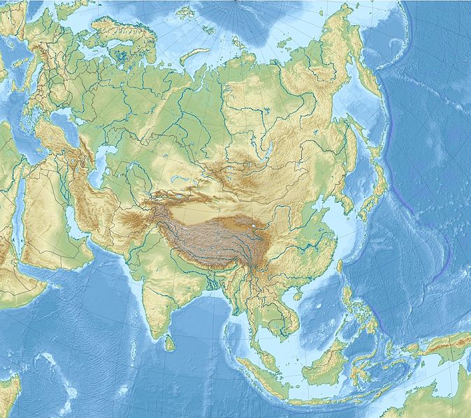
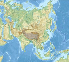
English: Relief Location map of Asia.
|
| Date | |
| Source | Own work |
| Author | Uwe Dedering |
Licensing
- You are free:
- to share – to copy, distribute and transmit the work
- to remix – to adapt the work
- Under the following conditions:
- attribution – You must give appropriate credit, provide a link to the license, and indicate if changes were made. You may do so in any reasonable manner, but not in any way that suggests the licensor endorses you or your use.
- share alike – If you remix, transform, or build upon the material, you must distribute your contributions under the same or compatible license as the original.

|
Permission is granted to copy, distribute and/or modify this document under the terms of the GNU Free Documentation License, Version 1.2 or any later version published by the Free Software Foundation; with no Invariant Sections, no Front-Cover Texts, and no Back-Cover Texts. A copy of the license is included in the section entitled GNU Free Documentation License. |
File history
Click on a date/time to view the file as it appeared at that time.
| Date/Time | Thumbnail | Dimensions | User | Comment | |
|---|---|---|---|---|---|
| current | 14:33, 26 November 2010 |
| 1,181 × 1,050 (1.23 MB) | Uwe Dedering | {{Information |Description={{en|1= Relief Location map of Asia. * Projection: Lambert azimuthal equal-area projection. * Area of interest: :* N: 90.0° N :* S: -10.0° N :* W: 45.0° E :* E: 145.0° E * Projection center: :* NS: 40.0° N :* WE: 95.0° E * |
File usage
More than 100 pages use this file. The following list shows the first 100 pages that use this file only. A full list is available.
- Abarim
- Adana
- Akkalkot
- Al-Abwa'
- Al-Asad Airbase
- Al Bahah
- Aleppo
- Amami, Kagoshima
- Amethi
- Amman
- Ankara
- Baghdad
- Baku
- Bandar Seri Begawan
- Battle of Peleliu
- Beirut
- Bishkek
- Bosporus
- Bà Rịa–Vũng Tàu province
- Bình Dương province
- Bình Phước province
- Colossae
- Daegu
- Daegu International Airport
- Damascus
- Deir ez-Zor
- Dena
- Denizli
- Dubai
- Dushanbe
- Ephesus
- Eskişehir
- Gaziantep
- Ghazni
- Gwangju
- Gwangju Airport
- Haeju Airport
- Hama
- Herat
- Ho Chi Minh City
- Homs
- Hualien Airport
- Istanbul
- Istiqlal Mosque, Jakarta
- Jabal Thawr
- Jableh
- Jaipur
- Jebel Al Mebrah
- Jeju International Airport
- Kabul
- Kadena Air Base
- Kandahar
- Karbala
- Khan Tengri
- King Abdulaziz Air Base
- King Khalid International Airport
- Kokshetau
- Konya
- Kunsan Air Base
- Kyoto
- Lake Sevan
- Latakia
- Lohit River
- Lower Kachura Lake
- Masjid Hajjah Fatimah
- Medina
- Midian
- Moga, Punjab
- Mount Arafat
- Mount Everest
- Muscat
- Muzdalifah
- Nellore
- Nicosia
- North Aral Sea
- Osan Air Base
- Pazyryk burials
- Pokhara
- Presidente Nicolau Lobato International Airport
- Pyongyang
- Raqqa
- Riyadh
- Samarkand
- Sampul tapestry
- Shagan (lake)
- Siberia Airlines Flight 1812
- South China Sea
- Taiwan Strait
- Tartus
- Tashkent
- Tehran
- Tel Aviv
- Thrilla in Manila
- Tiền Giang province
- Tonle Bati
- Tonlé Sap
- Ulaanbaatar
- Ulsan
- West Baray
- Özgön
View more links to this file.
Global file usage
The following other wikis use this file:
- Usage on ar.wikipedia.org
- Usage on arz.wikipedia.org
- Usage on ast.wikipedia.org
- Usage on av.wikipedia.org
- Usage on azb.wikipedia.org
- Usage on az.wikipedia.org
- Usage on ban.wikipedia.org
- Usage on ba.wikipedia.org
View more global usage of this file.
Metadata
Original file (1,181 × 1,050 pixels, file size: 1.23 MB, MIME type: image/jpeg)
| This is a file from the
Wikimedia Commons. Information from its
description page there is shown below. Commons is a freely licensed media file repository. You can help. |
Summary
| Description |
English: Relief Location map of Asia.
|
| Date | |
| Source | Own work |
| Author | Uwe Dedering |
Licensing
- You are free:
- to share – to copy, distribute and transmit the work
- to remix – to adapt the work
- Under the following conditions:
- attribution – You must give appropriate credit, provide a link to the license, and indicate if changes were made. You may do so in any reasonable manner, but not in any way that suggests the licensor endorses you or your use.
- share alike – If you remix, transform, or build upon the material, you must distribute your contributions under the same or compatible license as the original.
|
|
Permission is granted to copy, distribute and/or modify this document under the terms of the GNU Free Documentation License, Version 1.2 or any later version published by the Free Software Foundation; with no Invariant Sections, no Front-Cover Texts, and no Back-Cover Texts. A copy of the license is included in the section entitled GNU Free Documentation License. |
File history
Click on a date/time to view the file as it appeared at that time.
| Date/Time | Thumbnail | Dimensions | User | Comment | |
|---|---|---|---|---|---|
| current | 14:33, 26 November 2010 |
| 1,181 × 1,050 (1.23 MB) | Uwe Dedering | {{Information |Description={{en|1= Relief Location map of Asia. * Projection: Lambert azimuthal equal-area projection. * Area of interest: :* N: 90.0° N :* S: -10.0° N :* W: 45.0° E :* E: 145.0° E * Projection center: :* NS: 40.0° N :* WE: 95.0° E * |
File usage
More than 100 pages use this file. The following list shows the first 100 pages that use this file only. A full list is available.
- Abarim
- Adana
- Akkalkot
- Al-Abwa'
- Al-Asad Airbase
- Al Bahah
- Aleppo
- Amami, Kagoshima
- Amethi
- Amman
- Ankara
- Baghdad
- Baku
- Bandar Seri Begawan
- Battle of Peleliu
- Beirut
- Bishkek
- Bosporus
- Bà Rịa–Vũng Tàu province
- Bình Dương province
- Bình Phước province
- Colossae
- Daegu
- Daegu International Airport
- Damascus
- Deir ez-Zor
- Dena
- Denizli
- Dubai
- Dushanbe
- Ephesus
- Eskişehir
- Gaziantep
- Ghazni
- Gwangju
- Gwangju Airport
- Haeju Airport
- Hama
- Herat
- Ho Chi Minh City
- Homs
- Hualien Airport
- Istanbul
- Istiqlal Mosque, Jakarta
- Jabal Thawr
- Jableh
- Jaipur
- Jebel Al Mebrah
- Jeju International Airport
- Kabul
- Kadena Air Base
- Kandahar
- Karbala
- Khan Tengri
- King Abdulaziz Air Base
- King Khalid International Airport
- Kokshetau
- Konya
- Kunsan Air Base
- Kyoto
- Lake Sevan
- Latakia
- Lohit River
- Lower Kachura Lake
- Masjid Hajjah Fatimah
- Medina
- Midian
- Moga, Punjab
- Mount Arafat
- Mount Everest
- Muscat
- Muzdalifah
- Nellore
- Nicosia
- North Aral Sea
- Osan Air Base
- Pazyryk burials
- Pokhara
- Presidente Nicolau Lobato International Airport
- Pyongyang
- Raqqa
- Riyadh
- Samarkand
- Sampul tapestry
- Shagan (lake)
- Siberia Airlines Flight 1812
- South China Sea
- Taiwan Strait
- Tartus
- Tashkent
- Tehran
- Tel Aviv
- Thrilla in Manila
- Tiền Giang province
- Tonle Bati
- Tonlé Sap
- Ulaanbaatar
- Ulsan
- West Baray
- Özgön
View more links to this file.
Global file usage
The following other wikis use this file:
- Usage on ar.wikipedia.org
- Usage on arz.wikipedia.org
- Usage on ast.wikipedia.org
- Usage on av.wikipedia.org
- Usage on azb.wikipedia.org
- Usage on az.wikipedia.org
- Usage on ban.wikipedia.org
- Usage on ba.wikipedia.org
View more global usage of this file.