Size of this preview:
800 × 494 pixels. Other resolutions:
320 × 198 pixels |
640 × 395 pixels |
1,024 × 632 pixels |
1,276 × 788 pixels.
Original file (1,276 × 788 pixels, file size: 199 KB, MIME type: image/jpeg)
| This is a file from the
Wikimedia Commons. Information from its
description page there is shown below. Commons is a freely licensed media file repository. You can help. |
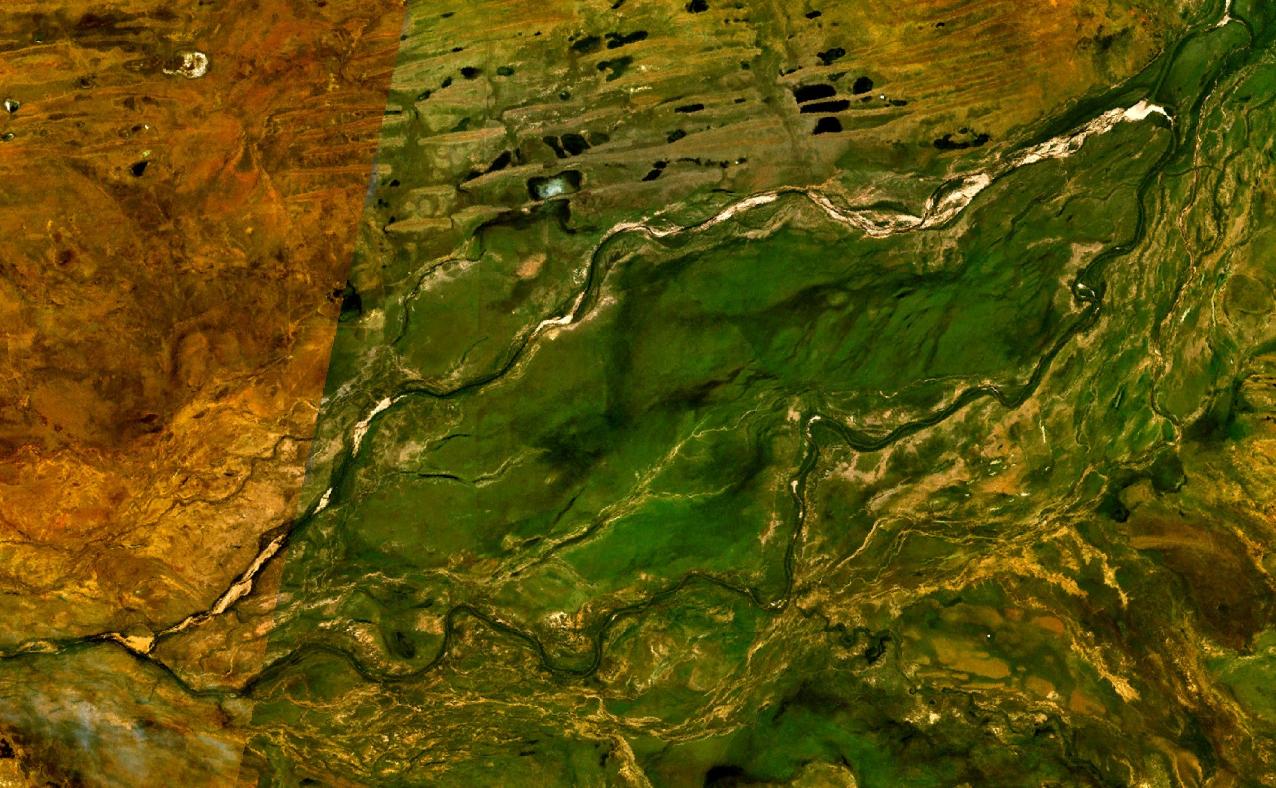
| Description | This is an image of Alexander Island in the Fitzroy River, Western Australia. | |||
| Date | Created on 2007-10-12; not sure when the satellite image was collected. | |||
| Source | It was made with NASA World Wind using Landsat 7 data. | |||
| Author | It was created by Hesperian. Any IP involved in the creation of this image is released into the public domain. | |||
| Permission ( Reusing this file) |
|

.jpg)
File history
Click on a date/time to view the file as it appeared at that time.
| Date/Time | Thumbnail | Dimensions | User | Comment | |
|---|---|---|---|---|---|
| current | 12:28, 12 November 2007 |
| 1,276 × 788 (199 KB) | Hesperian | {{Information |Description=This is an image of Alexander Island in the Fitzroy River, Western Australia. |Source=It was made with NASA World Wind using Landsat 7 data. |Date=Created on 2007-10-12; not sure when the satellite image was collected. |Author=I |
File usage
The following pages on the English Wikipedia use this file (pages on other projects are not listed):
Global file usage
The following other wikis use this file:
- Usage on bo.wikipedia.org
- Usage on ceb.wikipedia.org
- Usage on de.wikipedia.org
- Usage on it.wikipedia.org
- Usage on uk.wikipedia.org
- Usage on www.wikidata.org
Metadata
.jpg)
Size of this preview:
800 × 494 pixels. Other resolutions:
320 × 198 pixels |
640 × 395 pixels |
1,024 × 632 pixels |
1,276 × 788 pixels.
Original file (1,276 × 788 pixels, file size: 199 KB, MIME type: image/jpeg)
| This is a file from the
Wikimedia Commons. Information from its
description page there is shown below. Commons is a freely licensed media file repository. You can help. |
| Description | This is an image of Alexander Island in the Fitzroy River, Western Australia. | |||
| Date | Created on 2007-10-12; not sure when the satellite image was collected. | |||
| Source | It was made with NASA World Wind using Landsat 7 data. | |||
| Author | It was created by Hesperian. Any IP involved in the creation of this image is released into the public domain. | |||
| Permission ( Reusing this file) |
|
File history
Click on a date/time to view the file as it appeared at that time.
| Date/Time | Thumbnail | Dimensions | User | Comment | |
|---|---|---|---|---|---|
| current | 12:28, 12 November 2007 |
| 1,276 × 788 (199 KB) | Hesperian | {{Information |Description=This is an image of Alexander Island in the Fitzroy River, Western Australia. |Source=It was made with NASA World Wind using Landsat 7 data. |Date=Created on 2007-10-12; not sure when the satellite image was collected. |Author=I |
File usage
The following pages on the English Wikipedia use this file (pages on other projects are not listed):
Global file usage
The following other wikis use this file:
- Usage on bo.wikipedia.org
- Usage on ceb.wikipedia.org
- Usage on de.wikipedia.org
- Usage on it.wikipedia.org
- Usage on uk.wikipedia.org
- Usage on www.wikidata.org