Photos • Location


Size of this preview:
800 × 533 pixels. Other resolutions:
320 × 213 pixels |
640 × 427 pixels |
1,024 × 683 pixels |
1,280 × 853 pixels |
2,560 × 1,707 pixels |
3,888 × 2,592 pixels.
Original file (3,888 × 2,592 pixels, file size: 2.88 MB, MIME type: image/jpeg)
| This is a file from the
Wikimedia Commons. Information from its
description page there is shown below. Commons is a freely licensed media file repository. You can help. |
Summary
| Description |
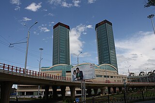
English: Rakhat Towers, among the tallest buildings in Almaty, Kazakhstan
Русский: Рахат Тауэрс, одни из высочайших зданий в Алма-Ате, Казахстан |
| Date | |
| Source | Own work |
| Author | Ds02006 |
| Camera location |
| View this and other nearby images on: OpenStreetMap |
|
|---|
Licensing
| I, the copyright holder of this work, release this work into the
public domain. This applies worldwide. In some countries this may not be legally possible; if so: I grant anyone the right to use this work for any purpose, without any conditions, unless such conditions are required by law. |
File history
Click on a date/time to view the file as it appeared at that time.
| Date/Time | Thumbnail | Dimensions | User | Comment | |
|---|---|---|---|---|---|
| current | 04:24, 5 June 2009 |
| 3,888 × 2,592 (2.88 MB) | Ds02006 | {{Information |Description={{en|1=Rakhat Towers, among the tallest buildings in Almaty, Kazakhstan}} {{ru|1=Рахат Тауэрс, одни из высочайших зданий в Алма-Ате, Казахстан}} |Source=Own work by uploader |Aut |
File usage
The following pages on the English Wikipedia use this file (pages on other projects are not listed):
Global file usage
The following other wikis use this file:
- Usage on ar.wikipedia.org
- Usage on de.wikipedia.org
- Usage on ha.wikipedia.org
- Usage on hu.wikipedia.org
- Usage on kk.wikipedia.org
- Usage on mdf.wikipedia.org
- Usage on ru.wikipedia.org
- Usage on www.wikidata.org
Metadata
Size of this preview:
800 × 533 pixels. Other resolutions:
320 × 213 pixels |
640 × 427 pixels |
1,024 × 683 pixels |
1,280 × 853 pixels |
2,560 × 1,707 pixels |
3,888 × 2,592 pixels.
Original file (3,888 × 2,592 pixels, file size: 2.88 MB, MIME type: image/jpeg)
| This is a file from the
Wikimedia Commons. Information from its
description page there is shown below. Commons is a freely licensed media file repository. You can help. |
Summary
| Description |
English: Rakhat Towers, among the tallest buildings in Almaty, Kazakhstan
Русский: Рахат Тауэрс, одни из высочайших зданий в Алма-Ате, Казахстан |
| Date | |
| Source | Own work |
| Author | Ds02006 |
| Camera location |
| View this and other nearby images on: OpenStreetMap |
|
|---|
Licensing
| I, the copyright holder of this work, release this work into the
public domain. This applies worldwide. In some countries this may not be legally possible; if so: I grant anyone the right to use this work for any purpose, without any conditions, unless such conditions are required by law. |
File history
Click on a date/time to view the file as it appeared at that time.
| Date/Time | Thumbnail | Dimensions | User | Comment | |
|---|---|---|---|---|---|
| current | 04:24, 5 June 2009 |
| 3,888 × 2,592 (2.88 MB) | Ds02006 | {{Information |Description={{en|1=Rakhat Towers, among the tallest buildings in Almaty, Kazakhstan}} {{ru|1=Рахат Тауэрс, одни из высочайших зданий в Алма-Ате, Казахстан}} |Source=Own work by uploader |Aut |
File usage
The following pages on the English Wikipedia use this file (pages on other projects are not listed):
Global file usage
The following other wikis use this file:
- Usage on ar.wikipedia.org
- Usage on de.wikipedia.org
- Usage on ha.wikipedia.org
- Usage on hu.wikipedia.org
- Usage on kk.wikipedia.org
- Usage on mdf.wikipedia.org
- Usage on ru.wikipedia.org
- Usage on www.wikidata.org