Photos • Location


Size of this preview:
800 × 450 pixels. Other resolutions:
320 × 180 pixels |
640 × 360 pixels |
1,024 × 576 pixels |
1,280 × 720 pixels |
2,560 × 1,439 pixels |
4,299 × 2,417 pixels.
Original file (4,299 × 2,417 pixels, file size: 5.99 MB, MIME type: image/jpeg)
| This is a file from the
Wikimedia Commons. Information from its
description page there is shown below. Commons is a freely licensed media file repository. You can help. |
_006.jpg)
Summary
| Description |
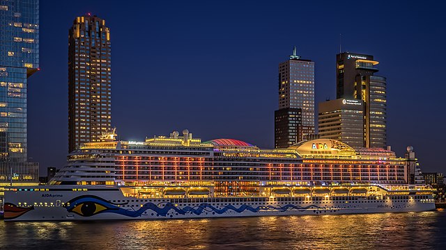
English: Cruiseship AIDAprima - Wilhelminakade - Port of Rotterdam |
| Date | |
| Source | ms AIDA prima - Wilhelminakade - Port of Rotterdam |
| Author | Frans Berkelaar |
| Camera location |
| View this and other nearby images on: OpenStreetMap |
|
|---|
_006.jpg¶ms=051.905586_N_0004.484975_E_globe:Earth_type:camera_source:Flickr_&language=en)
Licensing
This file is licensed under the
Creative Commons
Attribution 2.0 Generic license.
- You are free:
- to share – to copy, distribute and transmit the work
- to remix – to adapt the work
- Under the following conditions:
- attribution – You must give appropriate credit, provide a link to the license, and indicate if changes were made. You may do so in any reasonable manner, but not in any way that suggests the licensor endorses you or your use.
| This image, originally posted to Flickr, was reviewed on 23 May 2016 by the administrator or reviewer Elisfkc, who confirmed that it was available on Flickr under the stated license on that date. |

|
Attribution information, such as the author's name, e-mail, website, or signature, that was once visible in the image itself has been moved into the image metadata and/or image description page. This makes the image easier to reuse and more language-neutral, and makes the text easier to process and search for. Commons
discourages placing visible author information in images.
|
File history
Click on a date/time to view the file as it appeared at that time.
| Date/Time | Thumbnail | Dimensions | User | Comment | |
|---|---|---|---|---|---|
| current | 03:55, 23 May 2016 |
| 4,299 × 2,417 (5.99 MB) | Rolf H. | {{Information |Description={{en|Cruiseship AIDAprima - Wilhelminakade - Port of Rotterdam}} |Source=[https://www.flickr.com/photos/28169156@N03/26437359392/ ms AIDA prima - Wilhelminakade - Port of Rotterdam] |Date=2016-04-19 20:31 |Author=[https://www... |
File usage
The following pages on the English Wikipedia use this file (pages on other projects are not listed):
Global file usage
The following other wikis use this file:
- Usage on no.wikipedia.org
Metadata
_006.jpg)
Size of this preview:
800 × 450 pixels. Other resolutions:
320 × 180 pixels |
640 × 360 pixels |
1,024 × 576 pixels |
1,280 × 720 pixels |
2,560 × 1,439 pixels |
4,299 × 2,417 pixels.
Original file (4,299 × 2,417 pixels, file size: 5.99 MB, MIME type: image/jpeg)
| This is a file from the
Wikimedia Commons. Information from its
description page there is shown below. Commons is a freely licensed media file repository. You can help. |
Summary
| Description |
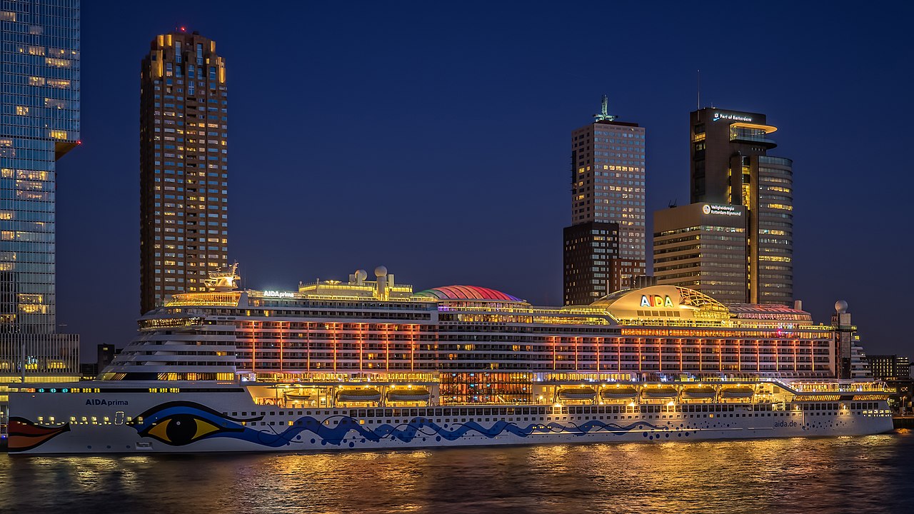
English: Cruiseship AIDAprima - Wilhelminakade - Port of Rotterdam |
| Date | |
| Source | ms AIDA prima - Wilhelminakade - Port of Rotterdam |
| Author | Frans Berkelaar |
| Camera location |
| View this and other nearby images on: OpenStreetMap |
|
|---|
Licensing
This file is licensed under the
Creative Commons
Attribution 2.0 Generic license.
- You are free:
- to share – to copy, distribute and transmit the work
- to remix – to adapt the work
- Under the following conditions:
- attribution – You must give appropriate credit, provide a link to the license, and indicate if changes were made. You may do so in any reasonable manner, but not in any way that suggests the licensor endorses you or your use.
| This image, originally posted to Flickr, was reviewed on 23 May 2016 by the administrator or reviewer Elisfkc, who confirmed that it was available on Flickr under the stated license on that date. |
|
|
Attribution information, such as the author's name, e-mail, website, or signature, that was once visible in the image itself has been moved into the image metadata and/or image description page. This makes the image easier to reuse and more language-neutral, and makes the text easier to process and search for. Commons
discourages placing visible author information in images.
|
File history
Click on a date/time to view the file as it appeared at that time.
| Date/Time | Thumbnail | Dimensions | User | Comment | |
|---|---|---|---|---|---|
| current | 03:55, 23 May 2016 |
| 4,299 × 2,417 (5.99 MB) | Rolf H. | {{Information |Description={{en|Cruiseship AIDAprima - Wilhelminakade - Port of Rotterdam}} |Source=[https://www.flickr.com/photos/28169156@N03/26437359392/ ms AIDA prima - Wilhelminakade - Port of Rotterdam] |Date=2016-04-19 20:31 |Author=[https://www... |
File usage
The following pages on the English Wikipedia use this file (pages on other projects are not listed):
Global file usage
The following other wikis use this file:
- Usage on no.wikipedia.org