Photos • Location


Size of this preview:
617 × 600 pixels. Other resolutions:
247 × 240 pixels |
494 × 480 pixels |
790 × 768 pixels |
1,054 × 1,024 pixels |
1,552 × 1,508 pixels.
Original file (1,552 × 1,508 pixels, file size: 384 KB, MIME type: image/jpeg)
| This is a file from the
Wikimedia Commons. Information from its
description page there is shown below. Commons is a freely licensed media file repository. You can help. |
Summary
| Description |
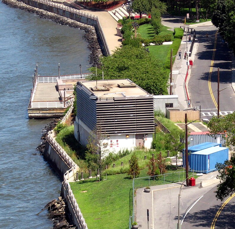
English: Looking north and down from
en:Queensborough Bridge at venitlation structure for
en:63rd Street Tunnel. See also
Image:E63d St Ventilating Tower jeh.JPG |
| Date | |
| Source | Own work |
| Author | Jim.henderson |
| Camera location | | View this and other nearby images on: OpenStreetMap |
|
|---|
Licensing
| I, the copyright holder of this work, release this work into the
public domain. This applies worldwide. In some countries this may not be legally possible; if so: I grant anyone the right to use this work for any purpose, without any conditions, unless such conditions are required by law. |
File history
Click on a date/time to view the file as it appeared at that time.
| Date/Time | Thumbnail | Dimensions | User | Comment | |
|---|---|---|---|---|---|
| current | 20:53, 4 September 2008 |
| 1,552 × 1,508 (384 KB) | Jim.henderson | {{Information |Description={{en|1=Looking north and down from en:Queensborough Bridge at venitlation structure for 63d Street tunnel}} |Source=Own work by uploader |Author= Jim.henderson |Date=August 2008 |Permission= |other_ver |
File usage
The following pages on the English Wikipedia use this file (pages on other projects are not listed):
Global file usage
The following other wikis use this file:
- Usage on it.wikipedia.org
- Usage on ja.wikipedia.org
- Usage on nl.wikipedia.org
- Usage on www.wikidata.org
Metadata
Size of this preview:
617 × 600 pixels. Other resolutions:
247 × 240 pixels |
494 × 480 pixels |
790 × 768 pixels |
1,054 × 1,024 pixels |
1,552 × 1,508 pixels.
Original file (1,552 × 1,508 pixels, file size: 384 KB, MIME type: image/jpeg)
| This is a file from the
Wikimedia Commons. Information from its
description page there is shown below. Commons is a freely licensed media file repository. You can help. |
Summary
| Description |
English: Looking north and down from
en:Queensborough Bridge at venitlation structure for
en:63rd Street Tunnel. See also
Image:E63d St Ventilating Tower jeh.JPG |
| Date | |
| Source | Own work |
| Author | Jim.henderson |
| Camera location | | View this and other nearby images on: OpenStreetMap |
|
|---|
Licensing
| I, the copyright holder of this work, release this work into the
public domain. This applies worldwide. In some countries this may not be legally possible; if so: I grant anyone the right to use this work for any purpose, without any conditions, unless such conditions are required by law. |
File history
Click on a date/time to view the file as it appeared at that time.
| Date/Time | Thumbnail | Dimensions | User | Comment | |
|---|---|---|---|---|---|
| current | 20:53, 4 September 2008 |
| 1,552 × 1,508 (384 KB) | Jim.henderson | {{Information |Description={{en|1=Looking north and down from en:Queensborough Bridge at venitlation structure for 63d Street tunnel}} |Source=Own work by uploader |Author= Jim.henderson |Date=August 2008 |Permission= |other_ver |
File usage
The following pages on the English Wikipedia use this file (pages on other projects are not listed):
Global file usage
The following other wikis use this file:
- Usage on it.wikipedia.org
- Usage on ja.wikipedia.org
- Usage on nl.wikipedia.org
- Usage on www.wikidata.org