Size of this preview:
800 × 360 pixels. Other resolutions:
320 × 144 pixels |
640 × 288 pixels |
1,024 × 461 pixels |
1,874 × 844 pixels.
Original file (1,874 × 844 pixels, file size: 423 KB, MIME type: image/jpeg)
| This is a file from the
Wikimedia Commons. Information from its
description page there is shown below. Commons is a freely licensed media file repository. You can help. |
Summary
| Description |
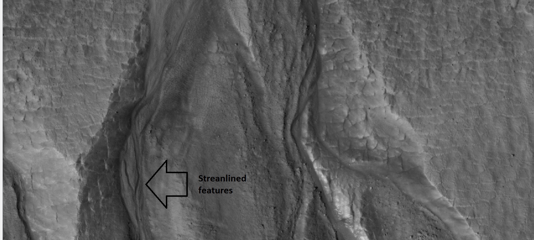
English: Close-up of gullies, as seen by hirise under HiWish program. Location is 55.8 N and 208.1 E. |
| Date | 5/7/12 |
| Source | http://hirise.lpl.arizona.edu/ESP_026420_2360 |
| Author |
Jim Secosky modified nasa image. Image credit: NASA/JPL/University of Arizona/Secosky |
Licensing
| This file is in the public domain in the United States because it was solely created by NASA. NASA copyright policy states that "NASA material is not protected by copyright unless noted". (See Template:PD-USGov, NASA copyright policy page or JPL Image Use Policy.) | ||
 |
Warnings:
|
File history
Click on a date/time to view the file as it appeared at that time.
| Date/Time | Thumbnail | Dimensions | User | Comment | |
|---|---|---|---|---|---|
| current | 21:58, 7 May 2012 |
| 1,874 × 844 (423 KB) | Jimmarsmars | {{Information |Description ={{en|1=Close-up of gullies, as seen by hirise under HiWish program. Location is 55.8 N and 208.1 E.}} |Source =Source=http://hirise.lpl.arizona.edu/ESP_026420_2360 |Author =Jim Secosky modified nasa image... |
| 21:55, 7 May 2012 |
 | 1,874 × 844 (423 KB) | Jimmarsmars | {{Information |Description ={{en|1=Close-up of gullies, as seen by hirise under HiWish program. Location is 55.8 N and 208.1 E.}} |Source =Source=http://hirise.lpl.arizona.edu/ESP_026420_2360 |Author =Jim Secosky modified nasa image... |
File usage
The following pages on the English Wikipedia use this file (pages on other projects are not listed):
Global file usage
Size of this preview:
800 × 360 pixels. Other resolutions:
320 × 144 pixels |
640 × 288 pixels |
1,024 × 461 pixels |
1,874 × 844 pixels.
Original file (1,874 × 844 pixels, file size: 423 KB, MIME type: image/jpeg)
| This is a file from the
Wikimedia Commons. Information from its
description page there is shown below. Commons is a freely licensed media file repository. You can help. |
Summary
| Description |
English: Close-up of gullies, as seen by hirise under HiWish program. Location is 55.8 N and 208.1 E. |
| Date | 5/7/12 |
| Source | http://hirise.lpl.arizona.edu/ESP_026420_2360 |
| Author |
Jim Secosky modified nasa image. Image credit: NASA/JPL/University of Arizona/Secosky |
Licensing
| This file is in the public domain in the United States because it was solely created by NASA. NASA copyright policy states that "NASA material is not protected by copyright unless noted". (See Template:PD-USGov, NASA copyright policy page or JPL Image Use Policy.) | ||
|
Warnings:
|
File history
Click on a date/time to view the file as it appeared at that time.
| Date/Time | Thumbnail | Dimensions | User | Comment | |
|---|---|---|---|---|---|
| current | 21:58, 7 May 2012 |
| 1,874 × 844 (423 KB) | Jimmarsmars | {{Information |Description ={{en|1=Close-up of gullies, as seen by hirise under HiWish program. Location is 55.8 N and 208.1 E.}} |Source =Source=http://hirise.lpl.arizona.edu/ESP_026420_2360 |Author =Jim Secosky modified nasa image... |
| 21:55, 7 May 2012 |
| 1,874 × 844 (423 KB) | Jimmarsmars | {{Information |Description ={{en|1=Close-up of gullies, as seen by hirise under HiWish program. Location is 55.8 N and 208.1 E.}} |Source =Source=http://hirise.lpl.arizona.edu/ESP_026420_2360 |Author =Jim Secosky modified nasa image... |
File usage
The following pages on the English Wikipedia use this file (pages on other projects are not listed):