Photos • Location


Size of this preview:
400 × 600 pixels. Other resolutions:
160 × 240 pixels |
320 × 480 pixels |
512 × 768 pixels |
682 × 1,024 pixels |
1,968 × 2,952 pixels.
Original file (1,968 × 2,952 pixels, file size: 1.1 MB, MIME type: image/jpeg)
| This is a file from the
Wikimedia Commons. Information from its
description page there is shown below. Commons is a freely licensed media file repository. You can help. |
|
This is an image of a place or building that is listed on the
National Register of Historic Places in the
United States of America. Its reference number is
73000697. |
| Description |
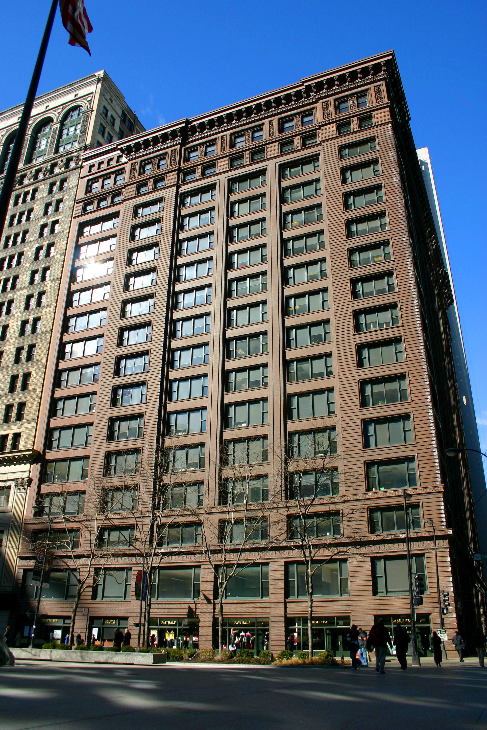
English: Marquette Building, Chicago, IL, USA |
|||
| Date | ||||
| Source | J. Crocker | |||
| Author | J. Crocker | |||
| Permission ( Reusing this file) |
|

| Object location |
| View this and other nearby images on: OpenStreetMap |
|
|---|
File history
Click on a date/time to view the file as it appeared at that time.
| Date/Time | Thumbnail | Dimensions | User | Comment | |
|---|---|---|---|---|---|
| current | 03:32, 4 March 2010 |
| 1,968 × 2,952 (1.1 MB) | Jcrocker | {{Information |Description={{en|1=temp}} |Source={{own}} |Author= Jcrocker |Date= |Permission= |other_versions= }} |
File usage
The following pages on the English Wikipedia use this file (pages on other projects are not listed):
- Chicago school (architecture)
- Holabird & Root
- List of National Historic Landmarks in Illinois
- Marquette Building (Chicago)
- National Register of Historic Places listings in Central Chicago
- User:Smallbones/NRHP Central Chicago
- User talk:Jcrocker
- User talk:TonyTheTiger/Archive 50
- Wikipedia:Featured picture candidates/August-2010
- Wikipedia:Featured picture candidates/Marquette Building
- Wikipedia:Today's featured article/requests/Early skyscrapers
- Wikipedia:Valued picture candidates/Marquette Building
- Wikipedia:Valued picture candidates/September-2010
- Wikipedia:WikiProject Chicago
- Wikipedia:WikiProject Chicago/Good articles
Global file usage
The following other wikis use this file:
- Usage on ar.wikipedia.org
- Usage on de.wikipedia.org
- Usage on en.wikivoyage.org
- Usage on es.wikipedia.org
- Usage on fr.wikipedia.org
- Usage on he.wikipedia.org
- Usage on pl.wikipedia.org
- Usage on www.wikidata.org
Size of this preview:
400 × 600 pixels. Other resolutions:
160 × 240 pixels |
320 × 480 pixels |
512 × 768 pixels |
682 × 1,024 pixels |
1,968 × 2,952 pixels.
Original file (1,968 × 2,952 pixels, file size: 1.1 MB, MIME type: image/jpeg)
| This is a file from the
Wikimedia Commons. Information from its
description page there is shown below. Commons is a freely licensed media file repository. You can help. |
|
This is an image of a place or building that is listed on the
National Register of Historic Places in the
United States of America. Its reference number is
73000697. |
| Description |
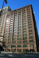
English: Marquette Building, Chicago, IL, USA |
|||
| Date | ||||
| Source | J. Crocker | |||
| Author | J. Crocker | |||
| Permission ( Reusing this file) |
|
| Object location |
| View this and other nearby images on: OpenStreetMap |
|
|---|
File history
Click on a date/time to view the file as it appeared at that time.
| Date/Time | Thumbnail | Dimensions | User | Comment | |
|---|---|---|---|---|---|
| current | 03:32, 4 March 2010 |
| 1,968 × 2,952 (1.1 MB) | Jcrocker | {{Information |Description={{en|1=temp}} |Source={{own}} |Author= Jcrocker |Date= |Permission= |other_versions= }} |
File usage
The following pages on the English Wikipedia use this file (pages on other projects are not listed):
- Chicago school (architecture)
- Holabird & Root
- List of National Historic Landmarks in Illinois
- Marquette Building (Chicago)
- National Register of Historic Places listings in Central Chicago
- User:Smallbones/NRHP Central Chicago
- User talk:Jcrocker
- User talk:TonyTheTiger/Archive 50
- Wikipedia:Featured picture candidates/August-2010
- Wikipedia:Featured picture candidates/Marquette Building
- Wikipedia:Today's featured article/requests/Early skyscrapers
- Wikipedia:Valued picture candidates/Marquette Building
- Wikipedia:Valued picture candidates/September-2010
- Wikipedia:WikiProject Chicago
- Wikipedia:WikiProject Chicago/Good articles
Global file usage
The following other wikis use this file:
- Usage on ar.wikipedia.org
- Usage on de.wikipedia.org
- Usage on en.wikivoyage.org
- Usage on es.wikipedia.org
- Usage on fr.wikipedia.org
- Usage on he.wikipedia.org
- Usage on pl.wikipedia.org
- Usage on www.wikidata.org