
Size of this preview:
800 × 524 pixels. Other resolutions:
320 × 210 pixels |
640 × 419 pixels |
1,024 × 671 pixels |
1,280 × 839 pixels |
2,560 × 1,678 pixels |
3,500 × 2,294 pixels.
Original file (3,500 × 2,294 pixels, file size: 8.38 MB, MIME type: image/png)
| This is a file from the
Wikimedia Commons. Information from its
description page there is shown below. Commons is a freely licensed media file repository. You can help. |
| Description |
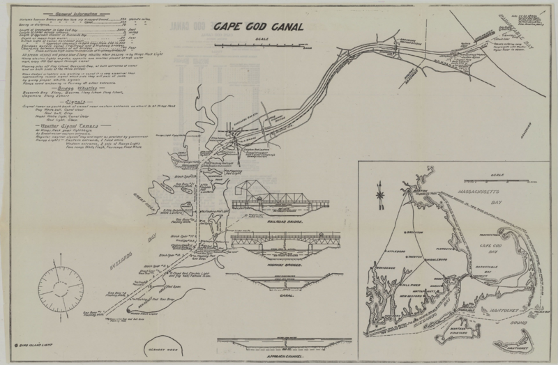
English: 1922 map of the Cape Cod Canal, showing bridges, mooring points, and other features |
||
| Date | |||
| Source | Scanned map on WardMaps, originally from the Yachtsman's Guide | ||
| Author | Unknown author | ||
| Permission ( Reusing this file) |
|
File history
Click on a date/time to view the file as it appeared at that time.
| Date/Time | Thumbnail | Dimensions | User | Comment | |
|---|---|---|---|---|---|
| current | 07:08, 12 January 2014 |
| 3,500 × 2,294 (8.38 MB) | Pi.1415926535 | {{Information |Description ={{en|1=1922 map of the Cape Cod Canal, showing bridges, mooring points, and other features}} |Source =[http://www.wardmaps.com/viewasset.php?aid=7435 Scanned map] on WardMaps, originally from the Yachtsman's Guide... |
File usage
The following pages on the English Wikipedia use this file (pages on other projects are not listed):
Global file usage
The following other wikis use this file:
- Usage on ar.wikipedia.org
- Usage on de.wikipedia.org
- Usage on ja.wikipedia.org
- Usage on pt.wikipedia.org
Size of this preview:
800 × 524 pixels. Other resolutions:
320 × 210 pixels |
640 × 419 pixels |
1,024 × 671 pixels |
1,280 × 839 pixels |
2,560 × 1,678 pixels |
3,500 × 2,294 pixels.
Original file (3,500 × 2,294 pixels, file size: 8.38 MB, MIME type: image/png)
| This is a file from the
Wikimedia Commons. Information from its
description page there is shown below. Commons is a freely licensed media file repository. You can help. |
| Description |
English: 1922 map of the Cape Cod Canal, showing bridges, mooring points, and other features |
||
| Date | |||
| Source | Scanned map on WardMaps, originally from the Yachtsman's Guide | ||
| Author | Unknown author | ||
| Permission ( Reusing this file) |
|
File history
Click on a date/time to view the file as it appeared at that time.
| Date/Time | Thumbnail | Dimensions | User | Comment | |
|---|---|---|---|---|---|
| current | 07:08, 12 January 2014 |
| 3,500 × 2,294 (8.38 MB) | Pi.1415926535 | {{Information |Description ={{en|1=1922 map of the Cape Cod Canal, showing bridges, mooring points, and other features}} |Source =[http://www.wardmaps.com/viewasset.php?aid=7435 Scanned map] on WardMaps, originally from the Yachtsman's Guide... |
File usage
The following pages on the English Wikipedia use this file (pages on other projects are not listed):
Global file usage
The following other wikis use this file:
- Usage on ar.wikipedia.org
- Usage on de.wikipedia.org
- Usage on ja.wikipedia.org
- Usage on pt.wikipedia.org