
Original file (2,148 × 1,681 pixels, file size: 3.68 MB, MIME type: image/png)
| This is a file from the
Wikimedia Commons. Information from its
description page there is shown below. Commons is a freely licensed media file repository. You can help. |
Summary
| Description |
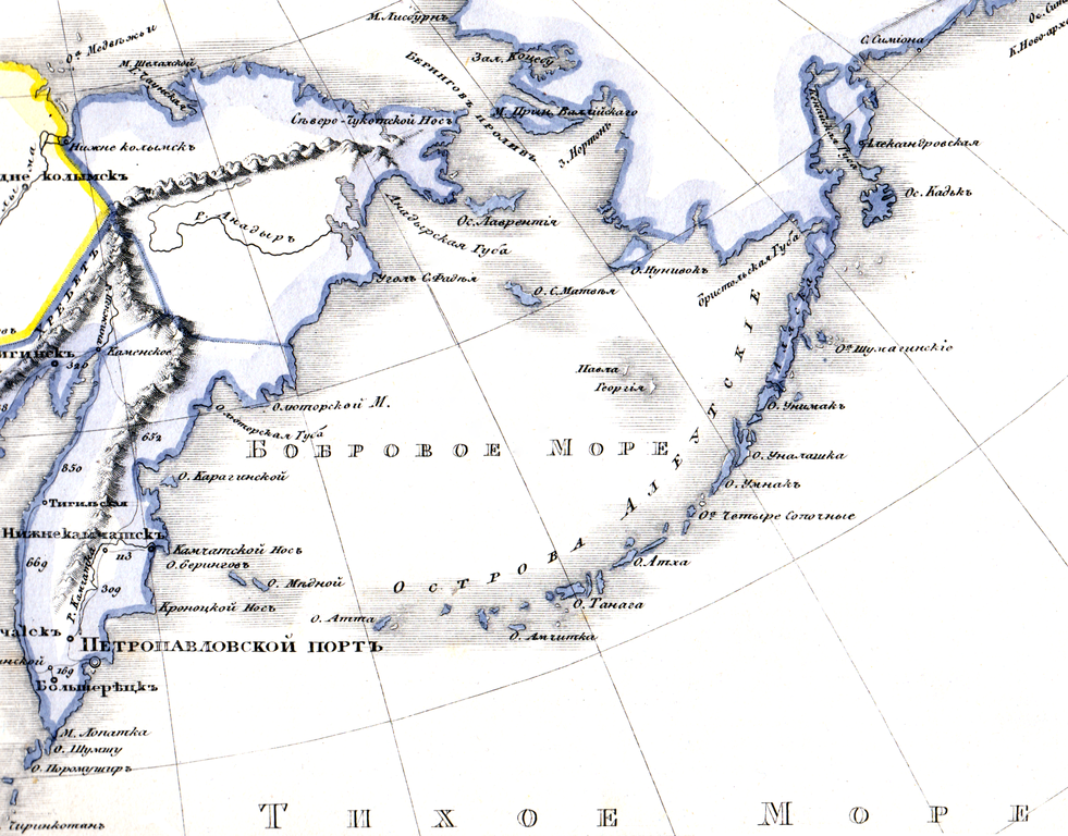
Русский: Часть карты с Бобровым морем.
Новая географическая дорожная карта Российской империи с означением 57 губерний, 8 областей, 4 градоначальств, 4 управлений, 8 воеводств, Земли Большой и Малой Кабарды и Киргиз Кайсаков. С показанием учебных округов, городов, примечательных мест, водяных сообщений, почтовых проезжих дорог, и расстояние между оными в верстах. Составлена и издана служащим в Военно-типографическом депо капитаном Медниковым. 1833. С.-Петербург. Издание сей карты служит единственно руководством преподавающим и учащимся Российской географии по курсу Г. Г. Профессор. Арсеньева и Зяславского и для путешествующих по России. |
| Date | |
| Source | Новая географическая дорожная карта Российской империи |
| Author | Медников, 1833 |
Licensing
|
This work is in the public domain in its country of origin and other countries and areas where the copyright term is the author's life plus 70 years or fewer. This work is in the public domain in the United States because it was published (or registered with the U.S. Copyright Office) before January 1, 1929. | |
| This file has been identified as being free of known restrictions under copyright law, including all related and neighboring rights. | |
File history
Click on a date/time to view the file as it appeared at that time.
| Date/Time | Thumbnail | Dimensions | User | Comment | |
|---|---|---|---|---|---|
| current | 12:24, 12 November 2015 |
| 2,148 × 1,681 (3.68 MB) | Ivtorov | User created page with UploadWizard |
File usage
Global file usage
The following other wikis use this file:
- Usage on be.wikipedia.org
- Usage on cv.wikipedia.org
- Usage on hy.wikipedia.org
- Usage on it.wikipedia.org
- Usage on ko.wikipedia.org
- Usage on ru.wikipedia.org
Metadata
Original file (2,148 × 1,681 pixels, file size: 3.68 MB, MIME type: image/png)
| This is a file from the
Wikimedia Commons. Information from its
description page there is shown below. Commons is a freely licensed media file repository. You can help. |
Summary
| Description |
Русский: Часть карты с Бобровым морем.
Новая географическая дорожная карта Российской империи с означением 57 губерний, 8 областей, 4 градоначальств, 4 управлений, 8 воеводств, Земли Большой и Малой Кабарды и Киргиз Кайсаков. С показанием учебных округов, городов, примечательных мест, водяных сообщений, почтовых проезжих дорог, и расстояние между оными в верстах. Составлена и издана служащим в Военно-типографическом депо капитаном Медниковым. 1833. С.-Петербург. Издание сей карты служит единственно руководством преподавающим и учащимся Российской географии по курсу Г. Г. Профессор. Арсеньева и Зяславского и для путешествующих по России. |
| Date | |
| Source | Новая географическая дорожная карта Российской империи |
| Author | Медников, 1833 |
Licensing
|
This work is in the public domain in its country of origin and other countries and areas where the copyright term is the author's life plus 70 years or fewer. This work is in the public domain in the United States because it was published (or registered with the U.S. Copyright Office) before January 1, 1929. | |
| This file has been identified as being free of known restrictions under copyright law, including all related and neighboring rights. | |
File history
Click on a date/time to view the file as it appeared at that time.
| Date/Time | Thumbnail | Dimensions | User | Comment | |
|---|---|---|---|---|---|
| current | 12:24, 12 November 2015 |
| 2,148 × 1,681 (3.68 MB) | Ivtorov | User created page with UploadWizard |
File usage
Global file usage
The following other wikis use this file:
- Usage on be.wikipedia.org
- Usage on cv.wikipedia.org
- Usage on hy.wikipedia.org
- Usage on it.wikipedia.org
- Usage on ko.wikipedia.org
- Usage on ru.wikipedia.org