Photos • Location
Farmton | |
|---|---|
| Coordinates: 28°50′49″N 81°03′38″W / 28.84694°N 81.06056°W | |
| Country | |
| State | |
| County | Volusia |
| Elevation | 16 ft (5 m) |
| Time zone | UTC-5 (Eastern (EST)) |
| • Summer ( DST) | UTC-4 (EDT) |
| enter ZIP code | 32764 |
| Area code | 386 |
| GNIS feature ID | 294761 [1] |
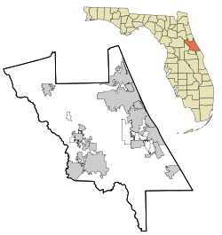
Farmton is an unincorporated community in Volusia County, Florida, United States off Osteen–Maytown Road, eight miles west of Interstate 95. Farmton is located near the St. Johns River, west of Cow Creek and east of Osteen.
References
- ^ "US Board on Geographic Names". United States Geological Survey. October 25, 2007. Retrieved January 31, 2008.

