Eure, North Carolina | |
|---|---|
 Eure | |
| Coordinates: 36°25′39″N 76°51′12″W / 36.42750°N 76.85333°W | |
| Country | United States |
| State | North Carolina |
| County | Gates |
| Incorporated | 1915 [1] (inactive) |
| Elevation | 23 ft (7 m) |
| Time zone | UTC-5 ( Eastern (EST)) |
| • Summer ( DST) | UTC-4 (EDT) |
| ZIP code | 27935
[2] |
| Area code | 252 |
| GNIS feature ID | 1025312 |
Eure is an unincorporated community in mid-western Gates County, North Carolina, United States. It lies at an elevation of 23 feet (7 m). [3] It is approximately 15 minutes away from Merchants Millpond State Park, [4] and about 40 minutes away from the Great Dismal Swamp. [5]
Eure was incorporated in 1915, but later fell in active in municipal affairs. [6] A volunteer fire department was established in 1980. [7]
References
- ^ "North Carolina Gazetteer". Retrieved November 25, 2023.
- ^ "Eure ZIP Code". zipdatamaps.com. 2022. Retrieved November 11, 2022.
- ^ U.S. Geological Survey Geographic Names Information System: Eure, North Carolina
- ^ "Eure to Merchants Millpond State Park". Eure to Merchants Millpond State Park. Retrieved 2020-01-28.
- ^ "Eure to Great Dismal Swamp National Wildlife Refuge". Eure to Great Dismal Swamp National Wildlife Refuge. Retrieved 2020-01-28.
- ^ Powell, William S. (1976). The North Carolina Gazetteer: A Dictionary of Tar Heel Places. Chapel Hill: The University of North Carolina Press. p. 165. ISBN 9780807812471.
- ^ "Eure Volunteer Fire Department, Inc. | USA Fire Departments". usfiredept.com. Retrieved 2020-01-28.
Municipalities and communities of
Gates County, North Carolina, United States | ||
|---|---|---|
| Town | 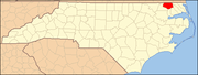 | |
| CDP | ||
|
Unincorporated communities | ||
Eure, North Carolina | |
|---|---|
Eure | |
| Coordinates: 36°25′39″N 76°51′12″W / 36.42750°N 76.85333°W | |
| Country | United States |
| State | North Carolina |
| County | Gates |
| Incorporated | 1915 [1] (inactive) |
| Elevation | 23 ft (7 m) |
| Time zone | UTC-5 ( Eastern (EST)) |
| • Summer ( DST) | UTC-4 (EDT) |
| ZIP code | 27935
[2] |
| Area code | 252 |
| GNIS feature ID | 1025312 |
Eure is an unincorporated community in mid-western Gates County, North Carolina, United States. It lies at an elevation of 23 feet (7 m). [3] It is approximately 15 minutes away from Merchants Millpond State Park, [4] and about 40 minutes away from the Great Dismal Swamp. [5]
Eure was incorporated in 1915, but later fell in active in municipal affairs. [6] A volunteer fire department was established in 1980. [7]
References
- ^ "North Carolina Gazetteer". Retrieved November 25, 2023.
- ^ "Eure ZIP Code". zipdatamaps.com. 2022. Retrieved November 11, 2022.
- ^ U.S. Geological Survey Geographic Names Information System: Eure, North Carolina
- ^ "Eure to Merchants Millpond State Park". Eure to Merchants Millpond State Park. Retrieved 2020-01-28.
- ^ "Eure to Great Dismal Swamp National Wildlife Refuge". Eure to Great Dismal Swamp National Wildlife Refuge. Retrieved 2020-01-28.
- ^ Powell, William S. (1976). The North Carolina Gazetteer: A Dictionary of Tar Heel Places. Chapel Hill: The University of North Carolina Press. p. 165. ISBN 9780807812471.
- ^ "Eure Volunteer Fire Department, Inc. | USA Fire Departments". usfiredept.com. Retrieved 2020-01-28.
Municipalities and communities of
Gates County, North Carolina, United States | ||
|---|---|---|
| Town | | |
| CDP | ||
|
Unincorporated communities | ||