Photos • Location


34°25′N 137°40′E / 34.417°N 137.667°E

Enshū
Nada
Nada
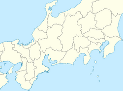
Location of Enshū Sea
Enshū Sea ( Japanese: 遠州灘 [1] [2]) is the sea area from Cape Irōzaki in Shizuoka Prefecture to Cape Daiō in Mie Prefecture. [3] It is also called Tōtōmi Sea ( Japanese: 遠江灘) or Tenryū Sea ( Japanese: 天竜灘).
References
- ^ "灘ってなに?". www1.kaiho.mlit.go.jp. Archived from the original on 2021-05-26. Retrieved 2021-05-26.
- ^ "えんしゅうなだ【遠州灘】 | え | 辞典". 学研キッズネット (in Japanese). Retrieved 2021-05-26.
-
^ 第2版, 日本大百科全書(ニッポニカ),デジタル大辞泉,ブリタニカ国際大百科事典 小項目事典,百科事典マイペディア,精選版 日本国語大辞典,世界大百科事典.
"遠州灘とは". コトバンク (in Japanese). Retrieved 2021-05-26.
{{
cite web}}
: CS1 maint: multiple names: authors list ( link) CS1 maint: numeric names: authors list ( link)
|
| This Japanese location article is a stub. You can help Wikipedia by expanding it. |
34°25′N 137°40′E / 34.417°N 137.667°E
Enshū
Nada
Nada
Location of Enshū Sea
Enshū Sea ( Japanese: 遠州灘 [1] [2]) is the sea area from Cape Irōzaki in Shizuoka Prefecture to Cape Daiō in Mie Prefecture. [3] It is also called Tōtōmi Sea ( Japanese: 遠江灘) or Tenryū Sea ( Japanese: 天竜灘).
References
- ^ "灘ってなに?". www1.kaiho.mlit.go.jp. Archived from the original on 2021-05-26. Retrieved 2021-05-26.
- ^ "えんしゅうなだ【遠州灘】 | え | 辞典". 学研キッズネット (in Japanese). Retrieved 2021-05-26.
-
^ 第2版, 日本大百科全書(ニッポニカ),デジタル大辞泉,ブリタニカ国際大百科事典 小項目事典,百科事典マイペディア,精選版 日本国語大辞典,世界大百科事典.
"遠州灘とは". コトバンク (in Japanese). Retrieved 2021-05-26.
{{
cite web}}
: CS1 maint: multiple names: authors list ( link) CS1 maint: numeric names: authors list ( link)
|
| This Japanese location article is a stub. You can help Wikipedia by expanding it. |