Englevale, North Dakota | |
|---|---|
 Buildings in Englevale | |
 Englevale, North Dakota  Englevale, North Dakota | |
| Coordinates: 46°23′28″N 97°54′14″W / 46.39111°N 97.90389°W | |
| Country | United States |
| State | North Dakota |
| County | Ransom |
| Area | |
| • Total | 1.49 sq mi (3.85 km2) |
| • Land | 1.49 sq mi (3.85 km2) |
| • Water | 0.00 sq mi (0.00 km2) |
| Elevation | 1,342 ft (409 m) |
| Population (
2020) | |
| • Total | 36 |
| • Density | 24.23/sq mi (9.35/km2) |
| Time zone | UTC-6 ( Central (CST)) |
| • Summer ( DST) | UTC-5 (CDT) |
| Area code | 701 |
| GNIS feature ID | 2584342 [2] |
Englevale is a census-designated place and unincorporated community in Ransom County, North Dakota, United States. Its population was 40 as of the 2010 census. [3] The community was initially named Marshall after landowner Marshall T. Davis; it was later renamed for Mathias L. Engel, a promoter for the community. [2]
| Census | Pop. | Note | %± |
|---|---|---|---|
| 2020 | 36 | — | |
| U.S. Decennial Census [4] | |||
- ^ "ArcGIS REST Services Directory". United States Census Bureau. Retrieved September 20, 2022.
- ^ a b c U.S. Geological Survey Geographic Names Information System: Englevale, North Dakota
- ^ "U.S. Census website". United States Census Bureau. Retrieved May 14, 2011.
- ^ "Census of Population and Housing". Census.gov. Retrieved June 4, 2016.
Municipalities and communities of
Ransom County, North Dakota, United States | ||
|---|---|---|
| Cities | 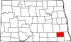 | |
| Townships | ||
| CDPs | ||
| Footnotes | ‡This populated place also has portions in an adjacent county or counties | |
| International | |
|---|---|
| National | |
|
| This North Dakota location article is a stub. You can help Wikipedia by expanding it. |
Englevale, North Dakota | |
|---|---|
|
Buildings in Englevale | |
Englevale, North Dakota Englevale, North Dakota | |
| Coordinates: 46°23′28″N 97°54′14″W / 46.39111°N 97.90389°W | |
| Country | United States |
| State | North Dakota |
| County | Ransom |
| Area | |
| • Total | 1.49 sq mi (3.85 km2) |
| • Land | 1.49 sq mi (3.85 km2) |
| • Water | 0.00 sq mi (0.00 km2) |
| Elevation | 1,342 ft (409 m) |
| Population (
2020) | |
| • Total | 36 |
| • Density | 24.23/sq mi (9.35/km2) |
| Time zone | UTC-6 ( Central (CST)) |
| • Summer ( DST) | UTC-5 (CDT) |
| Area code | 701 |
| GNIS feature ID | 2584342 [2] |
Englevale is a census-designated place and unincorporated community in Ransom County, North Dakota, United States. Its population was 40 as of the 2010 census. [3] The community was initially named Marshall after landowner Marshall T. Davis; it was later renamed for Mathias L. Engel, a promoter for the community. [2]
| Census | Pop. | Note | %± |
|---|---|---|---|
| 2020 | 36 | — | |
| U.S. Decennial Census [4] | |||
- ^ "ArcGIS REST Services Directory". United States Census Bureau. Retrieved September 20, 2022.
- ^ a b c U.S. Geological Survey Geographic Names Information System: Englevale, North Dakota
- ^ "U.S. Census website". United States Census Bureau. Retrieved May 14, 2011.
- ^ "Census of Population and Housing". Census.gov. Retrieved June 4, 2016.
Municipalities and communities of
Ransom County, North Dakota, United States | ||
|---|---|---|
| Cities | | |
| Townships | ||
| CDPs | ||
| Footnotes | ‡This populated place also has portions in an adjacent county or counties | |
| International | |
|---|---|
| National | |
|
| This North Dakota location article is a stub. You can help Wikipedia by expanding it. |