Elemir
Елемир | |
|---|---|
 The Orthodox Church | |
 Elemir Location of Elemir within Serbia  Elemir Elemir (Serbia)  Elemir Elemir (Europe) | |
| Coordinates: 45°26′20″N 20°17′32″E / 45.43889°N 20.29222°E | |
| Country | Serbia |
| Province | Vojvodina |
| District | Central Banat |
| Area | |
| • Elemir | 72.6 km2 (28.0 sq mi) |
| Elevation | 78 m (256 ft) |
| Population (2011) | |
| • Elemir | 4,338 |
| • Density | 60/km2 (150/sq mi) |
| Time zone | UTC+1 ( CET) |
| • Summer ( DST) | UTC+2 ( CEST) |
| Postal code | 23208 |
| Area code | +381(0)23 |
| Car plates | ZR |
Elemir ( Serbian Cyrillic: Елемир; Hungarian: Elemér) is a village located in the Zrenjanin municipality, in the Central Banat District of Serbia. It is situated in the province of Vojvodina. As of 2011 census, the village has a population of 4,338 inhabitants.
In Serbian, the village is known as Elemir or Елемир, in Hungarian as Elemér and in German as Elemer.

As of 2011 census, the village has a population of 4,338 inhabitants.
- 1869: 4,359
- 1900: 4,749
- 1948: 4,656
- 1953: 4,757
- 1961: n/a
- 1971: 5,001
- 1981: 4,998
- 1991: 4,724
- 2002: 4,690
- 2011: 4,338
The ethnic composition of the village (as of 2011 census):
- Serbs = 4,158 (88.66%)
- Romani = 181 (3.86%)
- Hungarians = 93 (1.98%)
- Yugoslavs = 54 (1.15%)
- Croats = 24 (0.51%)
- Others (3.84%)
-
 Kastel park in autumn
 -
 Orthodox church and primary school
 -
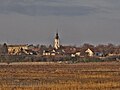
 Sunset near Elemir
 -
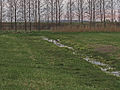 European white stork


- Slobodan Ćurčić, Broj stanovnika Vojvodine, Novi Sad, 1996.
| International | |
|---|---|
| National | |
|
| This Central Banat District, Vojvodina location article is a stub. You can help Wikipedia by expanding it. |
Elemir
Елемир | |
|---|---|
|
The Orthodox Church | |
Elemir Location of Elemir within Serbia Elemir Elemir (Serbia) Elemir Elemir (Europe) | |
| Coordinates: 45°26′20″N 20°17′32″E / 45.43889°N 20.29222°E | |
| Country | Serbia |
| Province | Vojvodina |
| District | Central Banat |
| Area | |
| • Elemir | 72.6 km2 (28.0 sq mi) |
| Elevation | 78 m (256 ft) |
| Population (2011) | |
| • Elemir | 4,338 |
| • Density | 60/km2 (150/sq mi) |
| Time zone | UTC+1 ( CET) |
| • Summer ( DST) | UTC+2 ( CEST) |
| Postal code | 23208 |
| Area code | +381(0)23 |
| Car plates | ZR |
Elemir ( Serbian Cyrillic: Елемир; Hungarian: Elemér) is a village located in the Zrenjanin municipality, in the Central Banat District of Serbia. It is situated in the province of Vojvodina. As of 2011 census, the village has a population of 4,338 inhabitants.
In Serbian, the village is known as Elemir or Елемир, in Hungarian as Elemér and in German as Elemer.
As of 2011 census, the village has a population of 4,338 inhabitants.
- 1869: 4,359
- 1900: 4,749
- 1948: 4,656
- 1953: 4,757
- 1961: n/a
- 1971: 5,001
- 1981: 4,998
- 1991: 4,724
- 2002: 4,690
- 2011: 4,338
The ethnic composition of the village (as of 2011 census):
- Serbs = 4,158 (88.66%)
- Romani = 181 (3.86%)
- Hungarians = 93 (1.98%)
- Yugoslavs = 54 (1.15%)
- Croats = 24 (0.51%)
- Others (3.84%)
-
Kastel park in autumn
-
Orthodox church and primary school
-
Sunset near Elemir
-
European white stork
- Slobodan Ćurčić, Broj stanovnika Vojvodine, Novi Sad, 1996.
| International | |
|---|---|
| National | |
|
| This Central Banat District, Vojvodina location article is a stub. You can help Wikipedia by expanding it. |