Photos • Location

Ed | |
|---|---|
 Ed Location within the state of Kentucky  Ed Ed (the United States) | |
| Coordinates: 37°22′24″N 85°2′34″W / 37.37333°N 85.04278°W | |
| Country | United States |
| State | Kentucky |
| County | Casey |
| Elevation | 1,184 ft (361 m) |
| Time zone | UTC-5 ( Eastern (EST)) |
| • Summer ( DST) | UTC-4 (EST) |
| GNIS feature ID | 2568375 [1] |
Ed was an unincorporated community in Casey County, Kentucky, United States.
Ed has been noted for its short place name. [2]

References
- ^ U.S. Geological Survey Geographic Names Information System: Ed, Kentucky
- ^ Ash, Russell (November 10, 2011). Boring, Botty and Spong. RHCP. p. 70. ISBN 978-1-4090-9739-6.
Municipalities and communities of
Casey County, Kentucky, United States | ||
|---|---|---|
| City | 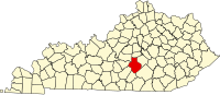 | |
|
Unincorporated Communities | ||
| Ghost Towns | ||
|
| This Casey County, Kentucky state location article is a stub. You can help Wikipedia by expanding it. |
Ed | |
|---|---|
Ed Location within the state of Kentucky Ed Ed (the United States) | |
| Coordinates: 37°22′24″N 85°2′34″W / 37.37333°N 85.04278°W | |
| Country | United States |
| State | Kentucky |
| County | Casey |
| Elevation | 1,184 ft (361 m) |
| Time zone | UTC-5 ( Eastern (EST)) |
| • Summer ( DST) | UTC-4 (EST) |
| GNIS feature ID | 2568375 [1] |
Ed was an unincorporated community in Casey County, Kentucky, United States.
Ed has been noted for its short place name. [2]
References
- ^ U.S. Geological Survey Geographic Names Information System: Ed, Kentucky
- ^ Ash, Russell (November 10, 2011). Boring, Botty and Spong. RHCP. p. 70. ISBN 978-1-4090-9739-6.
Municipalities and communities of
Casey County, Kentucky, United States | ||
|---|---|---|
| City | | |
|
Unincorporated Communities | ||
| Ghost Towns | ||
|
| This Casey County, Kentucky state location article is a stub. You can help Wikipedia by expanding it. |