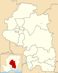
| Durley | |
|---|---|
 The Robin Hood Inn on Durley Street in the village | |
Location within
Hampshire | |
| Population | 992 [1] |
| OS grid reference | SU5218916710 |
| Civil parish |
|
| District | |
| Shire county | |
| Region | |
| Country | England |
| Sovereign state | United Kingdom |
| Post town | SOUTHAMPTON |
| Postcode district | SO32 |
| Dialling code | 01489 |
| Police | Hampshire and Isle of Wight |
| Fire | Hampshire and Isle of Wight |
| Ambulance | South Central |
| UK Parliament | |
Durley is a village and civil parish in the City of Winchester district of Hampshire, England. It is located approximately 7½ miles (12.1 km) northeast of Southampton and has a population of around 992. [2] The village is home to two pubs, The Robin Hood Inn and the Farmers Home. Both of the pubs have a rich history dating back till the nineteenth century. Durley is home to one school, Durley CE Primary. Which is home to approximately 130 pupils ranging from four to eleven years of age. The village also has one pre-school called Durley Ladybirds. The village is also home to a local church called the Church of the Holy Cross where services are regularly held.
Governance
The village is part of the civil parish of Durley [3] and is part of the Bishop's Waltham ward of the City of Winchester non-metropolitan district of Hampshire County Council. [4] T
Church
The village Church is the Holy Cross. [5] It has some external features that date from the 13th century while its font appears to be 12th century. [5] The church underwent a significant restoration in 1879. [5]
References
![]() Media related to
Durley at Wikimedia Commons
Media related to
Durley at Wikimedia Commons
- ^ Census, 2011
- ^ "Custom report - Nomis - Official Labour Market Statistics". www.nomisweb.co.uk. Retrieved 15 April 2021.
- ^ legal record of public rights of way in Hampshire - sheet 1310 (PDF) (Map). 1 : 10,000. Cartography by Ordnance Survey. Hampshire County Council. 2008. Retrieved 5 November 2010.
- ^ "Containing areas from mapit.mysociety.org". 2010. Retrieved 5 November 2010.
- ^ a b c O’Brien, Charles; Bailey, Bruce; Pevsner, Nikolaus; Lloyd, David W. (2018). The Buildings of England Hampshire: South. Yale University Press. pp. 243–244. ISBN 9780300225037.
| Durley | |
|---|---|
 The Robin Hood Inn on Durley Street in the village | |
Location within
Hampshire | |
| Population | 992 [1] |
| OS grid reference | SU5218916710 |
| Civil parish |
|
| District | |
| Shire county | |
| Region | |
| Country | England |
| Sovereign state | United Kingdom |
| Post town | SOUTHAMPTON |
| Postcode district | SO32 |
| Dialling code | 01489 |
| Police | Hampshire and Isle of Wight |
| Fire | Hampshire and Isle of Wight |
| Ambulance | South Central |
| UK Parliament | |
Durley is a village and civil parish in the City of Winchester district of Hampshire, England. It is located approximately 7½ miles (12.1 km) northeast of Southampton and has a population of around 992. [2] The village is home to two pubs, The Robin Hood Inn and the Farmers Home. Both of the pubs have a rich history dating back till the nineteenth century. Durley is home to one school, Durley CE Primary. Which is home to approximately 130 pupils ranging from four to eleven years of age. The village also has one pre-school called Durley Ladybirds. The village is also home to a local church called the Church of the Holy Cross where services are regularly held.
Governance
The village is part of the civil parish of Durley [3] and is part of the Bishop's Waltham ward of the City of Winchester non-metropolitan district of Hampshire County Council. [4] T
Church
The village Church is the Holy Cross. [5] It has some external features that date from the 13th century while its font appears to be 12th century. [5] The church underwent a significant restoration in 1879. [5]
References
![]() Media related to
Durley at Wikimedia Commons
Media related to
Durley at Wikimedia Commons
- ^ Census, 2011
- ^ "Custom report - Nomis - Official Labour Market Statistics". www.nomisweb.co.uk. Retrieved 15 April 2021.
- ^ legal record of public rights of way in Hampshire - sheet 1310 (PDF) (Map). 1 : 10,000. Cartography by Ordnance Survey. Hampshire County Council. 2008. Retrieved 5 November 2010.
- ^ "Containing areas from mapit.mysociety.org". 2010. Retrieved 5 November 2010.
- ^ a b c O’Brien, Charles; Bailey, Bruce; Pevsner, Nikolaus; Lloyd, David W. (2018). The Buildings of England Hampshire: South. Yale University Press. pp. 243–244. ISBN 9780300225037.


