Photos • Location
Draytonville, South Carolina | |
|---|---|
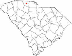
 Location of Draytonville, South Carolina | |
| Coordinates: 35°02′58″N 81°35′37″W / 35.04944°N 81.59361°W | |
| Country | United States |
| State | South Carolina |
| County | Cherokee |
| Elevation | 830 ft (250 m) |
| Time zone | UTC-5 ( Eastern (EST)) |
| • Summer ( DST) | UTC-4 (EDT) |
| Area code | 864 |
| GNIS feature ID | 1222092 [1] |
Draytonville is an unincorporated community in Cherokee County, South Carolina, United States. [1] It lies near the city of Gaffney.
References
Draytonville, South Carolina | |
|---|---|
 Location of Draytonville, South Carolina | |
| Coordinates: 35°02′58″N 81°35′37″W / 35.04944°N 81.59361°W | |
| Country | United States |
| State | South Carolina |
| County | Cherokee |
| Elevation | 830 ft (250 m) |
| Time zone | UTC-5 ( Eastern (EST)) |
| • Summer ( DST) | UTC-4 (EDT) |
| Area code | 864 |
| GNIS feature ID | 1222092 [1] |
Draytonville is an unincorporated community in Cherokee County, South Carolina, United States. [1] It lies near the city of Gaffney.
References
