Dowling, Michigan | |
|---|---|
 Dowling | |
| Coordinates: 42°31′21″N 85°15′11″W / 42.52250°N 85.25306°W | |
| Country | United States |
| State | Michigan |
| County | Barry |
| Township | Baltimore |
| Area | |
| • Total | 6.29 sq mi (16.28 km2) |
| • Land | 6.08 sq mi (15.75 km2) |
| • Water | 0.20 sq mi (0.53 km2) |
| Elevation | 952 ft (290 m) |
| Population (
2020) | |
| • Total | 351 |
| • Density | 57.72/sq mi (22.29/km2) |
| Time zone | UTC-5 ( Eastern (EST)) |
| • Summer ( DST) | UTC-4 (EDT) |
| ZIP code | 49050 |
| Area code | 269 |
| FIPS code | 26-22900 |
| GNIS feature ID | 0624850 |
Dowling is a census-designated place (CDP) in Baltimore Township in Barry County, Michigan, United States. The population was 351 at the 2020 census. [2]
History
The settlement was informally named "Baltimore" as early as 1842 in memory of the home of prominent settlers. A post office named Baltimore was established in May 1850. The name was changed to Dowling in March 1880. [3]
Geography
This section needs additional citations for
verification. (December 2020) |
Dowling is located southeast of the center of Barry County. The center of town is located at the intersection of state highway M-37 and East Dowling Road. M-37 leads north 9 miles (14 km) to Hastings, the Barry County seat, and south 16 miles (26 km) to downtown Battle Creek.
The Baltimore Township office is located 1 mile (1.6 km) east of the center of Dowling. The southern edge of the CDP is the border with Johnstown Township.
According to the United States Census Bureau, the Dowling CDP has a total area of 6.3 square miles (16.3 km2), of which 6.1 square miles (15.7 km2) is land and 2.0 square miles (5.2 km2), or 3.21%, is water, [4] consisting of the northern half of Clear Lake.
Demographics
| Census | Pop. | Note | %± |
|---|---|---|---|
| 2020 | 351 | — | |
| U.S. Decennial Census [5] | |||
References
- ^ "2020 U.S. Gazetteer Files". United States Census Bureau. Retrieved May 21, 2022.
- ^ "Dowling CPD, Michigan - Census Bureau Profile". United States Census Bureau. Retrieved February 26, 2024.
- ^ Romig, Walter (1986) [1973]. Michigan Place Names. Detroit, Michigan: Wayne State University Press. ISBN 0-8143-1838-X.
- ^ "Geographic Identifiers: 2010 Demographic Profile Data (G001): Dowling CDP, Michigan". U.S. Census Bureau, American Factfinder. Archived from the original on February 12, 2020. Retrieved December 23, 2013.
- ^ "Census of Population and Housing". Census.gov. Retrieved June 4, 2016.
External links
Municipalities and communities of
Barry County, Michigan, United States | ||
|---|---|---|
| City | 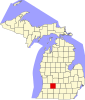 | |
| Villages | ||
|
Charter townships | ||
|
Civil townships | ||
| CDPs | ||
|
Other communities | ||
Dowling, Michigan | |
|---|---|
Dowling | |
| Coordinates: 42°31′21″N 85°15′11″W / 42.52250°N 85.25306°W | |
| Country | United States |
| State | Michigan |
| County | Barry |
| Township | Baltimore |
| Area | |
| • Total | 6.29 sq mi (16.28 km2) |
| • Land | 6.08 sq mi (15.75 km2) |
| • Water | 0.20 sq mi (0.53 km2) |
| Elevation | 952 ft (290 m) |
| Population (
2020) | |
| • Total | 351 |
| • Density | 57.72/sq mi (22.29/km2) |
| Time zone | UTC-5 ( Eastern (EST)) |
| • Summer ( DST) | UTC-4 (EDT) |
| ZIP code | 49050 |
| Area code | 269 |
| FIPS code | 26-22900 |
| GNIS feature ID | 0624850 |
Dowling is a census-designated place (CDP) in Baltimore Township in Barry County, Michigan, United States. The population was 351 at the 2020 census. [2]
History
The settlement was informally named "Baltimore" as early as 1842 in memory of the home of prominent settlers. A post office named Baltimore was established in May 1850. The name was changed to Dowling in March 1880. [3]
Geography
This section needs additional citations for
verification. (December 2020) |
Dowling is located southeast of the center of Barry County. The center of town is located at the intersection of state highway M-37 and East Dowling Road. M-37 leads north 9 miles (14 km) to Hastings, the Barry County seat, and south 16 miles (26 km) to downtown Battle Creek.
The Baltimore Township office is located 1 mile (1.6 km) east of the center of Dowling. The southern edge of the CDP is the border with Johnstown Township.
According to the United States Census Bureau, the Dowling CDP has a total area of 6.3 square miles (16.3 km2), of which 6.1 square miles (15.7 km2) is land and 2.0 square miles (5.2 km2), or 3.21%, is water, [4] consisting of the northern half of Clear Lake.
Demographics
| Census | Pop. | Note | %± |
|---|---|---|---|
| 2020 | 351 | — | |
| U.S. Decennial Census [5] | |||
References
- ^ "2020 U.S. Gazetteer Files". United States Census Bureau. Retrieved May 21, 2022.
- ^ "Dowling CPD, Michigan - Census Bureau Profile". United States Census Bureau. Retrieved February 26, 2024.
- ^ Romig, Walter (1986) [1973]. Michigan Place Names. Detroit, Michigan: Wayne State University Press. ISBN 0-8143-1838-X.
- ^ "Geographic Identifiers: 2010 Demographic Profile Data (G001): Dowling CDP, Michigan". U.S. Census Bureau, American Factfinder. Archived from the original on February 12, 2020. Retrieved December 23, 2013.
- ^ "Census of Population and Housing". Census.gov. Retrieved June 4, 2016.
External links
Municipalities and communities of
Barry County, Michigan, United States | ||
|---|---|---|
| City | | |
| Villages | ||
|
Charter townships | ||
|
Civil townships | ||
| CDPs | ||
|
Other communities | ||