This article needs additional citations for
verification. (January 2019) |
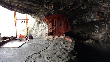
Dhak Bahiri is a cave in the Sahyadri hill range, situated near the village Jambhivli off village-Malavali in the Pune district of India. It was used by pilgrims and sages for the pilgrimage to the god Bahiri.[ citation needed]
The nearest col to the cave sits at the end of a 1-hour hike along a trail leading out of Jambhivli. From there, the terrain rises into the Dhak and Kalakrai peak. Reaching the cave requires ascending the col and walking along the scarp, followed by a 30' vertical ascent.
Water from the rock face drains into a cistern in the cave. There is room inside for 15 - 20 people to camp overnight. The local village maintains a supply of utensils and cookware on hand for use by campers. [1]

-
 Dhak fort
 -
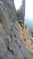 The cole between Dhak and kalakrai pinnacle
 -
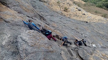 The vertical climb
 -
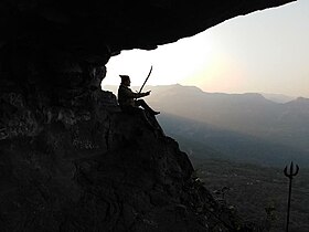
 The Bahiri cave
 -
 Water cistern in the cave
 -
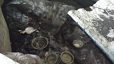 The utensils dipped in water
 -
 Dhak fort and the pinnacle
 -
 JAI SHIVRAI


- ^ "Dhak-Bahiri fort wadhap | forts in raigad | kokan | trekking". www.kokansearch.com.
18°52′29.6″N 73°25′42″E / 18.874889°N 73.42833°E
|
| This article about a location in Pune district is a stub. You can help Wikipedia by expanding it. |
This article needs additional citations for
verification. (January 2019) |
Dhak Bahiri is a cave in the Sahyadri hill range, situated near the village Jambhivli off village-Malavali in the Pune district of India. It was used by pilgrims and sages for the pilgrimage to the god Bahiri.[ citation needed]
The nearest col to the cave sits at the end of a 1-hour hike along a trail leading out of Jambhivli. From there, the terrain rises into the Dhak and Kalakrai peak. Reaching the cave requires ascending the col and walking along the scarp, followed by a 30' vertical ascent.
Water from the rock face drains into a cistern in the cave. There is room inside for 15 - 20 people to camp overnight. The local village maintains a supply of utensils and cookware on hand for use by campers. [1]
-
Dhak fort
-
The cole between Dhak and kalakrai pinnacle
-
The vertical climb
-
The Bahiri cave
-
Water cistern in the cave
-
The utensils dipped in water
-
Dhak fort and the pinnacle
-
JAI SHIVRAI
- ^ "Dhak-Bahiri fort wadhap | forts in raigad | kokan | trekking". www.kokansearch.com.
18°52′29.6″N 73°25′42″E / 18.874889°N 73.42833°E
|
| This article about a location in Pune district is a stub. You can help Wikipedia by expanding it. |