Photos • Location
Denis Island Airport | |||||||||||
|---|---|---|---|---|---|---|---|---|---|---|---|
 | |||||||||||
| Summary | |||||||||||
| Airport type | Private | ||||||||||
| Serves | Denis Island, Seychelles | ||||||||||
| Elevation AMSL | 10 ft / 3 m | ||||||||||
| Coordinates | 03°48′05″S 55°40′00″E / 3.80139°S 55.66667°E | ||||||||||
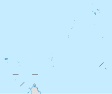
| Map | |||||||||||
| Runways | |||||||||||
| |||||||||||
Denis Island Airport ( IATA: DEI, ICAO: FSSD) is an airstrip serving Denis Island in the Seychelles.
The island is 94 kilometres (58 mi) north of Victoria, the capital of the Seychelles.
| Airlines | Destinations |
|---|---|
| Air Seychelles | Charter: Mahé |
- ^ Airport information for DEI at Great Circle Mapper.
- ^ Google Maps - Denis Island
- OpenStreetMap - Denis Island
- OurAirports - Denis Island
- FallingRain - Denis Island Airport
- Accident history for Denis Island Airport at Aviation Safety Network
Denis Island Airport | |||||||||||
|---|---|---|---|---|---|---|---|---|---|---|---|
 | |||||||||||
| Summary | |||||||||||
| Airport type | Private | ||||||||||
| Serves | Denis Island, Seychelles | ||||||||||
| Elevation AMSL | 10 ft / 3 m | ||||||||||
| Coordinates | 03°48′05″S 55°40′00″E / 3.80139°S 55.66667°E | ||||||||||
| Map | |||||||||||
| Runways | |||||||||||
| |||||||||||
Denis Island Airport ( IATA: DEI, ICAO: FSSD) is an airstrip serving Denis Island in the Seychelles.
The island is 94 kilometres (58 mi) north of Victoria, the capital of the Seychelles.
| Airlines | Destinations |
|---|---|
| Air Seychelles | Charter: Mahé |
- ^ Airport information for DEI at Great Circle Mapper.
- ^ Google Maps - Denis Island
- OpenStreetMap - Denis Island
- OurAirports - Denis Island
- FallingRain - Denis Island Airport
- Accident history for Denis Island Airport at Aviation Safety Network
