Den Ham | |
|---|---|
,_RP-T-1890-A-2298.jpg) Drawing of Den Ham (1761–1828) | |
 Flag  Coat of arms | |
 Den Ham Location in the Netherlands  Den Ham Den Ham (Netherlands) | |
| Coordinates: 52°27′54″N 6°29′39″E / 52.46500°N 6.49417°E | |
| Country | Netherlands |
| Province | Overijssel |
| Municipality | Twenterand |
| Area | |
| • Total | 26.98 km2 (10.42 sq mi) |
| Elevation | 7 m (23 ft) |
| Population (2021)
[1] | |
| • Total | 5,830 |
| • Density | 220/km2 (560/sq mi) |
| Time zone | UTC+1 ( CET) |
| • Summer ( DST) | UTC+2 ( CEST) |
| Postal code | 7683
[1] |
| Dialing code | 0546 |
Den Ham [dɛn ɦɑm] is a village in the Dutch province of Overijssel. It is located in the municipality of Twenterand, about 15 km northwest of Almelo.
Den Ham was a separate municipality until 2001, when it became a part of Vriezenveen. It was subsequently renamed Twenterand in 2002. [3]
Den Ham is an esdorp which was first mentioned in 1333. During the Dutch Revolt it was under frequent attack. [4] In 1840, it was home to 748 people. [5] It the mid-19th century, it was surpassed by Vroomshoop which had better connections to the outside world. In 1914, the dairy factory De Eensgezindheid opened in Den Ham. [4]
-
 Den Ham, reformed church
 -
 Former town hall (1966)
 -
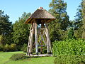 Bell tower
 -
 Dairy factory in Den Ham


- ^ a b c "Kerncijfers wijken en buurten 2021". Central Bureau of Statistics. Retrieved 18 March 2022.
- ^ "Postcodetool for 7683AA". Actueel Hoogtebestand Nederland (in Dutch). Het Waterschapshuis. Retrieved 18 March 2022.
- ^ Ad van der Meer and Onno Boonstra, Repertorium van Nederlandse gemeenten, KNAW, 2011.
- ^ a b Ronald Stenvert & Jan ten Hove (1998). "Den Ham" (in Dutch). Zwolle: Waanders. p. 91. ISBN 90 400 9200 1. Retrieved 18 March 2022.
- ^ "Den Ham". Plaatsengids (in Dutch). Retrieved 18 March 2022.
| National | |
|---|---|
| Geographic | |
|
| This Overijssel location article is a stub. You can help Wikipedia by expanding it. |
Den Ham | |
|---|---|
|
Drawing of Den Ham (1761–1828) | |
|
Flag Coat of arms | |
Den Ham Location in the Netherlands Den Ham Den Ham (Netherlands) | |
| Coordinates: 52°27′54″N 6°29′39″E / 52.46500°N 6.49417°E | |
| Country | Netherlands |
| Province | Overijssel |
| Municipality | Twenterand |
| Area | |
| • Total | 26.98 km2 (10.42 sq mi) |
| Elevation | 7 m (23 ft) |
| Population (2021)
[1] | |
| • Total | 5,830 |
| • Density | 220/km2 (560/sq mi) |
| Time zone | UTC+1 ( CET) |
| • Summer ( DST) | UTC+2 ( CEST) |
| Postal code | 7683
[1] |
| Dialing code | 0546 |
Den Ham [dɛn ɦɑm] is a village in the Dutch province of Overijssel. It is located in the municipality of Twenterand, about 15 km northwest of Almelo.
Den Ham was a separate municipality until 2001, when it became a part of Vriezenveen. It was subsequently renamed Twenterand in 2002. [3]
Den Ham is an esdorp which was first mentioned in 1333. During the Dutch Revolt it was under frequent attack. [4] In 1840, it was home to 748 people. [5] It the mid-19th century, it was surpassed by Vroomshoop which had better connections to the outside world. In 1914, the dairy factory De Eensgezindheid opened in Den Ham. [4]
-
Den Ham, reformed church
-
Former town hall (1966)
-
Bell tower
-
Dairy factory in Den Ham
- ^ a b c "Kerncijfers wijken en buurten 2021". Central Bureau of Statistics. Retrieved 18 March 2022.
- ^ "Postcodetool for 7683AA". Actueel Hoogtebestand Nederland (in Dutch). Het Waterschapshuis. Retrieved 18 March 2022.
- ^ Ad van der Meer and Onno Boonstra, Repertorium van Nederlandse gemeenten, KNAW, 2011.
- ^ a b Ronald Stenvert & Jan ten Hove (1998). "Den Ham" (in Dutch). Zwolle: Waanders. p. 91. ISBN 90 400 9200 1. Retrieved 18 March 2022.
- ^ "Den Ham". Plaatsengids (in Dutch). Retrieved 18 March 2022.
| National | |
|---|---|
| Geographic | |
|
| This Overijssel location article is a stub. You can help Wikipedia by expanding it. |