Delta | |
|---|---|
 Location of Delta in Clay County, Alabama. | |
| Coordinates: 33°26′24″N 85°41′26″W / 33.44000°N 85.69056°W | |
| Country | United States |
| State | Alabama |
| County | Clay |
| Area | |
| • Total | 7.89 sq mi (20.44 km2) |
| • Land | 7.79 sq mi (20.17 km2) |
| • Water | 0.10 sq mi (0.27 km2) |
| Elevation | 1,109 ft (338 m) |
| Population (
2020) | |
| • Total | 260 |
| • Density | 33.39/sq mi (12.89/km2) |
| Time zone | UTC-6 ( CST) |
| • Summer ( DST) | UTC-5 (CDT) |
| Area code(s) | 256 & 938 |
| GNIS feature ID | 159494 [2] |
Delta is a census-designated place and unincorporated community in Clay County, Alabama, United States. Its population was 260 as of the 2020 census.
Geography
Climate
The climate in Delta is characterized by hot, humid summers and generally mild to cool winters. According to the Köppen Climate Classification system, this area has a humid subtropical climate, abbreviated "Cfa" on climate maps. [3]
| Month | Jan | Feb | Mar | Apr | May | Jun | Jul | Aug | Sep | Oct | Nov | Dec | Year |
|---|---|---|---|---|---|---|---|---|---|---|---|---|---|
| Mean daily maximum °F (°C) | 57 (14) |
60 (16) |
69 (21) |
77 (25) |
82 (28) |
90 (32) |
91 (33) |
91 (33) |
86 (30) |
76 (24) |
66 (19) |
59 (15) |
75 (24) |
| Daily mean °F (°C) | 44 (7) |
47 (8) |
55 (13) |
63 (17) |
70 (21) |
77 (25) |
79 (26) |
79 (26) |
74 (23) |
63 (17) |
52 (11) |
47 (8) |
63 (17) |
| Mean daily minimum °F (°C) | 34 (1) |
36 (2) |
44 (7) |
51 (11) |
59 (15) |
67 (19) |
70 (21) |
70 (21) |
64 (18) |
52 (11) |
41 (5) |
38 (3) |
52 (11) |
| Average precipitation inches (mm) | 6.2 (160) |
4.9 (120) |
7 (180) |
5.2 (130) |
4.1 (100) |
4.1 (100) |
5.2 (130) |
3.1 (79) |
4.2 (110) |
3.4 (86) |
3.8 (97) |
5.3 (130) |
56.5 (1,422) |
| Average precipitation days | 10 | 9 | 10 | 8 | 7 | 9 | 11 | 8 | 7 | 6 | 7 | 10 | 102 |
| Mean daily daylight hours | 10.7 | 11.5 | 12.4 | 13.5 | 14.4 | 14.8 | 14.6 | 13.8 | 12.8 | 11.7 | 10.9 | 10.4 | 12.6 |
| Source 1: AreaVibes [4] | |||||||||||||
| Source 2: Weatherbase [5] | |||||||||||||
Demographics
| Census | Pop. | Note | %± |
|---|---|---|---|
| 2020 | 260 | — | |
| U.S. Decennial Census [6] | |||
Notable people
- LaFayette L. Patterson, United States Representative born in Delta [7]
References
- ^ "2020 U.S. Gazetteer Files". United States Census Bureau. Retrieved October 29, 2021.
- ^ "Delta". Geographic Names Information System. United States Geological Survey, United States Department of the Interior.
- ^ Climate Summary for Delta, Alabama
- ^ "Delta, AL Weather". AreaVibes. Archived from the original on March 3, 2021. Retrieved June 10, 2021.
- ^ "Delta, Alabama Travel Weather Averages". Weatherbase. Archived from the original on September 15, 2015. Retrieved June 10, 2021.
- ^ "Census of Population and Housing". Census.gov. Retrieved June 4, 2016.
- ^ "Patterson, LaFayette Lee". Biographical Directory of the United States Congress. United States Congress. Retrieved January 17, 2012.
Municipalities and communities of
Clay County, Alabama, United States | ||
|---|---|---|
| City | 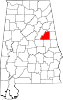 | |
| Town | ||
| CDPs | ||
|
Unincorporated communities | ||
|
| This Clay County, Alabama state location article is a stub. You can help Wikipedia by expanding it. |
Delta | |
|---|---|
|
Location of Delta in Clay County, Alabama. | |
| Coordinates: 33°26′24″N 85°41′26″W / 33.44000°N 85.69056°W | |
| Country | United States |
| State | Alabama |
| County | Clay |
| Area | |
| • Total | 7.89 sq mi (20.44 km2) |
| • Land | 7.79 sq mi (20.17 km2) |
| • Water | 0.10 sq mi (0.27 km2) |
| Elevation | 1,109 ft (338 m) |
| Population (
2020) | |
| • Total | 260 |
| • Density | 33.39/sq mi (12.89/km2) |
| Time zone | UTC-6 ( CST) |
| • Summer ( DST) | UTC-5 (CDT) |
| Area code(s) | 256 & 938 |
| GNIS feature ID | 159494 [2] |
Delta is a census-designated place and unincorporated community in Clay County, Alabama, United States. Its population was 260 as of the 2020 census.
Geography
Climate
The climate in Delta is characterized by hot, humid summers and generally mild to cool winters. According to the Köppen Climate Classification system, this area has a humid subtropical climate, abbreviated "Cfa" on climate maps. [3]
| Month | Jan | Feb | Mar | Apr | May | Jun | Jul | Aug | Sep | Oct | Nov | Dec | Year |
|---|---|---|---|---|---|---|---|---|---|---|---|---|---|
| Mean daily maximum °F (°C) | 57 (14) |
60 (16) |
69 (21) |
77 (25) |
82 (28) |
90 (32) |
91 (33) |
91 (33) |
86 (30) |
76 (24) |
66 (19) |
59 (15) |
75 (24) |
| Daily mean °F (°C) | 44 (7) |
47 (8) |
55 (13) |
63 (17) |
70 (21) |
77 (25) |
79 (26) |
79 (26) |
74 (23) |
63 (17) |
52 (11) |
47 (8) |
63 (17) |
| Mean daily minimum °F (°C) | 34 (1) |
36 (2) |
44 (7) |
51 (11) |
59 (15) |
67 (19) |
70 (21) |
70 (21) |
64 (18) |
52 (11) |
41 (5) |
38 (3) |
52 (11) |
| Average precipitation inches (mm) | 6.2 (160) |
4.9 (120) |
7 (180) |
5.2 (130) |
4.1 (100) |
4.1 (100) |
5.2 (130) |
3.1 (79) |
4.2 (110) |
3.4 (86) |
3.8 (97) |
5.3 (130) |
56.5 (1,422) |
| Average precipitation days | 10 | 9 | 10 | 8 | 7 | 9 | 11 | 8 | 7 | 6 | 7 | 10 | 102 |
| Mean daily daylight hours | 10.7 | 11.5 | 12.4 | 13.5 | 14.4 | 14.8 | 14.6 | 13.8 | 12.8 | 11.7 | 10.9 | 10.4 | 12.6 |
| Source 1: AreaVibes [4] | |||||||||||||
| Source 2: Weatherbase [5] | |||||||||||||
Demographics
| Census | Pop. | Note | %± |
|---|---|---|---|
| 2020 | 260 | — | |
| U.S. Decennial Census [6] | |||
Notable people
- LaFayette L. Patterson, United States Representative born in Delta [7]
References
- ^ "2020 U.S. Gazetteer Files". United States Census Bureau. Retrieved October 29, 2021.
- ^ "Delta". Geographic Names Information System. United States Geological Survey, United States Department of the Interior.
- ^ Climate Summary for Delta, Alabama
- ^ "Delta, AL Weather". AreaVibes. Archived from the original on March 3, 2021. Retrieved June 10, 2021.
- ^ "Delta, Alabama Travel Weather Averages". Weatherbase. Archived from the original on September 15, 2015. Retrieved June 10, 2021.
- ^ "Census of Population and Housing". Census.gov. Retrieved June 4, 2016.
- ^ "Patterson, LaFayette Lee". Biographical Directory of the United States Congress. United States Congress. Retrieved January 17, 2012.
Municipalities and communities of
Clay County, Alabama, United States | ||
|---|---|---|
| City | | |
| Town | ||
| CDPs | ||
|
Unincorporated communities | ||
|
| This Clay County, Alabama state location article is a stub. You can help Wikipedia by expanding it. |