Photos • Location
This article needs additional citations for
verification. (January 2024) |
| Dantakali Temple | |
|---|---|
 Front view of Dantakali Temple | |
| Religion | |
| Affiliation | Hinduism |
| District | Sunsari |
| Deity | Satidevi |
| Festivals | Navaratri, Dashain |
| Location | |
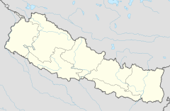
| Location | Dharan |
| State | Koshi |
| Country | Nepal |
| Geographic coordinates | 26°49′07″N 87°17′27″E / 26.8186°N 87.2909°E |
| Architecture | |
| Type | Pagoda |
| Elevation | 479.1456 m (1,572 ft) |
Dantakali Temple is a Hindu temple situated in the mountains of Bijayapur in Dharan, Nepal. Dantakali is named for the teeth of the goddess Satidevi. [1] Danta means teeth and Kali is a Hindu goddess.
- ^ "Dantakali Temple". khojnu.com. Retrieved 3 January 2024.
This article needs additional citations for
verification. (January 2024) |
| Dantakali Temple | |
|---|---|
 Front view of Dantakali Temple | |
| Religion | |
| Affiliation | Hinduism |
| District | Sunsari |
| Deity | Satidevi |
| Festivals | Navaratri, Dashain |
| Location | |
| Location | Dharan |
| State | Koshi |
| Country | Nepal |
| Geographic coordinates | 26°49′07″N 87°17′27″E / 26.8186°N 87.2909°E |
| Architecture | |
| Type | Pagoda |
| Elevation | 479.1456 m (1,572 ft) |
Dantakali Temple is a Hindu temple situated in the mountains of Bijayapur in Dharan, Nepal. Dantakali is named for the teeth of the goddess Satidevi. [1] Danta means teeth and Kali is a Hindu goddess.
- ^ "Dantakali Temple". khojnu.com. Retrieved 3 January 2024.

