You can help expand this article with text translated from
the corresponding article in French. (December 2009) Click [show] for important translation instructions.
|
Creys-Mépieu | |
|---|---|
 The church of Creys | |
 Creys-Mépieu  Creys-Mépieu | |
| Coordinates: 45°43′45″N 5°29′18″E / 45.7292°N 5.4883°E | |
| Country | France |
| Region | Auvergne-Rhône-Alpes |
| Department | Isère |
| Arrondissement | La Tour-du-Pin |
| Canton | Morestel |
| Government | |
| • Mayor (2020–2026) | Olivier Bonnard [1] |
| Area 1 | 28.99 km2 (11.19 sq mi) |
| Population (2021)
[2] | 1,538 |
| • Density | 53/km2 (140/sq mi) |
| Time zone | UTC+01:00 ( CET) |
| • Summer ( DST) | UTC+02:00 ( CEST) |
| INSEE/Postal code |
38139 /38510 |
| Elevation | 200–343 m (656–1,125 ft) (avg. 260 m or 850 ft) |
| 1 French Land Register data, which excludes lakes, ponds, glaciers > 1 km2 (0.386 sq mi or 247 acres) and river estuaries. | |
Creys-Mépieu (French pronunciation: [kʁɛ mepjø]) is a commune in the Isère department in southeastern France.
Created by prefectural decree of August 11, 1994, Creys-Mépieu was made from the fusion of the communes of Creys-Pusignieu and Mépieu which had been associated since September 29, 1989.
-
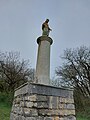 The statue dedicated to Mary, in Creys.
 -
 Creys.
 -
 The castle of Mépieu.


| Year | Pop. | ±% p.a. |
|---|---|---|
| 1968 | 631 | — |
| 1975 | 596 | −0.81% |
| 1982 | 960 | +7.05% |
| 1990 | 959 | −0.01% |
| 1999 | 1,091 | +1.44% |
| 2007 | 1,323 | +2.44% |
| 2012 | 1,512 | +2.71% |
| 2017 | 1,503 | −0.12% |
| Source: INSEE [3] | ||
- ^ "Répertoire national des élus: les maires". data.gouv.fr, Plateforme ouverte des données publiques françaises (in French). 2 December 2020.
- ^ "Populations légales 2021" (in French). The National Institute of Statistics and Economic Studies. 28 December 2023.
- ^ Population en historique depuis 1968, INSEE
|
| This Isère geographical article is a stub. You can help Wikipedia by expanding it. |
You can help expand this article with text translated from
the corresponding article in French. (December 2009) Click [show] for important translation instructions.
|
Creys-Mépieu | |
|---|---|
|
The church of Creys | |
Creys-Mépieu Creys-Mépieu | |
| Coordinates: 45°43′45″N 5°29′18″E / 45.7292°N 5.4883°E | |
| Country | France |
| Region | Auvergne-Rhône-Alpes |
| Department | Isère |
| Arrondissement | La Tour-du-Pin |
| Canton | Morestel |
| Government | |
| • Mayor (2020–2026) | Olivier Bonnard [1] |
| Area 1 | 28.99 km2 (11.19 sq mi) |
| Population (2021)
[2] | 1,538 |
| • Density | 53/km2 (140/sq mi) |
| Time zone | UTC+01:00 ( CET) |
| • Summer ( DST) | UTC+02:00 ( CEST) |
| INSEE/Postal code |
38139 /38510 |
| Elevation | 200–343 m (656–1,125 ft) (avg. 260 m or 850 ft) |
| 1 French Land Register data, which excludes lakes, ponds, glaciers > 1 km2 (0.386 sq mi or 247 acres) and river estuaries. | |
Creys-Mépieu (French pronunciation: [kʁɛ mepjø]) is a commune in the Isère department in southeastern France.
Created by prefectural decree of August 11, 1994, Creys-Mépieu was made from the fusion of the communes of Creys-Pusignieu and Mépieu which had been associated since September 29, 1989.
-
The statue dedicated to Mary, in Creys.
-
Creys.
-
The castle of Mépieu.
| Year | Pop. | ±% p.a. |
|---|---|---|
| 1968 | 631 | — |
| 1975 | 596 | −0.81% |
| 1982 | 960 | +7.05% |
| 1990 | 959 | −0.01% |
| 1999 | 1,091 | +1.44% |
| 2007 | 1,323 | +2.44% |
| 2012 | 1,512 | +2.71% |
| 2017 | 1,503 | −0.12% |
| Source: INSEE [3] | ||
- ^ "Répertoire national des élus: les maires". data.gouv.fr, Plateforme ouverte des données publiques françaises (in French). 2 December 2020.
- ^ "Populations légales 2021" (in French). The National Institute of Statistics and Economic Studies. 28 December 2023.
- ^ Population en historique depuis 1968, INSEE
|
| This Isère geographical article is a stub. You can help Wikipedia by expanding it. |