Country Acres, Texas | |
|---|---|
| Coordinates: 27°55′30″N 97°9′58″W / 27.92500°N 97.16611°W | |
| Country | United States |
| State | Texas |
| County | San Patricio |
| Area | |
| • Total | 0.1 sq mi (0.3 km2) |
| • Land | 0.1 sq mi (0.3 km2) |
| • Water | 0.0 sq mi (0 km2) |
| Population (
2010) | |
| • Total | 185 |
| • Density | 1,900/sq mi (710/km2) |
| Time zone | UTC-6 ( Central (CST)) |
| • Summer ( DST) | UTC-5 (CDT) |
| Zip Code | 78336 |
Country Acres is a census-designated place (CDP) in San Patricio County, Texas, United States. The population was 185 at the 2010 census. Prior to the 2010 census, Country Acres was part of the Falman-County Acres CDP. [1]
Geography
Country Acres is located at 27°55′30″N 97°9′58″W / 27.92500°N 97.16611°W (27.925064, -97.166012). [2]
Demographics
| Census | Pop. | Note | %± |
|---|---|---|---|
| 2010 | 185 | — | |
| U.S. Decennial Census
[3] 1850–1900 [4] 1910 [5] 1920 [6] 1930 [7] 1940 [8] 1950 [9] 1960 [10] 1970 [11] 1980 [12] 1990 [13] 2000 [14] 2010 [15] | |||
Education
The CDP is part of the Aransas Pass Independent School District. [16]
References
- ^ "Population and Housing Unit Counts, 2010 Census of Population and Housing" (PDF). Texas: 2010.
- ^ "Country Acres, Texas :: Boundary Map of Country Acres, Texas". Archived from the original on December 20, 2016. Retrieved December 17, 2016.
- ^ "Decennial Census by Decade". United States Census Bureau.
- ^ "1900 Census of Population - Population of Texas By Counties And Minor Civil Divisions" (PDF). United States Census Bureau.
- ^ "1910 Census of Population - Supplement for Texas" (PDF). United States Census Bureau.
- ^ "1920 Census of Population - Number of Inhabitants - Texas" (PDF). United States Census Bureau.
- ^ "1930 Census of Population - Number of Inhabitants - Texas" (PDF). United States Census Bureau.
- ^ "1940 Census of Population - Number of Inhabitants - Texas" (PDF). United States Census Bureau.
- ^ "1950 Census of Population - Number of Inhabitants - Texas" (PDF). United States Census Bureau.
- ^ "1960 Census of Population - Number of Inhabitants - Texas" (PDF). United States Census Bureau.
- ^ "1970 Census of Population - Number of Inhabitants - Texas" (PDF). United States Census Bureau.
- ^ "1980 Census of Population - Number of Inhabitants - Texas" (PDF). United States Census Bureau.
- ^ "1990 Census of Population - Population and Housing Unit Counts - Texas" (PDF). United States Census Bureau.
- ^ "2000 Census of Population - Population and Housing Unit Counts - Texas" (PDF). United States Census Bureau.
- ^ "2010 Census of Population - Population and Housing Unit Counts - Texas" (PDF). United States Census Bureau.
- ^ "2020 CENSUS - SCHOOL DISTRICT REFERENCE MAP: San Patricio County, TX" (PDF). U.S. Census Bureau. Retrieved June 28, 2022.
Municipalities and communities of
San Patricio County, Texas, United States | ||
|---|---|---|
| Cities | 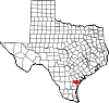 | |
| Towns | ||
| CDPs | ||
| Unincorporated community | ||
| Footnotes | ‡This populated place also has portions in an adjacent county or counties | |
 | This article about a location in San Patricio County, Texas is a stub. You can help Wikipedia by expanding it. |
Country Acres, Texas | |
|---|---|
| Coordinates: 27°55′30″N 97°9′58″W / 27.92500°N 97.16611°W | |
| Country | United States |
| State | Texas |
| County | San Patricio |
| Area | |
| • Total | 0.1 sq mi (0.3 km2) |
| • Land | 0.1 sq mi (0.3 km2) |
| • Water | 0.0 sq mi (0 km2) |
| Population (
2010) | |
| • Total | 185 |
| • Density | 1,900/sq mi (710/km2) |
| Time zone | UTC-6 ( Central (CST)) |
| • Summer ( DST) | UTC-5 (CDT) |
| Zip Code | 78336 |
Country Acres is a census-designated place (CDP) in San Patricio County, Texas, United States. The population was 185 at the 2010 census. Prior to the 2010 census, Country Acres was part of the Falman-County Acres CDP. [1]
Geography
Country Acres is located at 27°55′30″N 97°9′58″W / 27.92500°N 97.16611°W (27.925064, -97.166012). [2]
Demographics
| Census | Pop. | Note | %± |
|---|---|---|---|
| 2010 | 185 | — | |
| U.S. Decennial Census
[3] 1850–1900 [4] 1910 [5] 1920 [6] 1930 [7] 1940 [8] 1950 [9] 1960 [10] 1970 [11] 1980 [12] 1990 [13] 2000 [14] 2010 [15] | |||
Education
The CDP is part of the Aransas Pass Independent School District. [16]
References
- ^ "Population and Housing Unit Counts, 2010 Census of Population and Housing" (PDF). Texas: 2010.
- ^ "Country Acres, Texas :: Boundary Map of Country Acres, Texas". Archived from the original on December 20, 2016. Retrieved December 17, 2016.
- ^ "Decennial Census by Decade". United States Census Bureau.
- ^ "1900 Census of Population - Population of Texas By Counties And Minor Civil Divisions" (PDF). United States Census Bureau.
- ^ "1910 Census of Population - Supplement for Texas" (PDF). United States Census Bureau.
- ^ "1920 Census of Population - Number of Inhabitants - Texas" (PDF). United States Census Bureau.
- ^ "1930 Census of Population - Number of Inhabitants - Texas" (PDF). United States Census Bureau.
- ^ "1940 Census of Population - Number of Inhabitants - Texas" (PDF). United States Census Bureau.
- ^ "1950 Census of Population - Number of Inhabitants - Texas" (PDF). United States Census Bureau.
- ^ "1960 Census of Population - Number of Inhabitants - Texas" (PDF). United States Census Bureau.
- ^ "1970 Census of Population - Number of Inhabitants - Texas" (PDF). United States Census Bureau.
- ^ "1980 Census of Population - Number of Inhabitants - Texas" (PDF). United States Census Bureau.
- ^ "1990 Census of Population - Population and Housing Unit Counts - Texas" (PDF). United States Census Bureau.
- ^ "2000 Census of Population - Population and Housing Unit Counts - Texas" (PDF). United States Census Bureau.
- ^ "2010 Census of Population - Population and Housing Unit Counts - Texas" (PDF). United States Census Bureau.
- ^ "2020 CENSUS - SCHOOL DISTRICT REFERENCE MAP: San Patricio County, TX" (PDF). U.S. Census Bureau. Retrieved June 28, 2022.
Municipalities and communities of
San Patricio County, Texas, United States | ||
|---|---|---|
| Cities | | |
| Towns | ||
| CDPs | ||
| Unincorporated community | ||
| Footnotes | ‡This populated place also has portions in an adjacent county or counties | |
|
| This article about a location in San Patricio County, Texas is a stub. You can help Wikipedia by expanding it. |