| Costislost | |
|---|---|
 The entrance to Costislost | |
| Location | Egloshayle, Cornwall, England |
| Coordinates | 50°29′54″N 4°46′55″W / 50.4984°N 4.7819°W |
Listed Building – Grade II | |
| Official name | Costilost [sic] Farmhouse |
| Designated | 4 November 1988 |
| Reference no. | 1311181 |
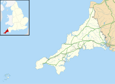
Costislost is a Grade II listed house in the parish of Egloshayle in Cornwall, England. [1] To the south are Costislost Plantations. It dates to probably the 17th century, and underwent remodelling in the 18th and 19th centuries. The property was a farmhouse for centuries [2] and belonged to the Lakeman family in the 19th century. [3]
Today it is run as an organic retreat and nutritional health centre. [4]
References
- ^ Ordnance Survey: Landranger map sheet 200 Newquay & Bodmin (Map). Ordnance Survey. ISBN 978-0-319-22938-5.
- ^ "Costislost Farmhouse". British Listed Buildings. Retrieved 9 December 2015.
- ^ Maclean, Sir John (1871). Parochial and Family History of the Parish of Egloshayle in the County of Cornwall. Nichols & Sons. p. 25.
- ^ "Costislost". Costislosthouse.co.uk. Retrieved 9 December 2015.
50°29′54″N 4°46′55″W / 50.4984°N 4.7819°W
| Costislost | |
|---|---|
 The entrance to Costislost | |
| Location | Egloshayle, Cornwall, England |
| Coordinates | 50°29′54″N 4°46′55″W / 50.4984°N 4.7819°W |
Listed Building – Grade II | |
| Official name | Costilost [sic] Farmhouse |
| Designated | 4 November 1988 |
| Reference no. | 1311181 |
Costislost is a Grade II listed house in the parish of Egloshayle in Cornwall, England. [1] To the south are Costislost Plantations. It dates to probably the 17th century, and underwent remodelling in the 18th and 19th centuries. The property was a farmhouse for centuries [2] and belonged to the Lakeman family in the 19th century. [3]
Today it is run as an organic retreat and nutritional health centre. [4]
References
- ^ Ordnance Survey: Landranger map sheet 200 Newquay & Bodmin (Map). Ordnance Survey. ISBN 978-0-319-22938-5.
- ^ "Costislost Farmhouse". British Listed Buildings. Retrieved 9 December 2015.
- ^ Maclean, Sir John (1871). Parochial and Family History of the Parish of Egloshayle in the County of Cornwall. Nichols & Sons. p. 25.
- ^ "Costislost". Costislosthouse.co.uk. Retrieved 9 December 2015.
50°29′54″N 4°46′55″W / 50.4984°N 4.7819°W
