Photos • Location
Consolação | |
|---|---|
Municipality | |
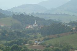
 View of Consolação, Minas Gerais | |
 Location in the
State of Minas Gerais | |
| Coordinates: 22°33′03″S 45°55′15″W / 22.55083°S 45.92083°W | |
| Country | |
| Region | Southeast |
| State | |
| Founded | December 30, 1962 |
| Area | |
| • Total | 85.936 km2 (33.180 sq mi) |
| Population (2020
[1]) | |
| • Total | 1,784 |
| • Density | 19.7/km2 (51/sq mi) |
| Time zone | UTC−3 ( BRT) |
| Postal Code | 37670-000 |
Consolação is a municipality in Minas Gerais, Brazil.
References
Consolação | |
|---|---|
Municipality | |
 View of Consolação, Minas Gerais | |
 Location in the
State of Minas Gerais | |
| Coordinates: 22°33′03″S 45°55′15″W / 22.55083°S 45.92083°W | |
| Country | |
| Region | Southeast |
| State | |
| Founded | December 30, 1962 |
| Area | |
| • Total | 85.936 km2 (33.180 sq mi) |
| Population (2020
[1]) | |
| • Total | 1,784 |
| • Density | 19.7/km2 (51/sq mi) |
| Time zone | UTC−3 ( BRT) |
| Postal Code | 37670-000 |
Consolação is a municipality in Minas Gerais, Brazil.

