Photos • Location
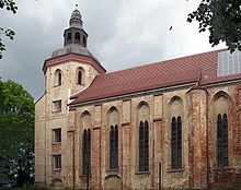
The former commandry church (now the Schlosskirche Mirow).


The Commandry of Mirow was a commandry of the Knights Hospitaller, based in Mirow, a town in Mecklenburg-Vorpommern. It existed from 1226 until 1648.
External links
| Authority control databases: Geographic |
|---|
53°16′36″N 12°48′35″E / 53.2767°N 12.8097°E
|
| This German history article is a stub. You can help Wikipedia by expanding it. |