A popular recreational destination, the gorge holds federally protected status as the Columbia River Gorge National Scenic Area and is managed by the Columbia River Gorge Commission and the
U.S. Forest Service.
Description
The Columbia River,
Klamath River in
northern California,
Pit River in northern California, and
Fraser River in southern
British Columbia are the only four rivers connecting the watersheds on the east side of the
Cascade Range to the
Pacific Ocean. Each river has carved out a gorge through the Cascades. The Columbia River Gorge marks the state line between Oregon and Washington, and its wide range of elevation and precipitation makes it an extremely diverse and dynamic place. Ranging from 4,000 feet (1,200 m) to sea level, and transitioning from 100 inches (2,500 mm) of precipitation to only 10 inches (250 mm) in 80 miles (130 km), the gorge provides the setting for a diverse collection of
ecosystems, from the
temperate rain forest on the western end—with an average annual precipitation of 75 to 100 inches (1,900 to 2,500 mm)—to the eastern grasslands with average annual precipitation between 10 and 15 inches (250 and 380 mm), to a transitional dry woodland between
Hood River and
The Dalles.[citation needed] Isolated
micro-habitats have allowed for many species of
endemic plants and animals to prosper, including at least 13 endemic wildflowers.
The gorge transitions between temperate rainforest to dry grasslands in only 80 miles (130 km), hosting a dramatic change in scenery while driving along
Interstate 84. In the western, temperate rainforest areas, forests are marked by
bigleaf maples,
Douglas fir, and
western hemlock, all covered in
epiphytes. In the transition zone (between Hood River and The Dalles), vegetation turns to
Oregon white oak,
ponderosa pine, and
cottonwood. At the eastern end, the forests make way for expansive
grasslands, with occasional pockets of
lodgepole and ponderosa pine.
Atmospheric pressure differentials east and west of the Cascades create a
wind tunnel effect in the deep cut of the gorge, generating 35-mile-per-hour (56 km/h) winds that make it a popular
windsurfing and
kiteboarding location. It also creates the right conditions for snow and ice storms during the winter months which also draw very cold east winds toward the mouth of the gorge on the west end.
Trails and day use sites are maintained by the
Forest Service and many Oregon and Washington
state parks.
Geology
The Columbia River Gorge began forming as far back as the
Miocene (roughly 17 to 12 million years ago), and continued to take shape through the
Pleistocene (2 million to 700,000 years ago). During this period the
Cascade Range was forming, which slowly moved the Columbia River's delta about 100 miles (160 km) north to its current location.[3]
Although the river slowly eroded the land over this period of time, the most drastic changes took place at the end of the
last ice age when the
Missoula Floods cut the steep, dramatic walls that exist today, flooding the river as high up as
Crown Point.[4] This quick erosion left many layers of
volcanic rock exposed.[3]
A view of the Columbia River Gorge from near the top of Mt. Hamilton, looking south from the
Washington side of the gorge. On the far left side of the image, the
Bonneville Dam is visible. On the left-center is the small town of
North Bonneville. Behind the hills in the center of the image, the peak of
Mt. Hood is just barely visible. The large rock at the river's edge on the right side is
Beacon Rock, which is 848 feet (258 m) tall. The high point to the right of center is
Nesmith Point, the highest point on the rim of the gorge at 3,848 feet (1,173 m).
Prior to the construction of the
Barlow Road, the only practical option for many immigrants to the
Willamette Valley along the
Oregon Trail was to convert their wagons into rafts at the Dalles. Many died or lost their possessions in the attempt to convey their wagons via rafts through the
Cascades Rapids.
The gorge has provided a transportation corridor for thousands of years.
Native Americans would travel through the gorge to trade at Celilo Falls, both along the river and over
Lolo Pass on the north side of
Mount Hood. In 1805, the route was used by the
Lewis and Clark Expedition to reach the Pacific.[6] Early European and American settlers subsequently established
steamboat lines and railroads through the gorge. Today, the
BNSF Railway runs freights along the Washington side of the river, while its rival, the
Union Pacific Railroad, runs freights along the Oregon shore. Until 1997, Amtrak's Pioneer also used the Union Pacific tracks. The Portland segment of the Empire Builder uses the BNSF tracks that pass through the gorge.
The
Columbia River Highway, built in the early 20th century, was the first major paved highway in the
Pacific Northwest. Shipping was greatly simplified after
Bonneville Dam and
The Dalles Dam submerged the gorge's major rapids such as Celilo Falls, a major salmon fishing site for local Native Americans until the site's submergence in 1957.
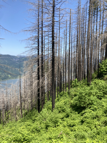
Trees damaged by the Eagle Creek Fire. New undergrowth is visible.
In November 1986,
Congress made the gorge the second
U.S. National Scenic Area and established the
Columbia River Gorge Commission as part of an
interstate compact.[7] The experimental designation came in lieu of being recognized as a
national park, which would require the existing industries in towns along the river to relocate. The designation was initially opposed by residents fearing government encroachment, due to restrictions in the plan for items such as building paint colors, and was also opposed by conservationists who feared additional development in the region.[8] In 2004, the gorge became the namesake of the
Columbia Gorge American Viticultural Area, a 4,432-acre (1,794 ha) area located on both sides of the river.
In fall 2017, the
Eagle Creek Fire burned in the gorge for three months, consuming almost 50,000 acres (78 sq mi; 200 km2). It reached 100% containment on November 30, 2017, but was not yet completely out.[9]
A popular recreational destination, the gorge holds federally protected status as the Columbia River Gorge National Scenic Area and is managed by the Columbia River Gorge Commission and the
U.S. Forest Service.
Description
The Columbia River,
Klamath River in
northern California,
Pit River in northern California, and
Fraser River in southern
British Columbia are the only four rivers connecting the watersheds on the east side of the
Cascade Range to the
Pacific Ocean. Each river has carved out a gorge through the Cascades. The Columbia River Gorge marks the state line between Oregon and Washington, and its wide range of elevation and precipitation makes it an extremely diverse and dynamic place. Ranging from 4,000 feet (1,200 m) to sea level, and transitioning from 100 inches (2,500 mm) of precipitation to only 10 inches (250 mm) in 80 miles (130 km), the gorge provides the setting for a diverse collection of
ecosystems, from the
temperate rain forest on the western end—with an average annual precipitation of 75 to 100 inches (1,900 to 2,500 mm)—to the eastern grasslands with average annual precipitation between 10 and 15 inches (250 and 380 mm), to a transitional dry woodland between
Hood River and
The Dalles.[citation needed] Isolated
micro-habitats have allowed for many species of
endemic plants and animals to prosper, including at least 13 endemic wildflowers.
The gorge transitions between temperate rainforest to dry grasslands in only 80 miles (130 km), hosting a dramatic change in scenery while driving along
Interstate 84. In the western, temperate rainforest areas, forests are marked by
bigleaf maples,
Douglas fir, and
western hemlock, all covered in
epiphytes. In the transition zone (between Hood River and The Dalles), vegetation turns to
Oregon white oak,
ponderosa pine, and
cottonwood. At the eastern end, the forests make way for expansive
grasslands, with occasional pockets of
lodgepole and ponderosa pine.
Atmospheric pressure differentials east and west of the Cascades create a
wind tunnel effect in the deep cut of the gorge, generating 35-mile-per-hour (56 km/h) winds that make it a popular
windsurfing and
kiteboarding location. It also creates the right conditions for snow and ice storms during the winter months which also draw very cold east winds toward the mouth of the gorge on the west end.
Trails and day use sites are maintained by the
Forest Service and many Oregon and Washington
state parks.
Geology
The Columbia River Gorge began forming as far back as the
Miocene (roughly 17 to 12 million years ago), and continued to take shape through the
Pleistocene (2 million to 700,000 years ago). During this period the
Cascade Range was forming, which slowly moved the Columbia River's delta about 100 miles (160 km) north to its current location.[3]
Although the river slowly eroded the land over this period of time, the most drastic changes took place at the end of the
last ice age when the
Missoula Floods cut the steep, dramatic walls that exist today, flooding the river as high up as
Crown Point.[4] This quick erosion left many layers of
volcanic rock exposed.[3]
A view of the Columbia River Gorge from near the top of Mt. Hamilton, looking south from the
Washington side of the gorge. On the far left side of the image, the
Bonneville Dam is visible. On the left-center is the small town of
North Bonneville. Behind the hills in the center of the image, the peak of
Mt. Hood is just barely visible. The large rock at the river's edge on the right side is
Beacon Rock, which is 848 feet (258 m) tall. The high point to the right of center is
Nesmith Point, the highest point on the rim of the gorge at 3,848 feet (1,173 m).
Prior to the construction of the
Barlow Road, the only practical option for many immigrants to the
Willamette Valley along the
Oregon Trail was to convert their wagons into rafts at the Dalles. Many died or lost their possessions in the attempt to convey their wagons via rafts through the
Cascades Rapids.
The gorge has provided a transportation corridor for thousands of years.
Native Americans would travel through the gorge to trade at Celilo Falls, both along the river and over
Lolo Pass on the north side of
Mount Hood. In 1805, the route was used by the
Lewis and Clark Expedition to reach the Pacific.[6] Early European and American settlers subsequently established
steamboat lines and railroads through the gorge. Today, the
BNSF Railway runs freights along the Washington side of the river, while its rival, the
Union Pacific Railroad, runs freights along the Oregon shore. Until 1997, Amtrak's Pioneer also used the Union Pacific tracks. The Portland segment of the Empire Builder uses the BNSF tracks that pass through the gorge.
The
Columbia River Highway, built in the early 20th century, was the first major paved highway in the
Pacific Northwest. Shipping was greatly simplified after
Bonneville Dam and
The Dalles Dam submerged the gorge's major rapids such as Celilo Falls, a major salmon fishing site for local Native Americans until the site's submergence in 1957.
Trees damaged by the Eagle Creek Fire. New undergrowth is visible.
In November 1986,
Congress made the gorge the second
U.S. National Scenic Area and established the
Columbia River Gorge Commission as part of an
interstate compact.[7] The experimental designation came in lieu of being recognized as a
national park, which would require the existing industries in towns along the river to relocate. The designation was initially opposed by residents fearing government encroachment, due to restrictions in the plan for items such as building paint colors, and was also opposed by conservationists who feared additional development in the region.[8] In 2004, the gorge became the namesake of the
Columbia Gorge American Viticultural Area, a 4,432-acre (1,794 ha) area located on both sides of the river.
In fall 2017, the
Eagle Creek Fire burned in the gorge for three months, consuming almost 50,000 acres (78 sq mi; 200 km2). It reached 100% containment on November 30, 2017, but was not yet completely out.[9]

 Crown Point in the Columbia River Gorge, looking upstream from Chanticleer Point
 Columbia River Gorge, photographed from the southern edge of the Gifford Pinchot National Forest
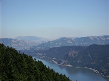 The view east towards The Dalles from Dog Mountain
 Native American petroglyphs in the Columbia River Gorge near The Dalles Dam
 Kitesurfing on the Columbia River
 View of Columbia River Gorge from Cape Horn Trail, looking east toward Beacon Rock
 Columbia River Gorge, photographed from Crown Point.
 Triple Falls
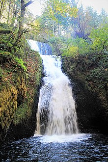
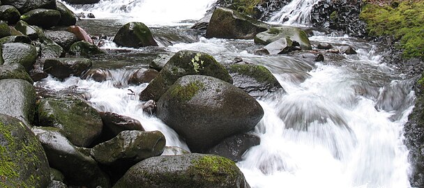 Oneonta Creek
 Horsethief Butte, near The Dalles
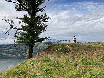 A couple overlooks the Columbia River Gorge from a viewpoint near Mosier, Oregon
 A view of the Oregon side of the Columbia River Gorge from Hamilton Mountain
 Columbia River Gorge with Mount Adams and Mount Saint Helens barely visible, seen from the Devils Rest Trail