Photos • Location
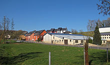
Buildings in Colpach-Haut, Luxembourg, along the main road

This article needs additional citations for
verification. (February 2024) |

Colpach-Haut ( Luxembourgish: Uewerkolpech, German: Obercolpach) is a village in the commune of Ell, in western Luxembourg. As of 2024 [update], the village has a population of 329. [1]
- ^ "Registre national des personnes physiques RNPP : Population par localité". data.public.lu. 2024-01-07.
49°46′N 5°49′E / 49.767°N 5.817°E
|
| This Luxembourg location article is a stub. You can help Wikipedia by expanding it. |
This article needs additional citations for
verification. (February 2024) |
Colpach-Haut ( Luxembourgish: Uewerkolpech, German: Obercolpach) is a village in the commune of Ell, in western Luxembourg. As of 2024 [update], the village has a population of 329. [1]
- ^ "Registre national des personnes physiques RNPP : Population par localité". data.public.lu. 2024-01-07.
49°46′N 5°49′E / 49.767°N 5.817°E
|
| This Luxembourg location article is a stub. You can help Wikipedia by expanding it. |