Coleanor, Alabama | |
|---|---|
 Coleanor, Alabama Location within the state of Alabama  Coleanor, Alabama Coleanor, Alabama (the United States) | |
| Coordinates: 33°05′44″N 87°02′09″W / 33.09556°N 87.03583°W | |
| Country | United States |
| State | Alabama |
| County | Bibb |
| Elevation | 489 ft (149 m) |
| Time zone | UTC-6 ( Central (CST)) |
| • Summer ( DST) | UTC-5 (CDT) |
| Area code(s) | 205, 659 |
| GNIS feature ID | 156200 [1] |
Coleanor, also known as Coal-Eleanor, is an unincorporated community in Bibb County, Alabama, United States.
History
The mine at Coleanor was originally known as the Upper Thompson Mine. [2] The Blocton-Cahaba Coal Company operated a coal mine at Coleanor. [3] Combined with nearby Piper, the two towns had a combined population of nearly 2,500. [4] Coleanor was connected by rail to Piper and was located on the Southern Railway. [5] The Coleanor Mine was closed after World War II.
In February 1934, members of the United Mine Workers called a strike at the Coleanor mine. [6] Alabama National Guard troops were called in to Coleanor on February 25 to restore order. [7]
Twelve different miners died working in the mines of Coleanor. [8]
A post office operated under the name Coleanor from 1901 to 1942. [9]
References
- ^ "Coleanor". Geographic Names Information System. United States Geological Survey, United States Department of the Interior.
- ^ Armes, Ethel (1972). The Story of Coal and Iron in Alabama. Birmingham: The Book-Keepers Press. p. 151.
- ^ Geological Survey of Alabama (1924). Bulletin - Geological Survey of Alabama. Geological Survey of Alabama. p. 48.
- ^ "Piper/Coleanor". The Historical Marker Database. HMDB.org. Retrieved March 10, 2020.
- ^ Rhoda C. Ellison (February 17, 1999). Bibb County, Alabama: The First Hundred Years. University of Alabama Press. p. 177. ISBN 978-0-8173-0987-9.
- ^ James Sanders Day (June 24, 2013). Diamonds in the Rough: A History of Alabama's Cahaba Coal Field. University of Alabama Press. p. 133. ISBN 978-0-8173-1794-2.
- ^ United States. National Recovery Administration (1936). Work Materials ... The Administration. p. 185.
- ^ "Alabama Coal Mine Fatalities, 1898-1938". Birmingham Public Library. Retrieved March 10, 2020.
- ^ "Bibb County". Jim Forte Postal History. Retrieved March 9, 2020.
Municipalities and communities of
Bibb County, Alabama, United States | ||
|---|---|---|
| Cities | 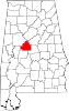 | |
| Towns | ||
|
Unincorporated communities | ||
| Ghost town | ||
| Footnotes | ‡This populated place also has portions in an adjacent county or counties | |
|
| This Bibb County, Alabama state location article is a stub. You can help Wikipedia by expanding it. |
Coleanor, Alabama | |
|---|---|
Coleanor, Alabama Location within the state of Alabama Coleanor, Alabama Coleanor, Alabama (the United States) | |
| Coordinates: 33°05′44″N 87°02′09″W / 33.09556°N 87.03583°W | |
| Country | United States |
| State | Alabama |
| County | Bibb |
| Elevation | 489 ft (149 m) |
| Time zone | UTC-6 ( Central (CST)) |
| • Summer ( DST) | UTC-5 (CDT) |
| Area code(s) | 205, 659 |
| GNIS feature ID | 156200 [1] |
Coleanor, also known as Coal-Eleanor, is an unincorporated community in Bibb County, Alabama, United States.
History
The mine at Coleanor was originally known as the Upper Thompson Mine. [2] The Blocton-Cahaba Coal Company operated a coal mine at Coleanor. [3] Combined with nearby Piper, the two towns had a combined population of nearly 2,500. [4] Coleanor was connected by rail to Piper and was located on the Southern Railway. [5] The Coleanor Mine was closed after World War II.
In February 1934, members of the United Mine Workers called a strike at the Coleanor mine. [6] Alabama National Guard troops were called in to Coleanor on February 25 to restore order. [7]
Twelve different miners died working in the mines of Coleanor. [8]
A post office operated under the name Coleanor from 1901 to 1942. [9]
References
- ^ "Coleanor". Geographic Names Information System. United States Geological Survey, United States Department of the Interior.
- ^ Armes, Ethel (1972). The Story of Coal and Iron in Alabama. Birmingham: The Book-Keepers Press. p. 151.
- ^ Geological Survey of Alabama (1924). Bulletin - Geological Survey of Alabama. Geological Survey of Alabama. p. 48.
- ^ "Piper/Coleanor". The Historical Marker Database. HMDB.org. Retrieved March 10, 2020.
- ^ Rhoda C. Ellison (February 17, 1999). Bibb County, Alabama: The First Hundred Years. University of Alabama Press. p. 177. ISBN 978-0-8173-0987-9.
- ^ James Sanders Day (June 24, 2013). Diamonds in the Rough: A History of Alabama's Cahaba Coal Field. University of Alabama Press. p. 133. ISBN 978-0-8173-1794-2.
- ^ United States. National Recovery Administration (1936). Work Materials ... The Administration. p. 185.
- ^ "Alabama Coal Mine Fatalities, 1898-1938". Birmingham Public Library. Retrieved March 10, 2020.
- ^ "Bibb County". Jim Forte Postal History. Retrieved March 9, 2020.
Municipalities and communities of
Bibb County, Alabama, United States | ||
|---|---|---|
| Cities | | |
| Towns | ||
|
Unincorporated communities | ||
| Ghost town | ||
| Footnotes | ‡This populated place also has portions in an adjacent county or counties | |
|
| This Bibb County, Alabama state location article is a stub. You can help Wikipedia by expanding it. |