Photos • Location

| Col des Rangiers | |
|---|---|
 Col des Rangiers | |
| Elevation | 856 m (2,808 ft) |
| Location | Switzerland |
| Range | Jura Mountains |
| Coordinates | 47°23′5.53″N 7°13′8.6″E / 47.3848694°N 7.219056°E |
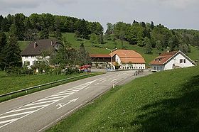
Col des Rangiers (el. 856 m.) is a mountain pass in the canton of Jura in Switzerland.
It connects Courgenay and Develier.
Wikimedia Commons has media related to
Col des Rangiers.
| Col des Rangiers | |
|---|---|
 Col des Rangiers | |
| Elevation | 856 m (2,808 ft) |
| Location | Switzerland |
| Range | Jura Mountains |
| Coordinates | 47°23′5.53″N 7°13′8.6″E / 47.3848694°N 7.219056°E |
Col des Rangiers (el. 856 m.) is a mountain pass in the canton of Jura in Switzerland.
It connects Courgenay and Develier.
Wikimedia Commons has media related to
Col des Rangiers.