This article has multiple issues. Please help
improve it or discuss these issues on the
talk page. (
Learn how and when to remove these template messages)
|
Coin Township | |
|---|---|
 Coin Township Location in Arkansas | |
| Coordinates: 36°19′22.46″N 93°19′42.08″W / 36.3229056°N 93.3283556°W | |
| Country | |
| State | |
| County | Carroll |
| Area | |
| • Total | 19.228 sq mi (49.80 km2) |
| • Land | 19.191 sq mi (49.70 km2) |
| • Water | 0.037 sq mi (0.10 km2) |
| Population (
2010) | |
| • Total | 655 |
| • Density | 34.13/sq mi (13.18/km2) |
| Time zone | UTC-6 ( CST) |
| • Summer ( DST) | UTC-5 ( CDT) |
| Zip Code | 72611 (
Alpena) |
| Area code | 870 |
Coin Township is one of twenty-one current townships in Carroll County, Arkansas, USA. Its population according to the 2020 census was 680, up from 655 at the 2010 census. [1]
Geography
According to the United States Census Bureau, Carrollton Township covers an area of 19.228 square miles (49.80 km2), 19.191 square miles (49.70 km2) of land and 0.037 square miles (0.096 km2) of water.
Cities, towns and villages
- Alpena (part)
References
- ^ Bureau, US Census. "Census.gov". Census.gov. Retrieved April 24, 2023.
- United States Census Bureau 2008 TIGER/Line Shapefiles
- United States Board on Geographic Names (GNIS)
- United States National Atlas
- Census 2010 U.S. Gazetteer Files: County Subdivisions in Arkansas
External links
Municipalities and communities of
Carroll County, Arkansas, United States | ||
|---|---|---|
| Cities | 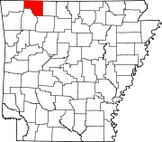 | |
| Towns | ||
| Townships | ||
|
Unincorporated communities | ||
| Ghost towns | ||
| Footnotes | ‡This populated place also has portions in an adjacent county or counties | |
|
| This article about a location in Carroll County, Arkansas is a stub. You can help Wikipedia by expanding it. |
This article has multiple issues. Please help
improve it or discuss these issues on the
talk page. (
Learn how and when to remove these template messages)
|
Coin Township | |
|---|---|
Coin Township Location in Arkansas | |
| Coordinates: 36°19′22.46″N 93°19′42.08″W / 36.3229056°N 93.3283556°W | |
| Country | |
| State | |
| County | Carroll |
| Area | |
| • Total | 19.228 sq mi (49.80 km2) |
| • Land | 19.191 sq mi (49.70 km2) |
| • Water | 0.037 sq mi (0.10 km2) |
| Population (
2010) | |
| • Total | 655 |
| • Density | 34.13/sq mi (13.18/km2) |
| Time zone | UTC-6 ( CST) |
| • Summer ( DST) | UTC-5 ( CDT) |
| Zip Code | 72611 (
Alpena) |
| Area code | 870 |
Coin Township is one of twenty-one current townships in Carroll County, Arkansas, USA. Its population according to the 2020 census was 680, up from 655 at the 2010 census. [1]
Geography
According to the United States Census Bureau, Carrollton Township covers an area of 19.228 square miles (49.80 km2), 19.191 square miles (49.70 km2) of land and 0.037 square miles (0.096 km2) of water.
Cities, towns and villages
- Alpena (part)
References
- ^ Bureau, US Census. "Census.gov". Census.gov. Retrieved April 24, 2023.
- United States Census Bureau 2008 TIGER/Line Shapefiles
- United States Board on Geographic Names (GNIS)
- United States National Atlas
- Census 2010 U.S. Gazetteer Files: County Subdivisions in Arkansas
External links
Municipalities and communities of
Carroll County, Arkansas, United States | ||
|---|---|---|
| Cities | | |
| Towns | ||
| Townships | ||
|
Unincorporated communities | ||
| Ghost towns | ||
| Footnotes | ‡This populated place also has portions in an adjacent county or counties | |
|
| This article about a location in Carroll County, Arkansas is a stub. You can help Wikipedia by expanding it. |