Photos • Location
| Cim de Plà de Pujalts | |
|---|---|
 | |
| Highest point | |
| Elevation | 2,056 m (6,745 ft) |
| Geography | |
| Location | Gombrèn, Catalonia, Spain |
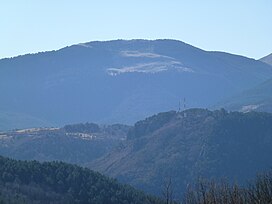
Cim de Plà de Pujalts is a mountain of Catalonia, Spain. It has an elevation of 2,056 metres above sea level. [1]
- ^ "Mapa Topogràfic de Catalunya". Institut Cartogràfic de Catalunya. Retrieved May 22, 2010..
| Cim de Plà de Pujalts | |
|---|---|
 | |
| Highest point | |
| Elevation | 2,056 m (6,745 ft) |
| Geography | |
| Location | Gombrèn, Catalonia, Spain |
Cim de Plà de Pujalts is a mountain of Catalonia, Spain. It has an elevation of 2,056 metres above sea level. [1]
- ^ "Mapa Topogràfic de Catalunya". Institut Cartogràfic de Catalunya. Retrieved May 22, 2010..