Photos • Location

Chong-Aryk
Чоң-Арык | |
|---|---|
 Chong-Aryk | |
| Coordinates: 41°53′30″N 72°38′40″E / 41.89167°N 72.64444°E | |
| Country | |
| Region | Jalal-Abad |
| District | Toktogul |
| Elevation | 1,014 m (3,327 ft) |
| Population (2021) | |
| • Total | 3,523 |
| Time zone | UTC+6 |
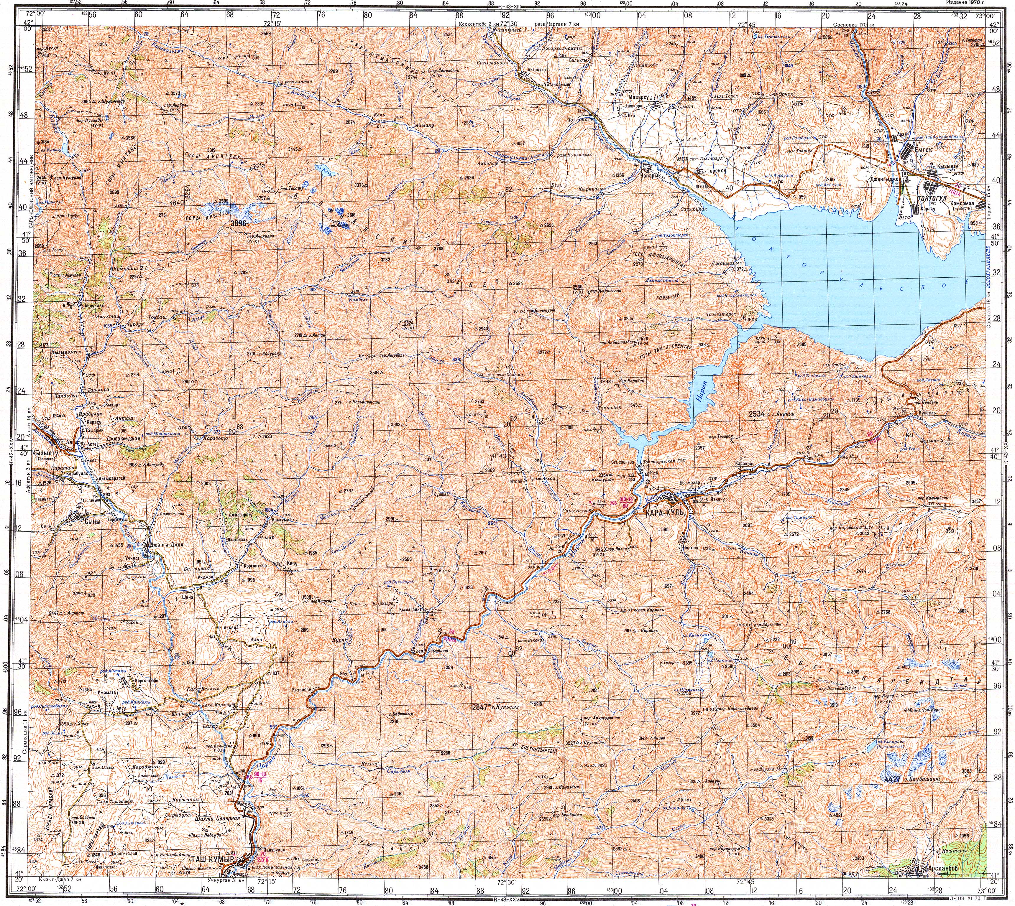
Chong-Aryk ( Kyrgyz: Чоң-Арык) is a village in Jalal-Abad Region of Kyrgyzstan. It is part of the Toktogul District. [1] Its population was 3,523 in 2021. [2] It lies near the northwestern end of the Toktogul Reservoir. [3]
- ^ "Classification system of territorial units of the Kyrgyz Republic" (in Kyrgyz). National Statistics Committee of the Kyrgyz Republic. May 2021. pp. 29–30.
- ^ "Population of regions, districts, towns, urban-type settlements, rural communities and villages of Kyrgyz Republic" (XLS) (in Russian). National Statistics Committee of the Kyrgyz Republic. 2021. Archived from the original on 10 November 2021.
- ^ Soviet military map K-43-19 (1:200,000)
Populated places in
Toktogul District,
Jalal-Abad Region | ||
|---|---|---|
Seat:
Toktogul | ||
| Cities |  | |
| Villages | ||
|
| This Jalal-Abad region location article is a stub. You can help Wikipedia by expanding it. |
Chong-Aryk
Чоң-Арык | |
|---|---|
Chong-Aryk | |
| Coordinates: 41°53′30″N 72°38′40″E / 41.89167°N 72.64444°E | |
| Country | |
| Region | Jalal-Abad |
| District | Toktogul |
| Elevation | 1,014 m (3,327 ft) |
| Population (2021) | |
| • Total | 3,523 |
| Time zone | UTC+6 |
Chong-Aryk ( Kyrgyz: Чоң-Арык) is a village in Jalal-Abad Region of Kyrgyzstan. It is part of the Toktogul District. [1] Its population was 3,523 in 2021. [2] It lies near the northwestern end of the Toktogul Reservoir. [3]
- ^ "Classification system of territorial units of the Kyrgyz Republic" (in Kyrgyz). National Statistics Committee of the Kyrgyz Republic. May 2021. pp. 29–30.
- ^ "Population of regions, districts, towns, urban-type settlements, rural communities and villages of Kyrgyz Republic" (XLS) (in Russian). National Statistics Committee of the Kyrgyz Republic. 2021. Archived from the original on 10 November 2021.
- ^ Soviet military map K-43-19 (1:200,000)
Populated places in
Toktogul District,
Jalal-Abad Region | ||
|---|---|---|
Seat:
Toktogul | ||
| Cities | | |
| Villages | ||
|
| This Jalal-Abad region location article is a stub. You can help Wikipedia by expanding it. |